Amguid Crater: Unveiling the Sahara’s Ancient Impact Site
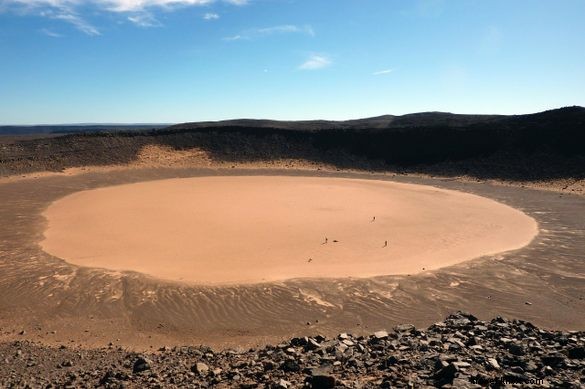
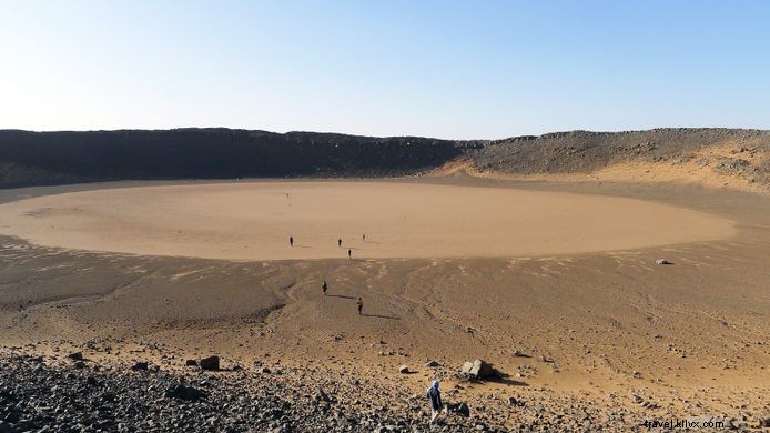
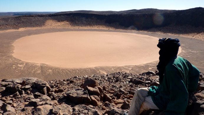
In a remote region of the Sahara Desert, an impact crater was punched into the land less than 100,000 years ago. Measuring some 500 meters (1,640 feet) wide and about 70 meters (230 feet) deep, the Amguid Crater is located in southwestern Algeria. On satellite imagery, the white spot of the flat, sandy crater floor is clearly visible; the residue formed by millennia of sporadic rain running into the bowl and evaporating.
The first known record of the Amguid crater in scientific literature was made by the French explorer Roman Karpoff, who noted a possible impact crater from a plane in 1948. The French geologist Jean-Phillippe Lefranc visited the crater in 1969.
The crater is almost perfectly circular, with steep walls and raised rims that are covered with large blocks of sandstone.
Shallow canyons cut through the plateau from east and west and spill out into the Erg Bou Zerafa sand sea to the north. One of the canyon mouths at the waterhole of Aguelman Rahla, has an unusually high concentration of pre-Islamic tombs. Rock art, neolithic tools and other pre-historic relics suggest the entire region was occupied thousands of years ago when the Saharan climate was less arid.
Amguid is the name of the nearest village (and army base) about 100 kilometers (62 miles) to the northeast.
Know Before You Go
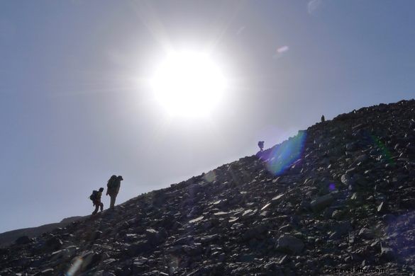
The best way to get to the Amguid crater is on foot from the village of Arak on the trans-Saharan Highway. The 120-mile walk takes about 10 days so you'll need the services of a guide, cook and a camel caravan to carry provisions. There are waterholes along the way for replenishment (not all of them obvious), but no human habitation of any kind. Nor is it possible for a 4x4 to follow this route from the south.
A 4x4 can get within 8 miles of the crater from the north, after leaving the trans-Sahara Highway midway between In Salah and Arak. It's a rough drive so it's best to leave the car at Aguelman Rahla and walk south over the plateau or follow the winding Oued Tafrekrek canyon, then climb up the side to the crater.