Hiking Greenland's Arctic Circle Trail: My First-Hand Trip Report (Part 1)
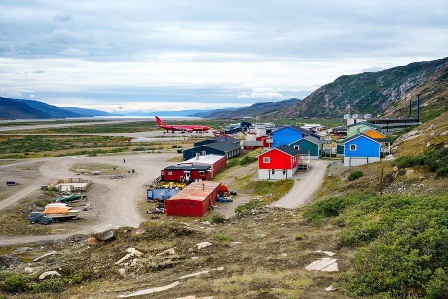
Kangerlussuaq, Greenland
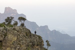
Standing alone on Greenland’s vast ice cap in profound silence, the sheer remoteness hits you. With a smile, I set off westward on the Arctic Circle Trail as snowflakes began to fall.
ARCTIC CIRCLE TRAIL SERIES
PART 1 | PART 2 | PART 3 | PART 4 | PACKING/LOGISTICS
Before hiking Greenland's Arctic Circle Trail, I assumed the island was mostly endless snow and ice. That's only partly true...
While 85% of Greenland is ice-covered, a vibrant coastal strip bursts with greens, reds, purples, and yellows—proving just how colorful it can be.
It's also the world's least densely populated country.
Greenland spans more land than Mexico but houses just 50,000 people versus Mexico's 122 million, offering vast untouched wilderness for exploration.
Kangerlussuaq (population 500), home to Greenland's main international airport, launched my journey after a 4-hour flight from Copenhagen.
The Arctic Circle Trail
Renowned as one of the world's top long-distance hikes, Greenland's Arctic Circle Trail spans up to 200 km (124 miles) from the ice cap edge to Sisimiut on the west coast.
For fit hikers, it takes 7-12 days depending on the route. Basic huts provide shelter, but a tent is essential.
Only about 300 adventurers tackle it annually, so solitude is common—days without seeing another soul. The prime season runs June to August.
I chose mid-August to dodge summer mosquito swarms.
Hikers must be fully self-sufficient.
No towns en route mean carrying all food and gear; cell service ends outside settlements.
I eagerly anticipated testing my skills in arctic isolation and disconnecting from constant connectivity.
"Travel and change of place impart new vigor to the mind."
(Seneca)
DAY 1: Exploring the Ice Cap
HIKING DISTANCE: 12 km (7.5 miles) | 5 hours
Arriving late after a Copenhagen delay, daylight lingered—Kangerlussuaq sits north of the Arctic Circle, with August sunsets near 11 p.m.
Most start from town via taxi to the trailhead, heading west. I opted for a unique launch: 40 km east at the ice cap edge.
Booking an afternoon tour with World of Greenland, I requested drop-off at the ice cap to hike back solo.
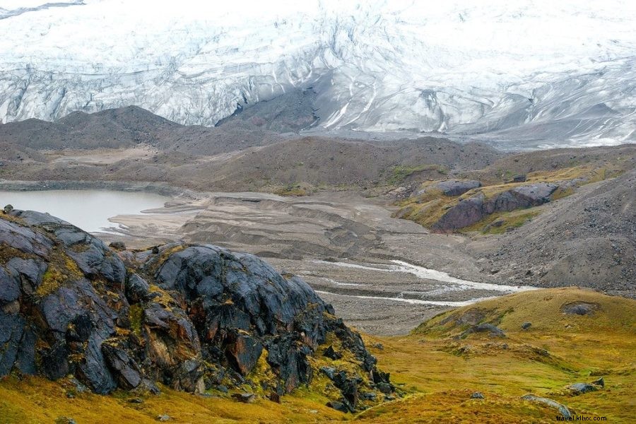
A 4x4 traversed rough roads to “Point 660,” where we explored the ice for an hour. No crampons needed—the grippy surface resembled crusty snow, safe without crevasses due to nearby glaciers.
Ice caps are stable and miles deep; glaciers are flowing rivers of ice.
First Signs of Wildlife
The group departed, leaving me to wander the ice cap longer. Spectacular blue meltwater rivers carved the endless icy expanse.
Few spots offer such accessible ice cap access without helicopters.
Dark clouds forced a descent; snow fell swiftly after blue skies—a Greenland hallmark: rapidly shifting weather.
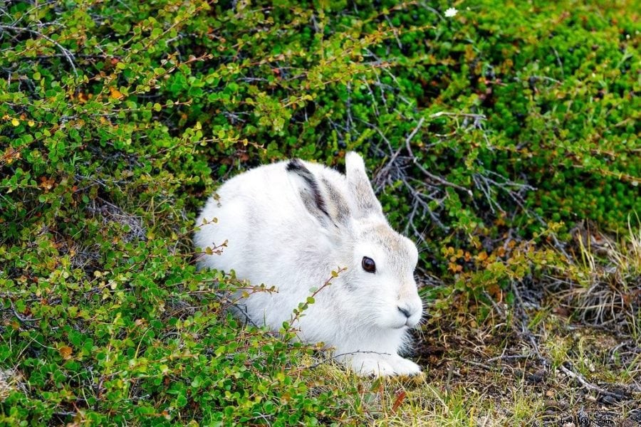
My first wildlife: an arctic hare in white fur against greenish-yellow terrain, then a reindeer crossing the road.
Wildlife encounters defined the trek.
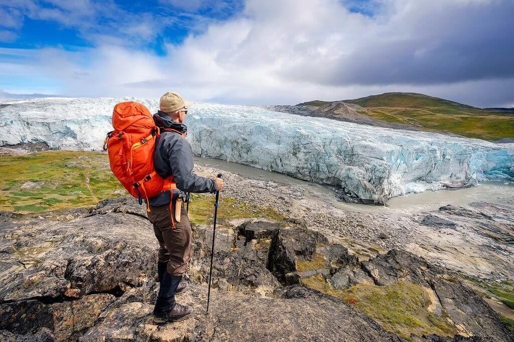
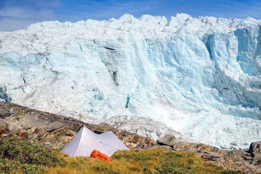
The 5-hour dirt road trek, built by Volkswagen for winter car tests, led to Russell Glacier, where I camped around 11 p.m.
DAY 2: Road to Kangerlussuaq
HIKING DISTANCE: 25 km (15.5 miles) | 6 hours
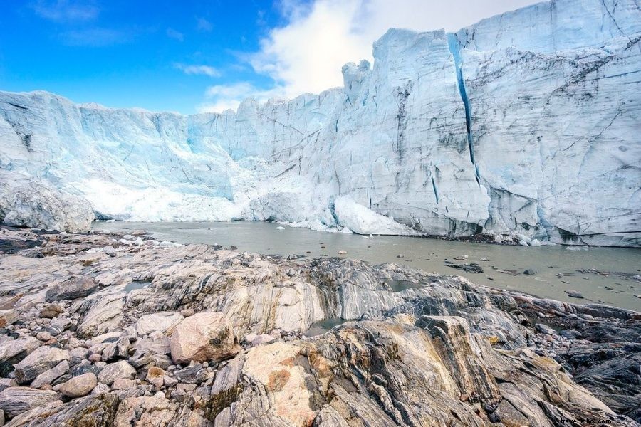
CRACK! BOOM! SPLASH! Massive ice calved from the 60m (180 ft) Russell Glacier, shaking the ground as it advanced.
This towering ice wall, laced with cracks, advances 25m yearly, calving under summer sun into a glacial river.
Moraine mountains—piles of gravel bulldozed by ancient ice—flank it.
It dwarfs you.
I lingered hours, witnessing bus-sized chunks fall. Stay distant: risks include crushing ice, ejections, or splash waves.
Arctic Deserts & Arctic Foxes
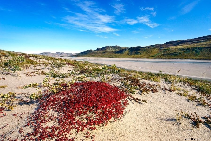
Following the river, the scene shifted to Sandflugtdalen, an arctic desert with wind-sculpted dunes.
Distant musk oxen—buffalo-like natives hunted by Inuit for meat and fur—headed to mountains. (Closer photos later.)
Nearby: remnants of a 1968 Lockheed T-33 crash from the former U.S. air base; pilots ejected safely.
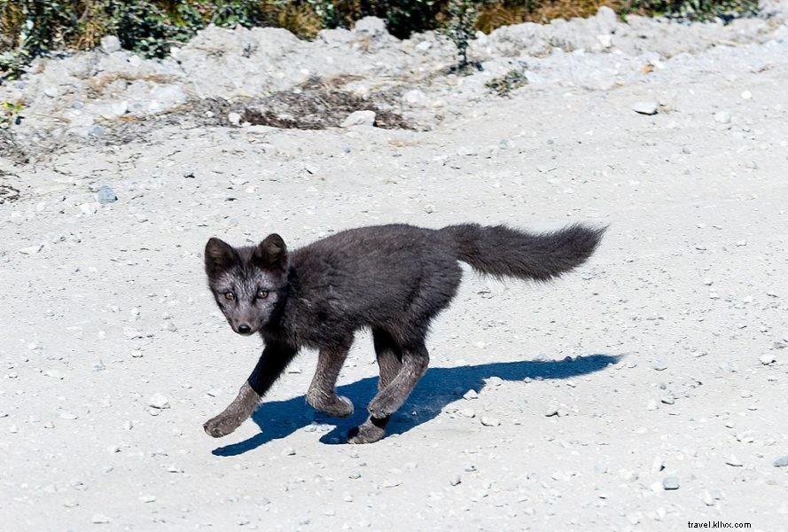
A black shape in the brush revealed an arctic fox via telephoto lens!
Cat-sized and shy, with white or blue coats, it bolted—but I snapped shots as it dashed by.
Spending the Night in Town
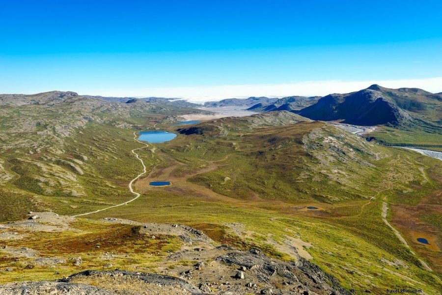
Near town, Sugarloaf Mountain offers 360° views: ice cap east, Kangerlussuaq west, Akuliarusiarsuup Kuua river below. Steep but rewarding; summit holds old U.S. radio towers.
Beyond: unexploded ordnance warnings from U.S. demolition—road safe, marked zones avoided (despite past grenade finds).
Back in town, I stayed at Polar Lodge to recharge gear and repack. Airport locker held excess food; I added dried fish and peanut M&Ms. Total: 9 days' provisions.
DAY 3: Road to Kellyville/Hundesø
HIKING DISTANCE: 20 km (12.5 miles) | 5 hours
Wrong stove canister bought; no replacements available. A local's offer failed due to refueling delays.
Cold meals it is—no stove.
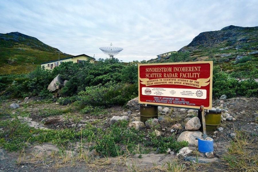
Skipping $50 taxi, I walked from town late afternoon past port, tanks, and Kellyville research station (pop. 7, studying atmosphere/auroras).
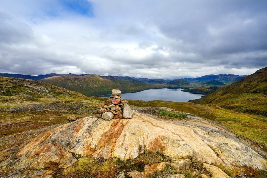
A red semi-circle cairn marks the true trail start: Greenland's wild frontier. From here, total self-reliance. ⭐
ARCTIC CIRCLE TRAIL SERIES
PART 1 | PART 2 | PART 3 | PART 4 | PACKING/LOGISTICS