10 Epic Backpacking Trips in Virginia: Unforgettable Trails for Adventure Seekers
Virginia boasts vast wilderness areas perfect for backpackers, including Shenandoah National Park and the expansive George Washington & Jefferson National Forests. These destinations offer cascading waterfalls, breathtaking overlooks, historic sites, and pristine campsites where you can unwind by a campfire, far from the digital world.
From the Atlantic shores of False Cape State Park to the historic highlands of Cumberland Gap National Historical Park, Virginia's backpacking routes span mountains, wilderness areas, and the iconic Appalachian Trail. Explore federally designated wildernesses and scenic byways on these top adventures.
Discover 10 premier Virginia backpacking trips below. Each includes the nearest town, mileage, elevation profile, GPS trailhead coordinates, highlights, camping details, and key tips. Pack your gear and hit the trail!
Ridge Trail at Cumberland Gap National Historical Park
Nearest Town: Ewing
Backpack Mileage: 20 miles end-to-end
Elevation High/Low: 3,400 ft high, 1,410 ft low
GPS Trailhead: 36.60967, -83.6379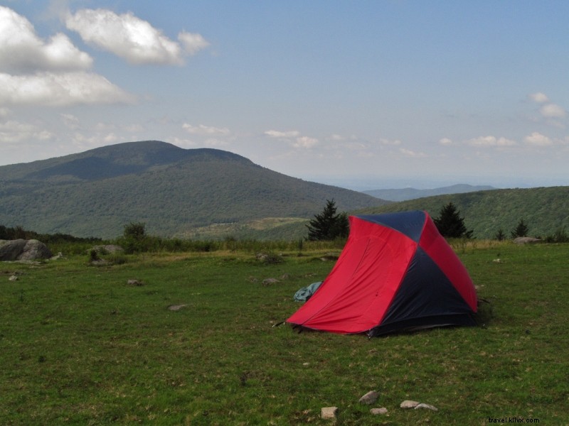
Why Go: Hike past natural wonders and historic sites like Hensley Settlement's preserved cabins, with panoramic views including the Smoky Mountains on clear days.
This premier route follows the Virginia-Kentucky border via the Ridge Trail from Lewis Hollow Trail. Highlights include Skylight Cave, Indian Rock shelter, Sand Cave waterfall, and White Rocks summit. Even without a shuttle, opt for loops or out-and-backs—the terrain eases on the ridge.
Camping: Five designated sites along the Ridge Trail, including a primitive cabin. Obtain a free backcountry permit from the visitor center.
Key Tip: Springs near each campsite; reserve the Martins Fork cabin ahead.
Mount Rogers High Country
Nearest Town: Konnarock
Backpack Mileage: 10-25 miles
Elevation High/Low: 5,728 ft high, 3,600 ft low
GPS Trailhead: 36.64618, -81.58307
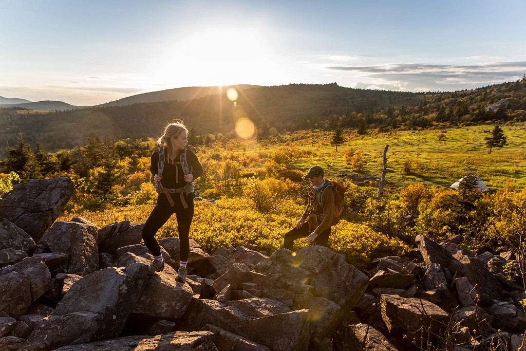
Why Go: Summit Virginia's highest point amid wild ponies, spruce-fir forests, meadows, rock spires, and streams in two wilderness areas and Grayson Highlands State Park.
Trails vary from narrow footpaths to equestrian routes. Customizable loops offer solitude outside peak weekends. Expect epic vistas and wildlife.
Camping: Appalachian Trail shelters and abundant scenic sites throughout.

Key Tip: Prepare for severe weather—clouds, wind, fog, rain year-round.
Torry Ridge Backcountry
Nearest Town: Sherando
Backpack Mileage: 20-mile loop
Elevation High/Low: 3,500 ft high, 1,700 ft low
GPS Trailhead: 37.90908, -79.05874
Why Go: Stunning views, waterfalls, creeks, and flexible camping options in a rewarding loop.
Start at Slacks Overlook: White Rock Falls, South Fork Back Creek, Sherando Lake trails, Torry Ridge views of Three Ridges, Mills Creek, and Bald Mountain.
Camping: Backcountry sites along creeks; developed options at Sherando Lake with water/showers in season.
Key Tip: Over 4,800 ft total elevation gain.
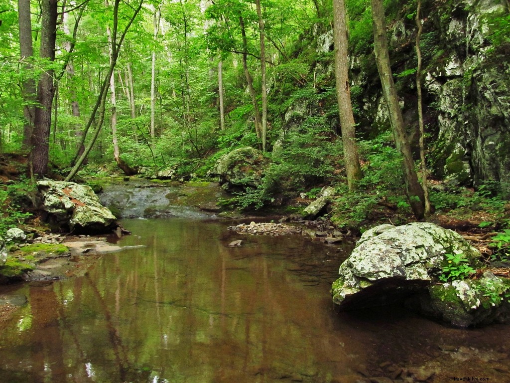
Ramseys Draft Wilderness
Nearest Town: Staunton
Backpack Mileage: 16-mile loop
Elevation High/Low: 4,000 ft high, 2,100 ft low
GPS Trailhead: 38.30838, -79.36089
Why Go: Pristine federally designated wilderness with trout streams, ridges, and old-growth forests.
Follow Ramseys Draft (multiple crossings), Right Prong to Hiner Spring, Tearjacket/Bald Ridge Trails, Bridge Hollow. Minimally maintained for true wilderness feel.
Camping: Sites along stream and near spring; ridge sites waterless.
Key Tip: Steep valley preserves old-growth; avoid winter.
Rockytop Big Run Loop
Nearest Town: Waynesboro
Backpack Mileage: 13-mile loop
Elevation High/Low: 2,800 ft high, 1,300 ft low
GPS Trailhead: 38.24115, -78.71098
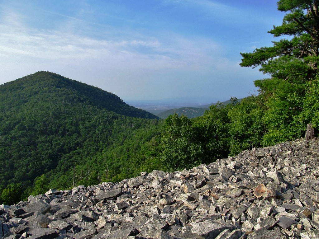
Why Go: Shenandoah's scenic ridges and largest watershed with talus views and crystal pools.
Rockytop Trail overlooks, descend to Big Run Portal for canyon hikes and old homesites, then Big Run Loop ascent.
Camping: Along Big Run (prime) or ridges (bring water). Permit required.
Key Tip: Numerous crossings; best late spring-fall.
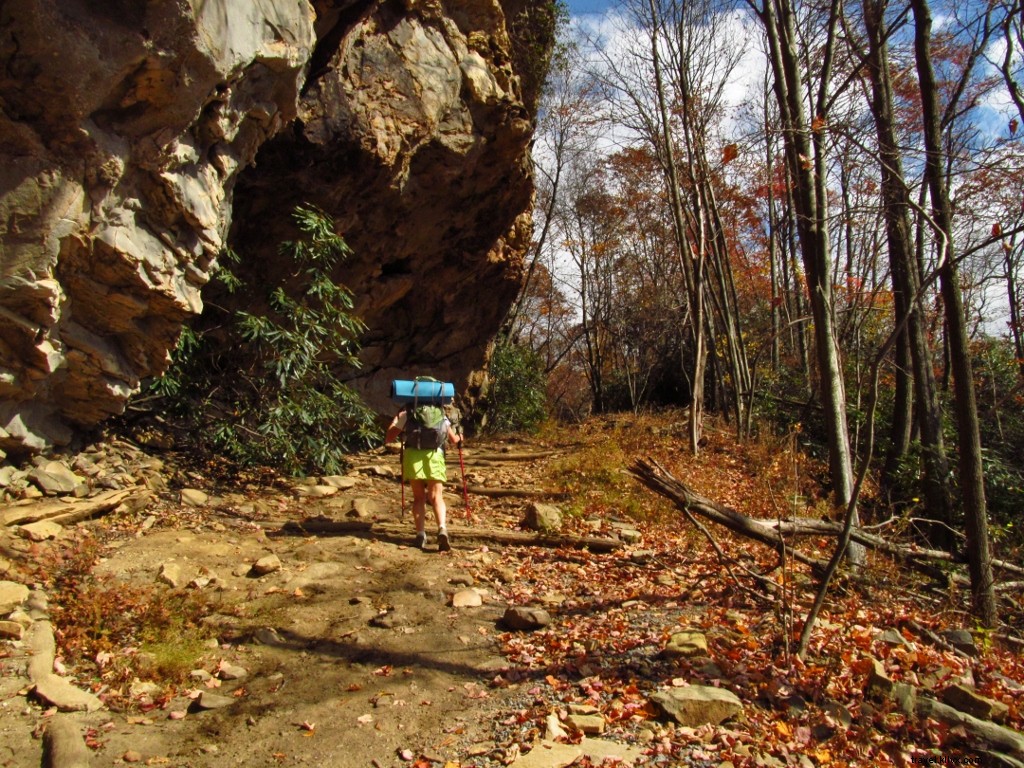
Hazel Country Loop
Nearest Town: Luray
Backpack Mileage: 18-mile loop
Elevation High/Low: 2,800 ft high, 1,300 ft low
GPS Trailhead: 38.63818, -78.31379
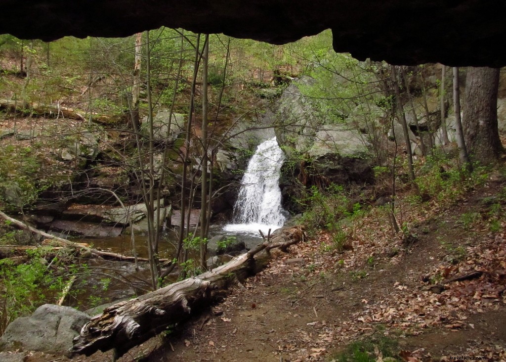
Why Go: Pioneer history meets Shenandoah wilderness: ruins, falls, caves.
Hazel Mountain Fire Road, White Rocks/Hazel Falls (cave pool), Hazel River, Sams Ridge/Nicholson Hollow, Hughes/Hannah Run Trails.
Camping: Along rivers/valleys. Permit required.
Key Tip: Rich in history with rock walls/chimneys.
Neighbor Mountain Jeremys Run Loop
Nearest Town: Luray
Backpack Mileage: 18-mile loop
Elevation High/Low: 2,800 ft high, 1,300 ft low
GPS Trailhead: 38.74094, -78.31189
Why Go: Solitude on Neighbor Mountain to alluring Jeremys Run cascades/pools.
Appalachian/Neighbor Trails, 15+ crossings, waterfalls.
Camping: Along stream/ridge (bring ridge water). Permit required.
Key Tip: Avoid after heavy rain.
Laurel Fork Backcountry
Nearest Town: Monterey
Backpack Mileage: 28-mile network
Elevation High/Low: 4,000 ft high, 3,200 ft low
GPS Trailhead: 38.57826, -79.62973
Why Go: Remote meadows, spruce, hardwoods, beaver ponds; extensive loops (use Nat Geo #791 map).
Stream/ridge trails on old rail grades; frequent crossings.
Camping: Along streams at confluences.
Key Tip: Access via Locust Springs Picnic Area (brief WV detour).
Northern Massanutten Mountain
Nearest Town: Strasburg
Backpack Mileage: 20+ miles
Elevation High/Low: 2,900 ft high, 900 ft low
GPS Trailhead: 38.92451, -78.33243
Why Go: Solitude near Shenandoah; Massanutten Mountain NRT loops, historic Signal Knob views.
Camping: Ridges/creeks; drier area—carry water.
Key Tip: Selective sites; don't skip reliable water sources.
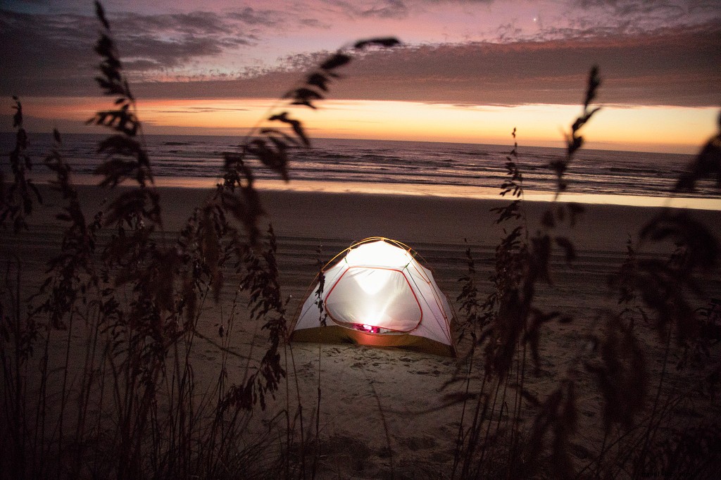
False Cape State Park
Nearest Town: Sandbridge
Backpack Mileage: 10-18 miles out-and-back
Elevation High/Low: 40 ft high, sea level
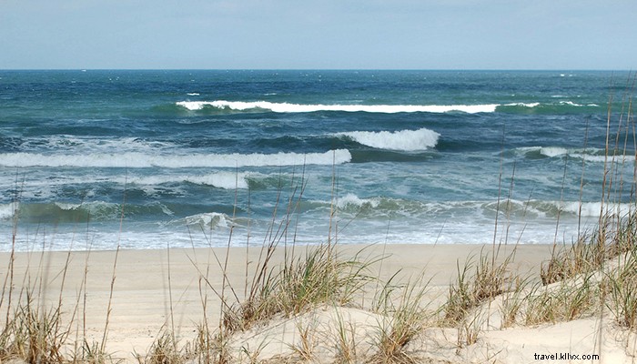
GPS Trailhead: 36.69222, -75.92466
Why Go: Coastal barrier island dunes, maritime forest, ocean surf—unique Virginia ecosystem.
Through Back Bay NWR; reservations essential (no same-day).
Camping: 12 primitive sites (bay/ocean sides); bugs/sun possible.
Key Tip: Limited freshwater (bring containers); no open fires, stoves only.