Top 10 Best Hikes on the Appalachian Trail in Virginia
Virginia claims a full quarter of the renowned 2,190-mile Appalachian Trail (AT), delivering about 550 miles of premier hiking opportunities. The AT in Virginia showcases trails to stunning overlooks, waterfalls, and wild landscapes, alongside scenic, cultural, and historical landmarks—including a vibrant trail town.
As the AT winds through Virginia's Appalachian Mountains, it traverses breathtaking terrain where towering peaks rise thousands of feet above lush valleys, cascading waterfalls tumble into dense forests, and wild rivers carve deep gorges amid majestic highlands. This section is a biological treasure, with over 4,000 feet of elevation change fostering diverse ecosystems mimicking flora and fauna from Georgia to New England.
The trail primarily meanders through Jefferson and George Washington National Forests, encompassing millions of acres of pristine wilderness teeming with diverse plant and animal life. It also passes through Shenandoah National Park and along the Blue Ridge Parkway, protected areas renowned for amplifying the finest AT experiences.
Discover these 10 rewarding hikes along the AT and its connectors in Virginia.
—DAMASCUS AND BEYOND—
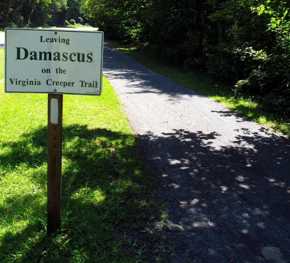
Length: 5.9-mile loop
Outstanding Features: Appalachian Trail town, streams, views
Trailhead GPS Coordinates: 36.63377, -81.79137
This engaging and unique AT hike blends the trail town of Damascus with nearby Jefferson National Forest paths. Begin at Damascus Town Park on the Virginia Creeper Trail, enjoying views of the town and flowing streams. Transition to the Appalachian Trail, ascending wooded ridges to panoramic mountain vistas. Connect with the Iron Mountain Trail, descend into a hollow, and loop back to Damascus, where the AT runs right through downtown.
Know Before You Go: Pack your wallet for treats and amenities while hiking through Damascus on the AT!
Nearby Attractions:
- Iconic Mount Rogers Outfitters
- Virginia Creeper Trail
- Southwest Virginia Cultural Center & Marketplace
- Barter Theatre
—MOUNT ROGERS HIGH COUNTRY—
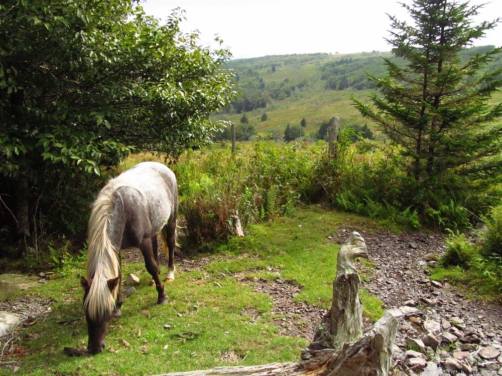
Length: 2-10 miles, there-and-back or loop
Outstanding Features: Wild ponies, designated wilderness, rock outcrops
Trailhead GPS Coordinates: 36.62124, -81.48448
From Grayson Highlands State Park, follow the AT across Virginia's highest elevations, where open balds offer sweeping views of stone monoliths and rare spruce-fir forests. Encounter the famous wild ponies, traverse Little Wilson Creek Wilderness, and explore diverse habitats leading to Pine Mountain. Summit a mile-high ridge and continue along rocky Wilburn Ridge.
Know Before You Go: High-elevation terrain means cool, foggy, or inclement weather is possible—dress and prepare accordingly.
Nearby Attractions:
- Grayson Highlands State Park camping
- New River Trail bicycling
- New River floating and fishing
- Rex Theater
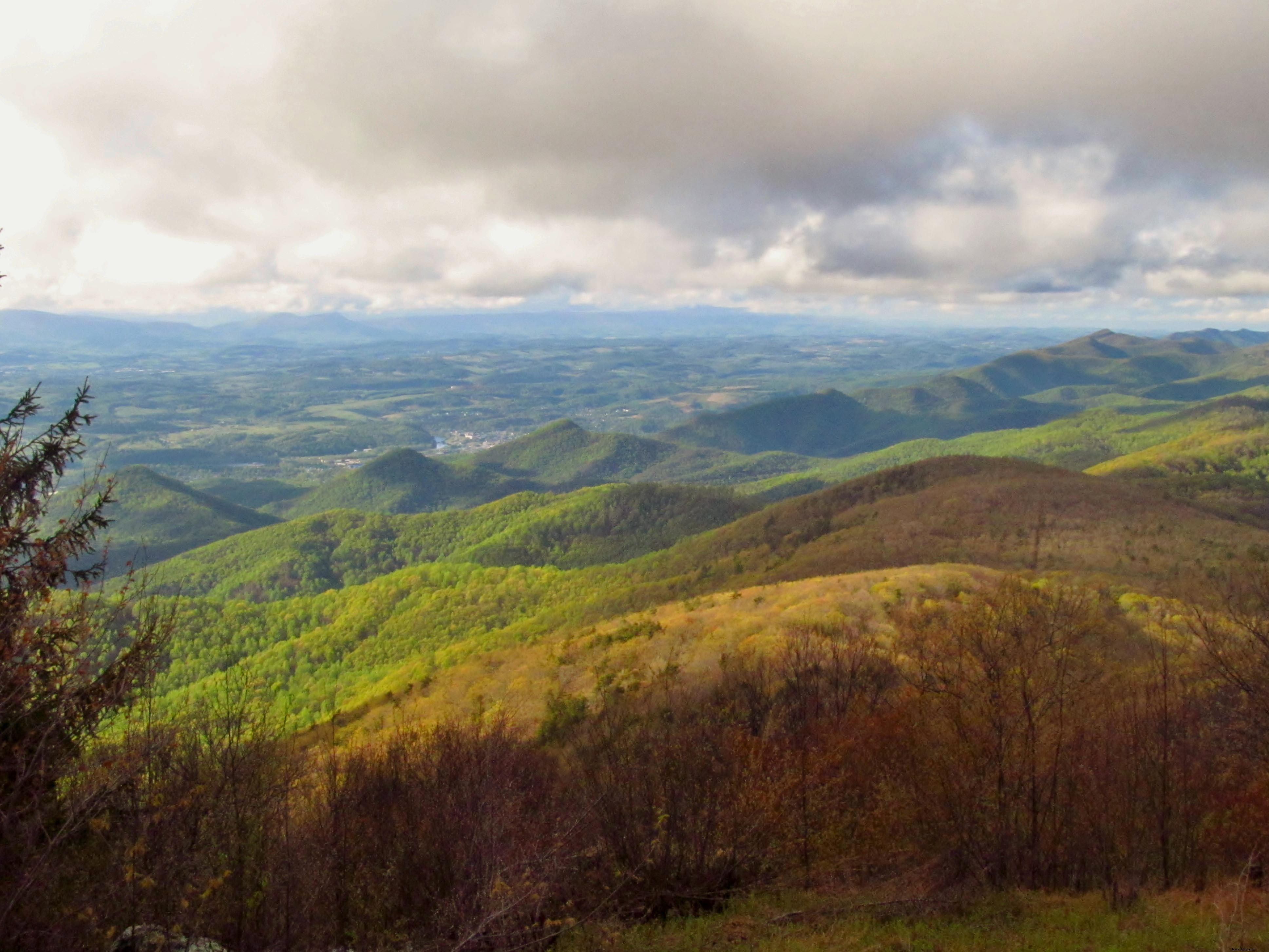
—CHESTNUT KNOB—
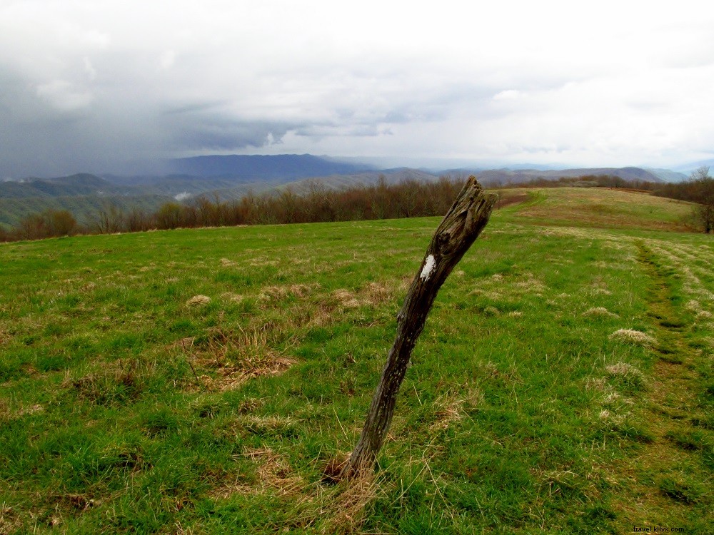
Length: 9.2-mile there-and-back
Outstanding Features: Historic stone ranger cabin, Burkes Garden, open meadows
Trailhead GPS Coordinates: 36.63377, -81.79137
Relish solitude and exceptional scenery on this trek. Follow the AT through open meadows with sweeping vistas to a historic stone fire warden's cabin atop Chestnut Knob. From here, admire Burkes Garden, one of Virginia's most picturesque rural valleys.
Know Before You Go: Open meadows span miles—follow wooden AT posts to stay on trail.
Nearby Attractions:
- Historic Crab Orchard Museum in Tazewell
—ANGELS REST—
Length: 5.0-mile there-and-back
Outstanding Features: Incredible vistas, challenging climb
Trailhead GPS Coordinates: 37.32991, -80.76299
This AT adventure ascends the northeast flank of Pearis Mountain to three spectacular viewpoints. Start near Pearisburg and follow switchbacks up a forested ridge to a boulder field, emerging at Angels Rest with jaw-dropping New River Valley views. Continue south to additional overlooks showcasing bucolic countryside between distant ridges.
Know Before You Go: The steady climb from Pearisburg demands good fitness, but it's rewarding and achievable.
Nearby Attractions:
- Paddle, raft or tube the New River
- Visit Giles County Historical Society
- Hike at Cascade Falls
- Tangent Outfitters
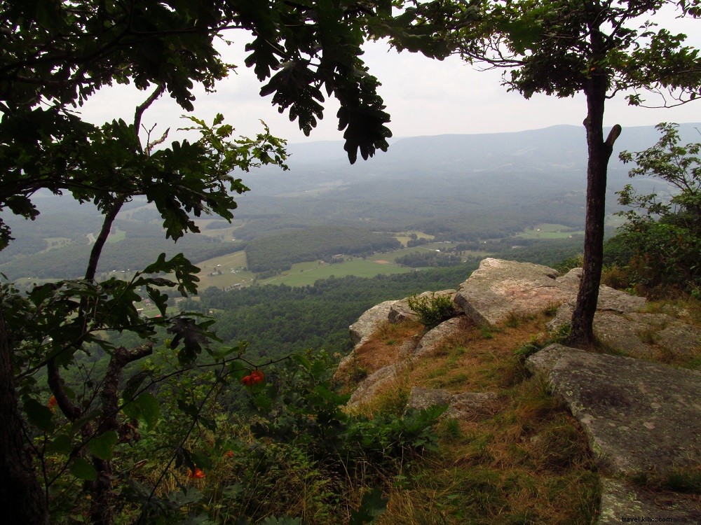
—KELLY KNOB—
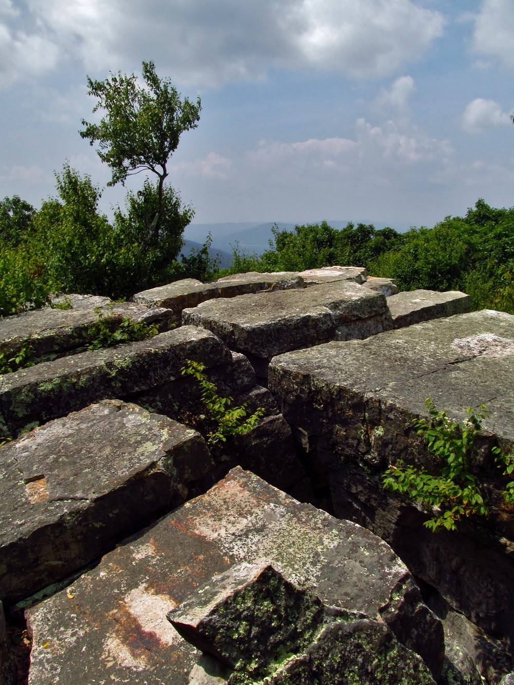
Length: 4.0-mile there-and-back
Outstanding Features: Solitude, high country, views
Trailhead GPS Coordinates: 37.3727, -80.44603
This moderate hike delivers rare solitude and vistas. From historic Newport north of Blacksburg, climb briefly to Johns Creek Mountain's crest, then stroll to Kelly Knob. A short spur leads to an outcrop overlooking the New River Valley and surrounding peaks.
Know Before You Go: The outcrop's stone base has cracks—step carefully for safe viewing.
Nearby Attractions:
- Paddle, raft or tube the New River
- Tour Blacksburg
- Sinking Creek Covered Bridge
- Mountain bike at Pandapas Pond
—MCAFEE KNOB—
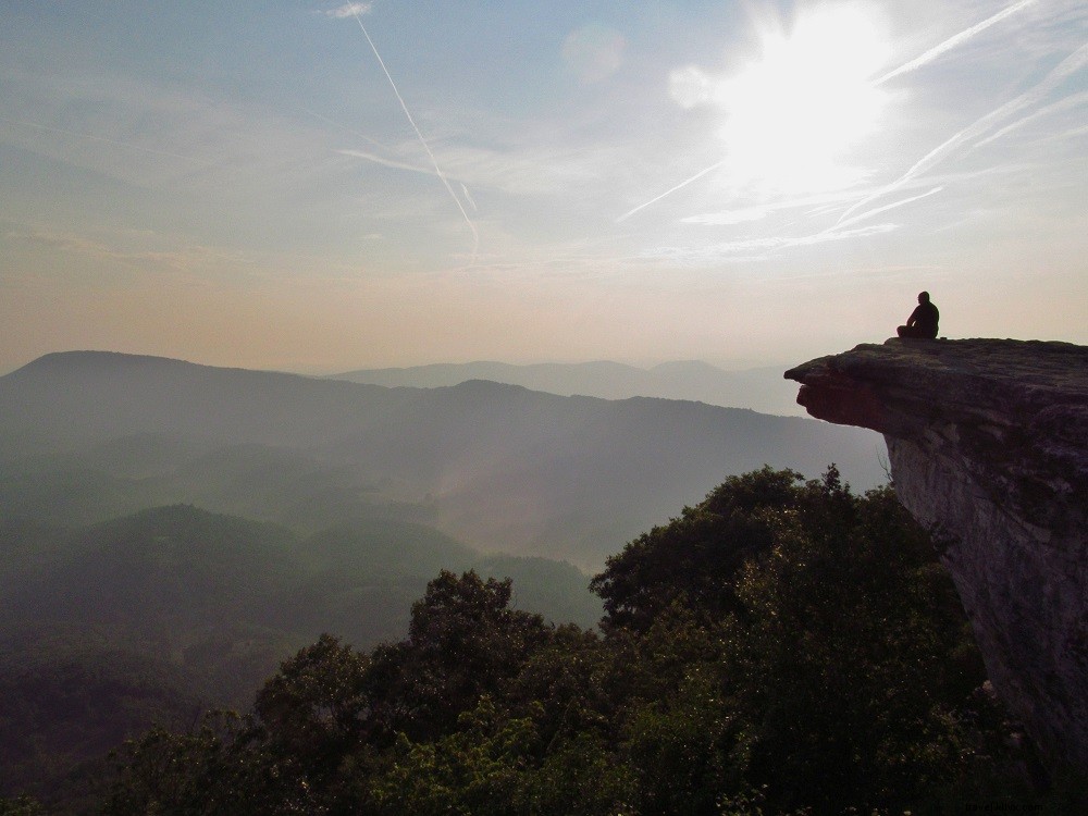
Length: 7.8-mile there-and-back
Outstanding Features: Most photographed spot on the AT
Trailhead GPS Coordinates: 37.38036, -80.0893
A perennial favorite, McAfee Knob—Virginia's AT icon—boasts an iconic overhang perfect for photos amid expansive mountain views. From the popular VA 311 trailhead, follow the AT north along Catawba Mountain, passing two shelters before ascending to the dramatic summit ledge.
Know Before You Go: Peak popularity means crowds—opt for early mornings, late afternoons, or weekdays.
Nearby Attractions:
- Paddle Craig Creek
- Walk the Hanging Rock Battlefield Trail
- Mill Mountain in Roanoke
- Poor Mountain Natural Area Preserve
—OTTIE POWELL MEMORIAL—
Length: 7.8-mile there-and-back
Outstanding Features: Views from Bluff Mountain, haunted trail shelter
Trailhead GPS Coordinates: 37.67793, -79.33386
Ascend the AT to Bluff Mountain's historic fire tower site for panoramic vistas and the poignant Ottie Powell Memorial, commemorating a child lost over a century ago. En route, pass the storied Punchbowl Mountain shelter, rumored to be haunted by Ottie's spirit.
Know Before You Go: If overnighting at Punchbowl Shelter, come prepared for eerie tales.
Nearby Attractions:
- Blue Ridge Parkway
- Paddle James River
- Hearthstone Lodge & Retreat Center
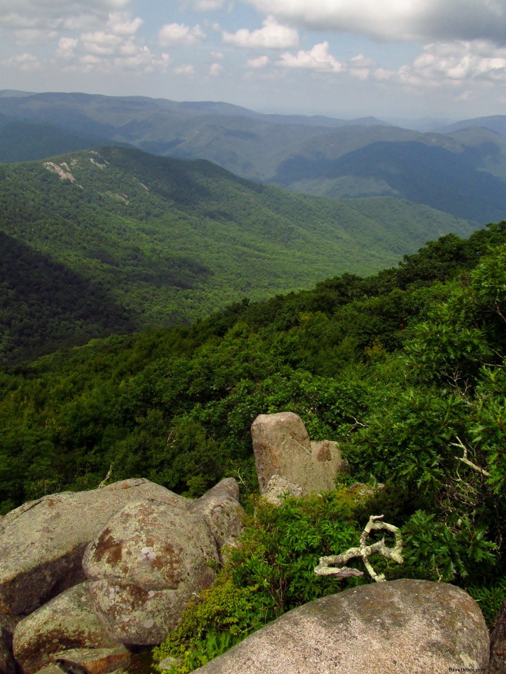
—THE PRIEST WILDERNESS—
Length: 3.6-mile there-and-back
Outstanding Features: Views from The Priest, federally designated wilderness
Trailhead GPS Coordinates: 37.83003, -79.08279
Venture into the 5,963-acre Priest Wilderness, established in 2000, to summit The Priest for dramatic Tye River Valley views. Pass springs, streams, and a trail shelter amid this protected high country.
Know Before You Go: From this trailhead, access Crabtree Falls, Virginia's tallest waterfall and one of the East's highest.
Nearby Attractions:
- Wades Mill
- Cyrus McCormick Farm
- Rockbridge Vineyard
- Blue Ridge Parkway
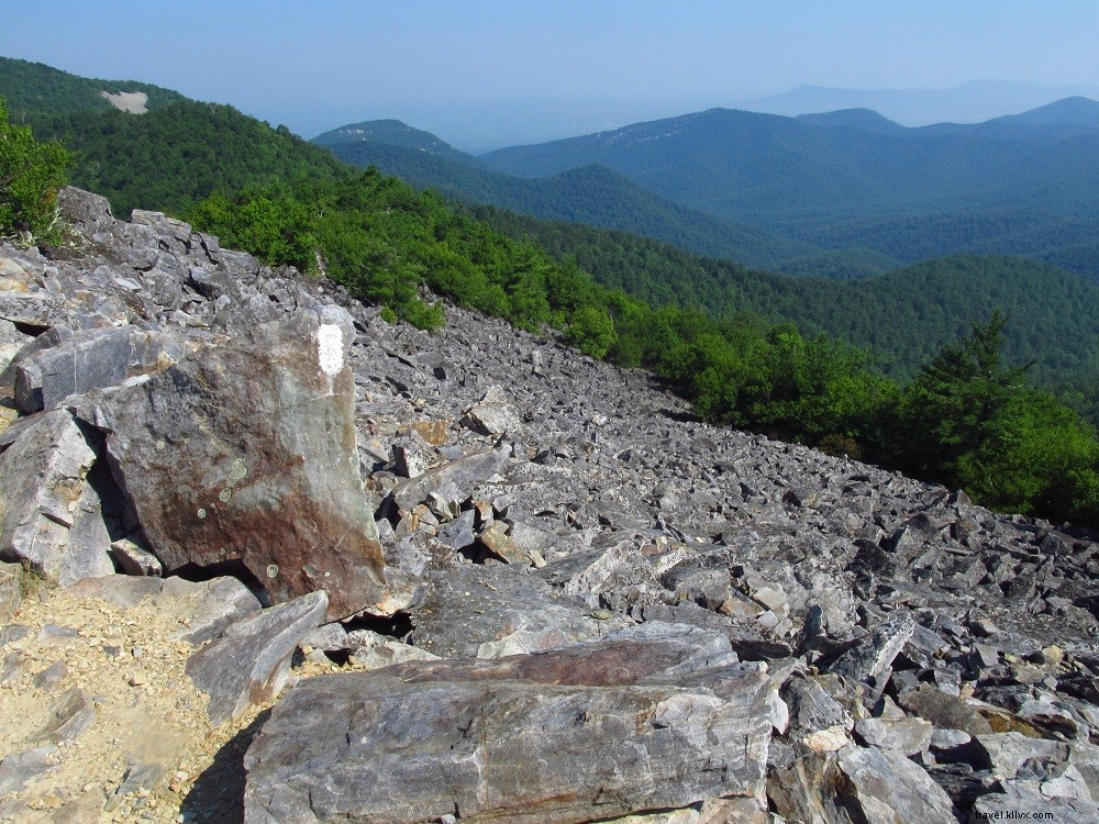
—BLACKROCK SUMMIT—
Length: 1.1-mile loop
Outstanding Features: Family-friendly, wide-ranging panoramas from boulder jumble
Trailhead GPS Coordinates: 38.223, -78.73331
This easy, family-friendly loop in Shenandoah National Park delights with geological wonders. From Skyline Drive, stroll the AT to a massive boulder field atop Blackrock Summit, offering multi-directional vistas. Return through woods with minimal elevation and boulder-scrambling fun.
Know Before You Go: Extend to 6.8 miles out-and-back via Trayfoot and Furnace Mountain Trails for more solitude and views.
Nearby Attractions:
- Skyline Drive
- Camp at Loft Mountain
- Grand Caverns in Grottoes
- Waynesboro’s Seven Arrows Brewing Company
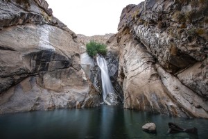
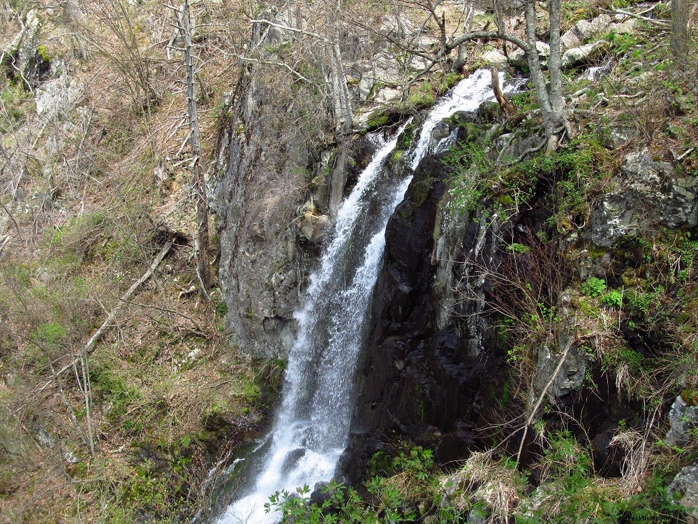
—LEWIS SPRINGS FALLS—
Length: 3.4-mile loop
Outstanding Features: Family-friendly, waterfalls, panoramic views
Trailhead GPS Coordinates: 38.223, -78.73331
In Shenandoah's Big Meadows, this popular loop heads north on the AT to viewpoint-rich Blackrock, then past striking rock formations to Lewis Falls Trail and the impressive 81-foot Lewis Springs Falls. Enjoy near and distant vistas before looping back.
Know Before You Go: Big Meadows offers visitor center, lodging, camping, ranger programs, and camp store nearby.
Nearby Attractions:
- Luray Caverns
- Big Meadows Lodge
- Victorian Inn
- Paddle or fish South Fork Shenandoah River
 Johnny Molloy, an experienced outdoor author, has penned numerous books and guides covering travels across 26 states, including Virginia. His works feature hiking, camping, paddling guides, regional overviews, and adventure narratives. He has extensively hiked, paddled, and camped throughout Virginia, from Cumberland Gap to the Eastern Shore.