Ultimate Insider's Guide to Signal Mountain's Best Hiking Trails Near Chattanooga
Just 20 minutes from downtown Chattanooga, Signal Mountain captivates nature lovers with its winding wooded paths, breathtaking panoramas, meandering streams, and extensive trail network. A scenic drive through this lush, forested town is enjoyable, but exploring on foot reveals its true splendor. Discover our top picks for immersive outdoor adventures showcasing the mountain's diverse natural beauty.
1. Signal Point and Edward's Point
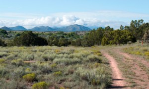
Edward's Point offers stunning overlooks of the Tennessee River Gorge, just north of Signal Point. Its appeal lies in the variety of access routes—hike a different trail each visit. The quickest path is an approximately 2-mile route from Edward's Point Road or a 3-mile bluff trail from Signal Point. Trails range from 2 to 7 miles, ideal for hiking, trail running, mountain biking, and ATVs. The expansive rock outcrop is perfect for picnics, relaxing, or photography.
2. Shackleford Ridge County Park
For a well-groomed hike, head to Shackleford Ridge Park (also known as the Sam Powell Trails). These color-coded loops suit casual walks or dog-friendly outings. Trails can be confusing, so photograph the map at the trailhead. Enjoy wooden footbridges, benches, a swinging bridge, and tree identification signs. Access from the parking lot behind Signal Mountain Middle High School; customize routes from under 1 mile to 6 miles.
3. Rainbow Lake
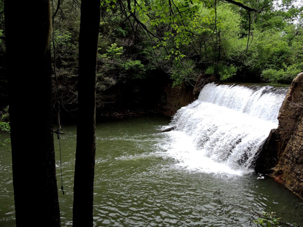
From the historic district's large parking lot, it's a gentle 0.75-mile descent to Rainbow Lake—a top family spot. The wide, smooth trail parallels the golf course, crossing footbridges and an old spring house. At the lake, admire the 1916 dam's waterfall and swinging bridge. Extend to a 2-mile loop or turn back. Its accessibility makes it ideal for all ages.
4. Mushroom Rock and Suck Creek
Starting from Shackleford Ridge trailhead, this public trail crosses private land to Mushroom Rock (1+ mile away)—a massive formation resembling a giant mushroom. Retrace steps or descend a short, very steep path to pristine Suck Creek, with its swift waters, rapids, and long swinging bridge. The uphill return is challenging but rewarding for a full day in nature.