Ultimate Guide to the Cumberland Trail: Segments, Highlights, and Essential Hiking Tips
The Cumberland Trail offers hikers an unparalleled journey through Tennessee's rugged, remote landscapes. Stretching along the state's eastern edge from Cumberland Gap on the Kentucky border nearly to Georgia, this trail forms a key segment of the ambitious Great Eastern Trail. While not yet fully continuous, over 200 miles across a dozen segments are complete, with dedicated volunteers steadily closing the gaps each year.
Trail development, managed by the nonprofit Cumberland Trail Conference (CTC) and the State of Tennessee, relies on grants from private donors. However, volunteers remain the true backbone—scouting routes, wielding pickaxes, clearing blowdowns, and more, nearly every day. Annually, over 100 college students join the CTC's BreakAway Alternative Spring Break program, hauling tools deep into the wilderness. Engineering feats like the suspension bridges at Big Soddy Creek and Suck Creek showcase their ingenuity, requiring tons of materials transported down sheer cliffs.
This guide details each segment of the Cumberland Trail. For detailed maps and updates, visit the Cumberland Trail Conference website.
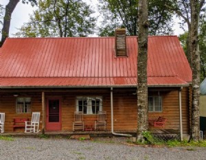
Note: Many sections traverse hunting areas—wear blaze orange during hunting season. Always carry water or a purifier, as natural sources are unreliable. Cell service is spotty, so plan accordingly.
Tennessee Gorge Segment
Sections: 4 | Total Mileage: 34.8 miles (some one-way, including loops)
Beginning at a stunning overlook of the Tennessee River near Chattanooga, this segment traces the Cumberland Plateau's edge. Dramatic vistas alternate with descents into steep, rocky gorges. Highlights include the Tennessee River Gorge, with suspension bridges over Middle and Suck Creeks. Gaze across the river and honor the volunteers who've shaped this path.
Don't miss the Julia Falls Overlook near Signal Point, discovered by CTC founder Sam Powell and his daughter Julia—a 100-foot waterfall now enjoyed by countless hikers.
North Chickamauga Creek Segment
Sections: 1 | Total Mileage: 8.3 miles one-way
Led by Samuel Hammonds of the Chattanooga-based Wild Trails, efforts here connect to Powell's original paths. The downstream trail hugs steep bluffs and historic coal mines. Upstream extensions will link to Suck Creek and Prentice Cooper State Forest.
The Soddy Sections and Possum Creek deliver wild beauty: deep gorges, sculpted sandstone, hemlocks, rhododendrons, and true wilderness immersion. Trail runner Dreama Campbell calls Possum Creek a favorite. The Possum Creek Gorge drops sharply to the creek, climbs back, descends again to Imodium Falls, then eases through rhododendron and pine forests.
Laurel-Snow Segment
Sections: 2 | Total Mileage: 18.2 miles (via connecting trails)
At Laurel-Snow State Natural Area, history meets natural splendor amid old coal mines. Named for Laurel Falls (80 feet) and Snow Falls (35 feet), trails plunge into gorges with waterfalls, swimming holes, and wildlife. Once an economic hub, it's now a visitor haven. Future additions: Graysville Mountain and Uplands sections.
Piney River and The Falls Segments
Sections: 1 each | Total Mileage: 9.6 miles one-way
Near Spring City, the Piney River Section follows the river past waterfalls and evergreens to a sandstone tower with ladders for treetop gorge views. Mostly gentle terrain with rushing water soundtrack. Currently, only the Lower Piney River (1.1 miles) links to Laurel-Snow; full connection to The Falls Segment pending. Nearby, explore Grassy Cove and Ozone Falls (110 feet).
The 7.2-mile Daddys Creek Section (in Crab Orchard Mountain Segment) offers gorge overlooks.
Obed Wild and Scenic River Segment
Sections: 2 | Total Mileage: 15.4 miles one-way
Experience Tennessee whitewater views once reserved for paddlers. Thru-hiker Chris Pickering praises the awe-inspiring rocks and foliage. Nicknamed the "trail of a thousand steps" for its rocky descents into Daddys Creek and Obed River gorges. Note time zone shift: south trailhead (Devil’s Breakfast Table) Central Time; north (Nemo Bridge) Eastern.
Bird Mountain Segment
Though incomplete, it will start in Wartburg for resupply, crossing to massive, uncrowded ridges near Frozen Head State Park. Existing trails reach high elevations, steep and rugged like the Smokies.
New River Segment
Sections: 3 | Mileage: 39.8 miles one-way
Among Tennessee's most remote sections, encounters with others are rare. Challenging creek crossings and elevation changes demand maps and preparation.
Cumberland Mountain Segment
Sections: 3 | Mileage: 38 miles
Northern terminus at Cumberland Gap National Historical Park, pioneer gateway via Daniel Boone. Site of the trail's 1965 announcement. Currently overgrown in spots due to land delays, but acquisition nears completion for restoration.
Access and Camping
The Cumberland Trail Conference provides section maps, trailhead directions, and free camping/overnight parking permits via their website. Options suit day hikes to multi-day backpacking.