Explore Ancient Petroglyphs: An Insider's Guide to La Cieneguilla and Tsankawi Trails Near Santa Fe
The La Cieneguilla site is also of interest to those tracing the route of El Camino de Tierra Adentro, as the ancient road passed along here as well. (Photo courtesy of Santa Fe County)
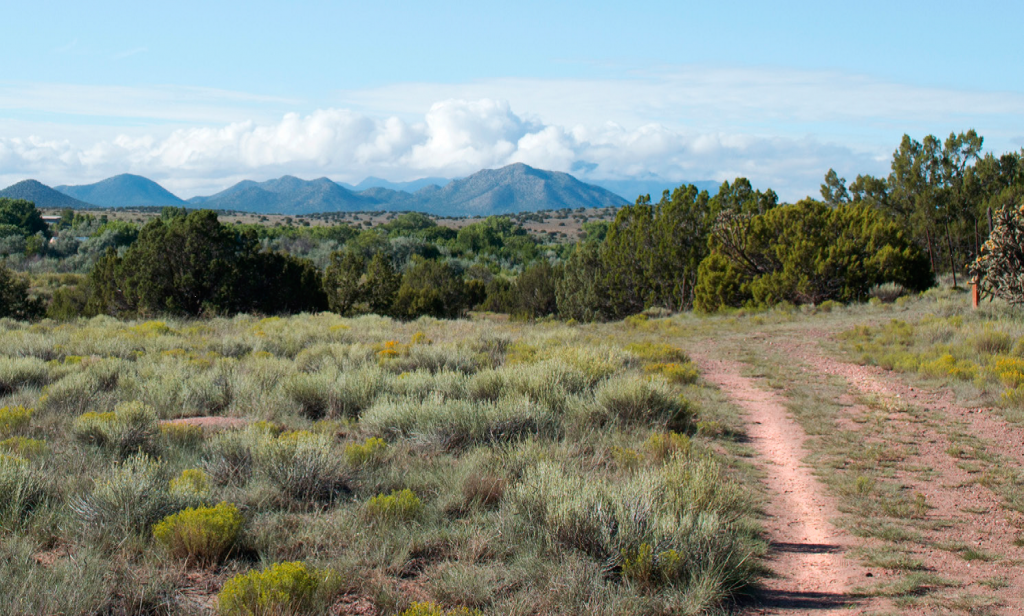
Just beyond the edge of Santa Fe, a short hike through deeply silent terrain reveals a rocky ledge etched with ancient secrets. Dark stone boulders whisper a cryptic language through thousands of petroglyphs at the La Cieneguilla Petroglyph Site and across the Southwest, dating to pre-Spanish colonial times.
Despite extensive scholarly research, the exact meanings of these carvings remain a mystery. Many depictions defy clear interpretation, inviting visitors to ponder their significance.
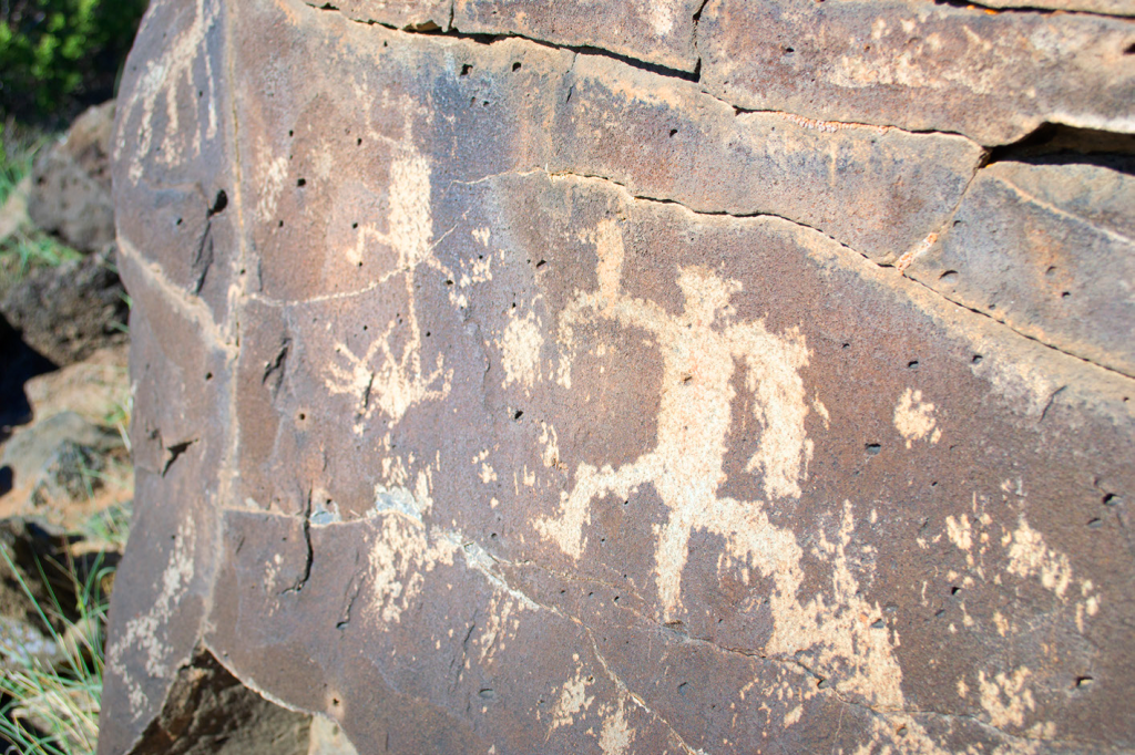
The La Cieneguilla site is known for a great number of hump-backed flute players images (Kokopelli) and bird figures. (Photo courtesy of Santa Fe County)
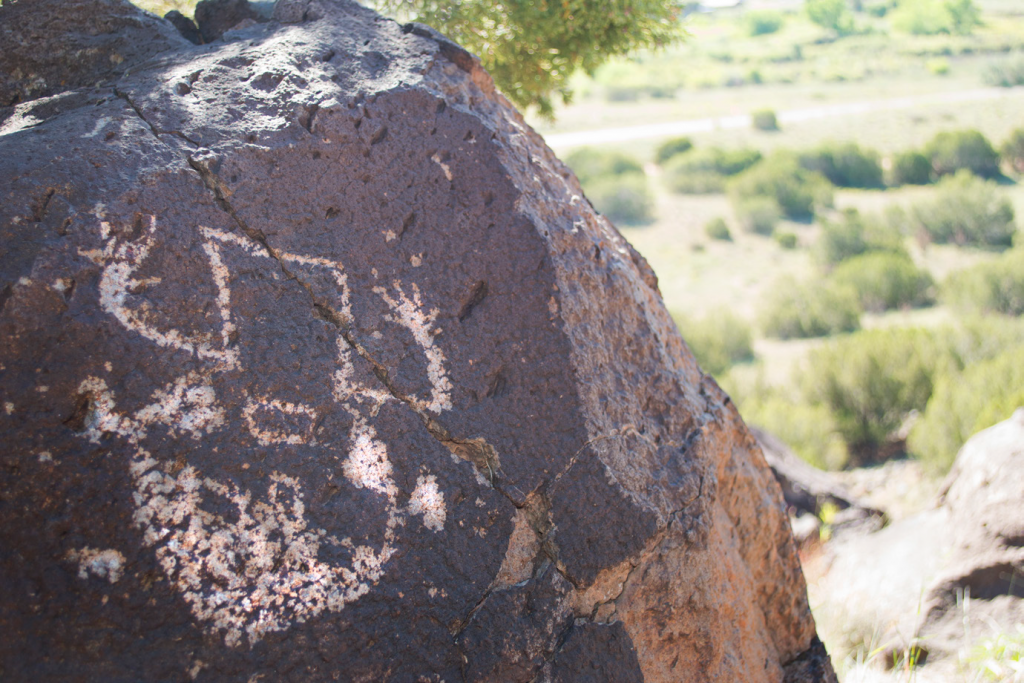
Petroglyphs are created by incising the dark desert varnish on rock surfaces to expose lighter stone beneath. They are kin to pictographs, which use natural pigments painted on stone.
Early techniques involved pecking small holes and connecting them; later, finer tools like bone saws were used. Human figures, called anthropomorphs, and animals, known as zoomorphs, dominate. The iconic Kokopelli—a hunchbacked flute player—appears frequently at La Cieneguilla and on the Tsankawi Trail, a remote section of Bandelier National Monument.
Speculative theories abound, from idle doodling (unlikely given the labor-intensive process on hard rock with primitive tools) to profound cultural symbols. Circles might symbolize the sun, eyes, the universe, or life's cycle. Humanoids could represent allies, enemies, or otherworldly beings. Ultimately, these carvings convey timeless human stories.
La Cieneguilla Petroglyph Site
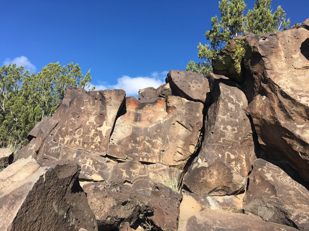
Hundreds of petroglyphs can be found along the mesa above the Santa Fe River. (Photo courtesy of Santa Fe County)
From Santa Fe, head south on I-25 to exit 276. Turn right onto Highway 599 (Santa Fe Relief Route), then left onto Airport Road. After about three miles, find the small parking area marked by a Bureau of Land Management sign for La Cieneguilla Petroglyph Site.
 You’ll also run into horned toad petroglyphs at the La Cieneguilla Petroglyph site. (Photo courtesy of Santa Fe County)
This trail suits experienced hikers, involving rock scrambling over large, potentially slippery boulders. Visit at sunrise or just before sunset for optimal shadows highlighting the carvings. Stay alert for footing and rattlesnakes.
Tsankawi Trail at Bandelier National Monument
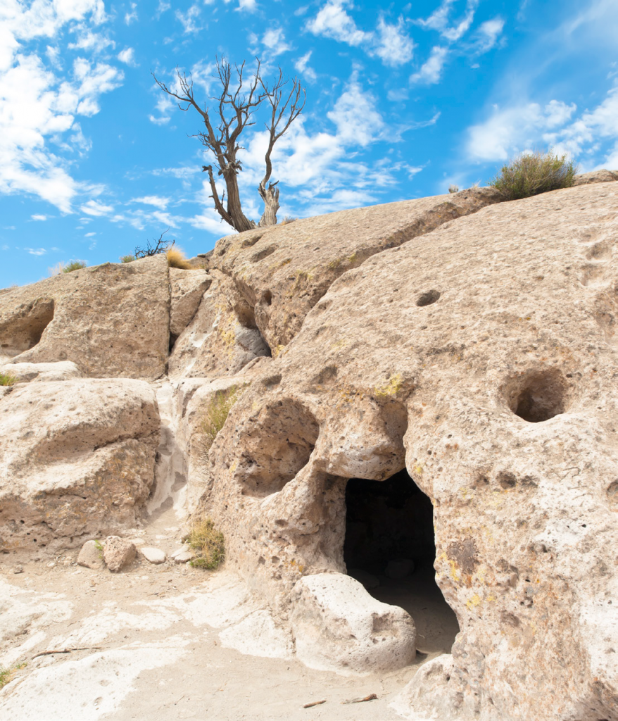
Ancient pueblo inhabits of Tsankawi dug caves into the soft tuff stone. (Photo courtesy of Santa Fe County)
From Santa Fe, take St. Francis Drive north to Highway 285, then Highway 502 (Los Alamos Highway) west. Exit onto NM Highway 4 toward Bandelier National Monument; after 1 mile, spot the gravel lot on the left signed “Tsankawi Prehistoric Site.”
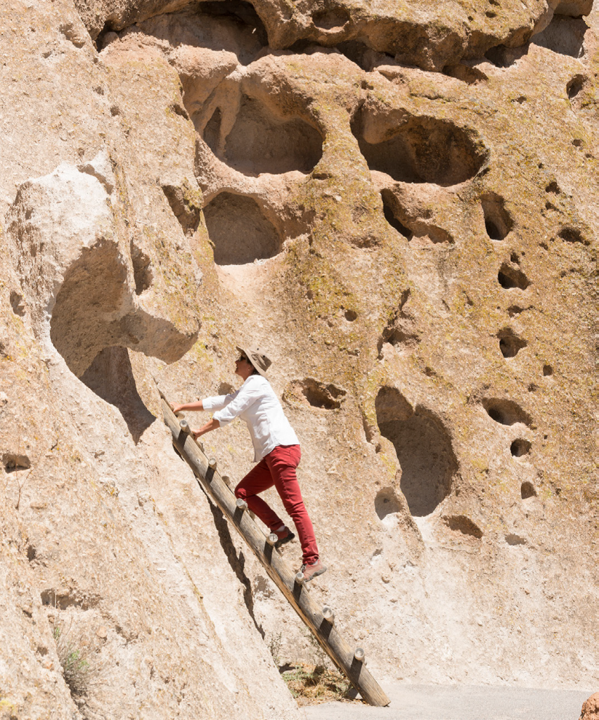 You’ll view several Kiva ladders on the Tsankawi trail. (Photo courtesy of Santa Fe County)
Tsankawi offers insight into Ancestral Tewa Pueblo life from the 1400s. Their descendants reside in nearby San Ildefonso Pueblo. Perched on a narrow mesa amid volcanic tuff, the site boasts stunning mountain views, intact ruins, cliff dwellings, and petroglyph panels featuring people, birds, animals, and stars.
The easy-to-moderate trail follows ancient paths, with ladders aiding steep sections—perfect for solitude, scenery, and history.
These trails are just the start of Santa Fe's outdoor adventures. Discover more in our blog, 4 Don't Miss Trails in Santa Fe County.
Plan your journey through time: Order your free Visitors Guide and explore current Santa Fe specials, packages, and deals.
This guide was developed in partnership with Tourism Santa Fe and Santa Fe County.