Hiking Carrauntoohil: Complete Guide to Ireland's Highest Peak
Kerry, Ireland
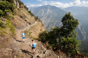
During a trip through County Kerry, I summited four of Ireland's tallest peaks in one day, including Carrauntoohil, the country's highest at 1,038 meters (3,407 feet). Here's my expert guide to this rewarding adventure.
For a challenging, cost-free outdoor pursuit in Ireland, hiking Carrauntoohil is unmatched. As Ireland's loftiest summit, it offers breathtaking views and a true test of endurance.
Carrauntoohil (Corrán Tuathail in Irish, meaning 'Tuathail's Sickle') anchors the MacGillycuddy's Reeks range in County Kerry.
It's an ideal excursion from Killarney, gateway to Killarney National Park.
Multiple routes ascend Carrauntoohil, but I chose the renowned Coomloughra Horseshoe Loop, hailed as Ireland's premier ridge walk.
This comprehensive guide covers all routes, firsthand insights from my hike, and essential packing advice for your Irish mountain quest.
Carrauntoohil Hiking Routes
Four primary routes suit hikers: three direct paths and the advanced Coomloughra Horseshoe, summiting Ireland's top three peaks.
The Devil's Ladder Route is the most popular for its accessibility.
As an experienced hiker seeking challenge, I opted for the demanding Coomloughra Horseshoe Loop.
1. Brother O’Shea’s Gully Trail
Distance: 6.8 miles
Hiking Time: 4-6 hours
Starting Location: Cronin’s Yard
The easiest option, starting at Cronin’s Yard like Devil’s Ladder. Traverse Hags Glen, fork right over Lough Gouragh, ascend gentle slopes with minor exposures, and reach the summit. Descend the same route.
2. Devil’s Ladder Trail
Distance: 7.1 miles
Hiking Time: 4-6 hours
Starting Location: Cronin’s Yard
The go-to tourist route from Cronin’s Yard, passing between Lough Gouragh and Lough Callee (after a river ford). The namesake ladder is a steep, scree-filled gully. Summit after the climb; return the same way.
3. The Caher Trail
Hiking Time: 4-6 hours
Starting Location: Hydro Track Parking Lot
Ascend via Caher (Ireland's third-highest peak). From the lot, pass a locked gate onto the steep Hydro Track (tractor road), enter the valley by Lough Eighter, climb right-side trail to Caher, ridge to Carrauntoohil summit. Descend same route.
4. Coomloughra Horseshoe Loop
Distance: 12 km (7.5 miles)
Hiking Time: 6-8 hours
Starting Location: Hydro Track Parking Lot
From the same lot as Caher Trail, veer left of Lough Eighter to encircle Beenkeragh, Carrauntoohil, and Caher in a horseshoe. This is the route I completed—details follow.
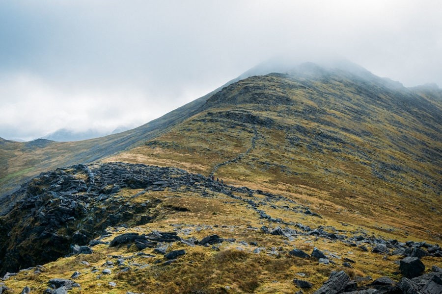
Hiking the Coomloughra Horseshoe
From the trailhead lot, I hopped a locked gate onto the steep Hydro Track concrete road.
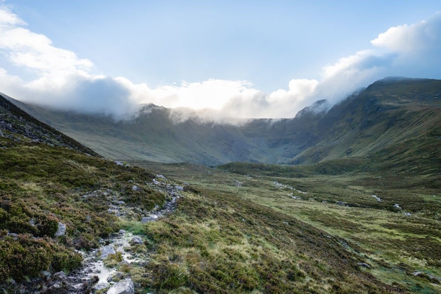
It was pre-dawn; I was first on trail.
The road yielded to a footpath after a livestock gate. As dawn broke, clouds shrouded the peaks.
I hoped for summit clearance!
Irish weather is notoriously fickle—often predictably inclement.
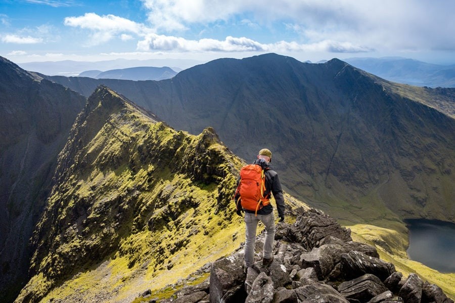
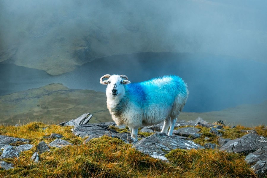
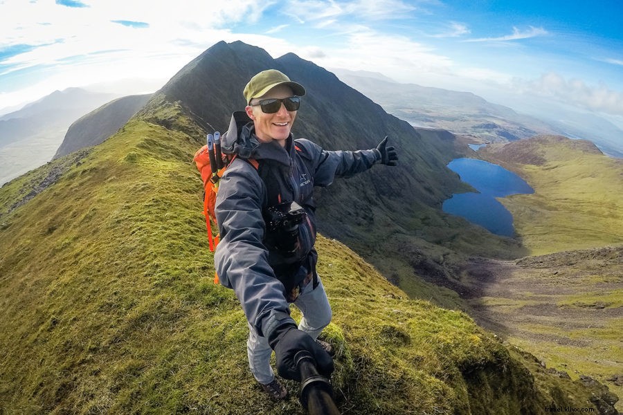
Scrambling Over Beenkeragh Ridge
Blue-marked sheep dotted the path—my sole companions.
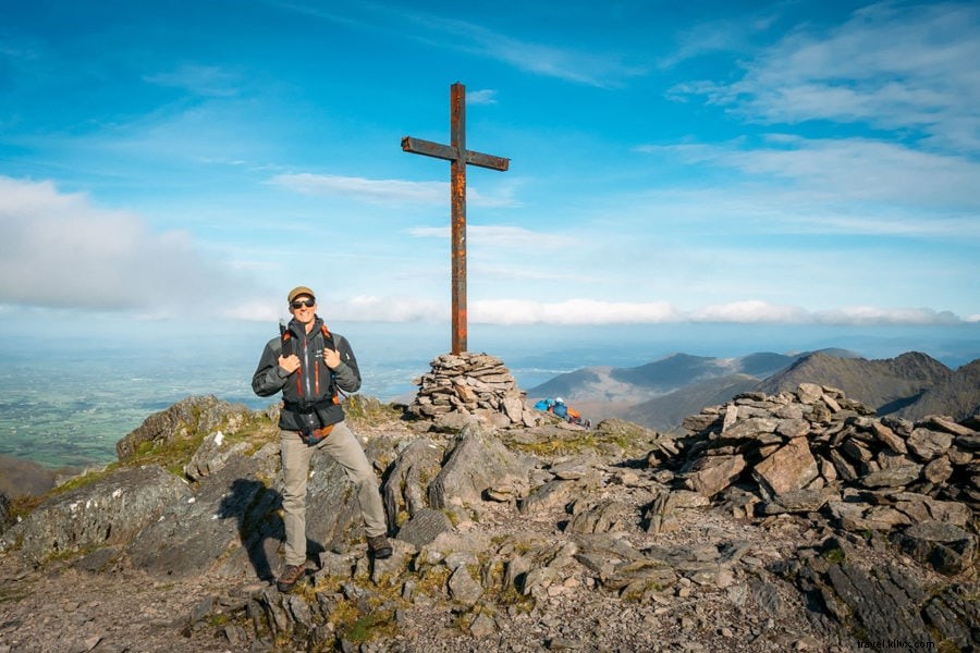
At Beenkeragh (Ireland's second-highest), clouds parted, revealing Carrauntoohil's steel cross.
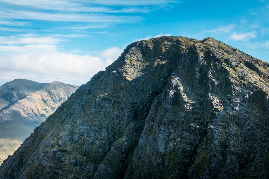
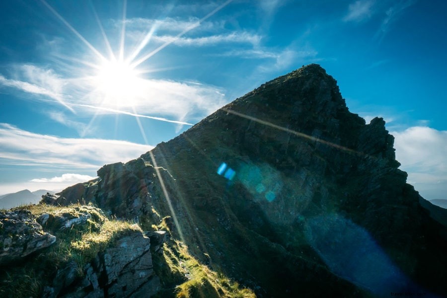
A narrow, exposed ridge followed: twisting rocks, sheer drops.
Avoid in rain or poor visibility.
Reaching Carrauntoohil Summit
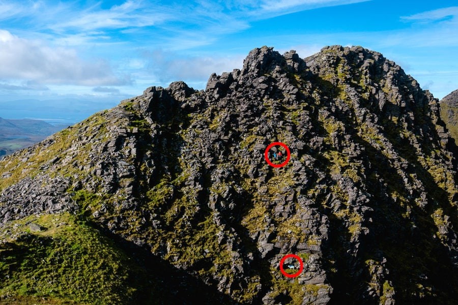
Ascending, I spotted distant hikers navigating boulders.
A sure-footed sheep scaled rocks below.
Up close, the 12-foot steel cross (replaced from wood; controversially felled in 2014, then restored) honors fallen climbers. Though modest in height, weather hazards persist.
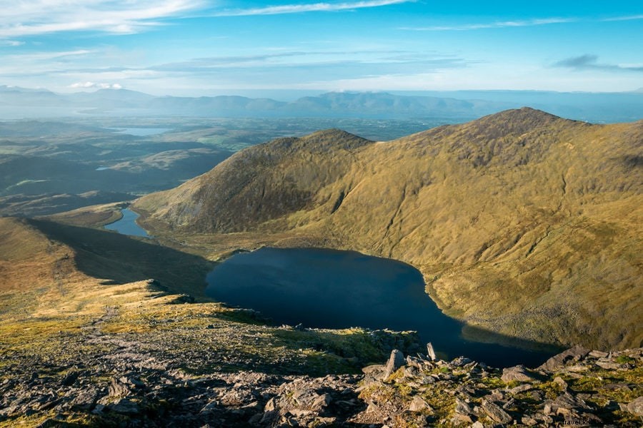
Clear skies granted panoramic views. In a roofless shelter, I lunched and brewed coffee before Caher.
Traverse to Caher
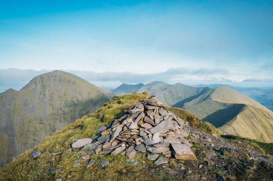
A level ridge walk rose to Caher (1,000m/3,300ft), Lough Eighter visible below.
Winds picked up; brief summit stop. Descending, a local recounted WWII plane crash victims.
Back at Hydro Track and car, mission complete: Ireland's top three peaks in a day.
Getting to Carrauntoohil
In southern County Kerry's MacGillycuddy's Reeks, 30 minutes' drive from Killarney.
Book via Discover Cars for best rates across providers. See my Ireland driving tips.
No public transit; taxi or guided tours with transport available.
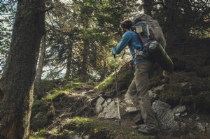
Carrauntoohil Packing List
Essential gear for safety and comfort. See my full backpacking checklist for more.
Clothing
Layer: rugged/quick-dry pants, base layer, fleece, waterproof/windproof jacket, gloves, buff.
Footwear
Waterproof trail runners or boots for boggy terrain—no sandals.
Equipment
Daypack, poles (optional), sunscreen, hat. My backpack guide here.
Food/Water
High-energy snacks (e.g., Pemmican, trail mix), stove for coffee, filtered bottle.
Expert Hiking Tips
- Mix routes up and down for variety.
- Respect weather/exposure—winds/fog turn risky fast.
- Share itinerary; follow safety protocols.
- Honor limits; trust instincts.
- Hike with partner if inexperienced.