Hiking Mount Whitney in Winter: Expert Guide to California's Highest Peak via Mountaineer's Route
Lone Pine, California
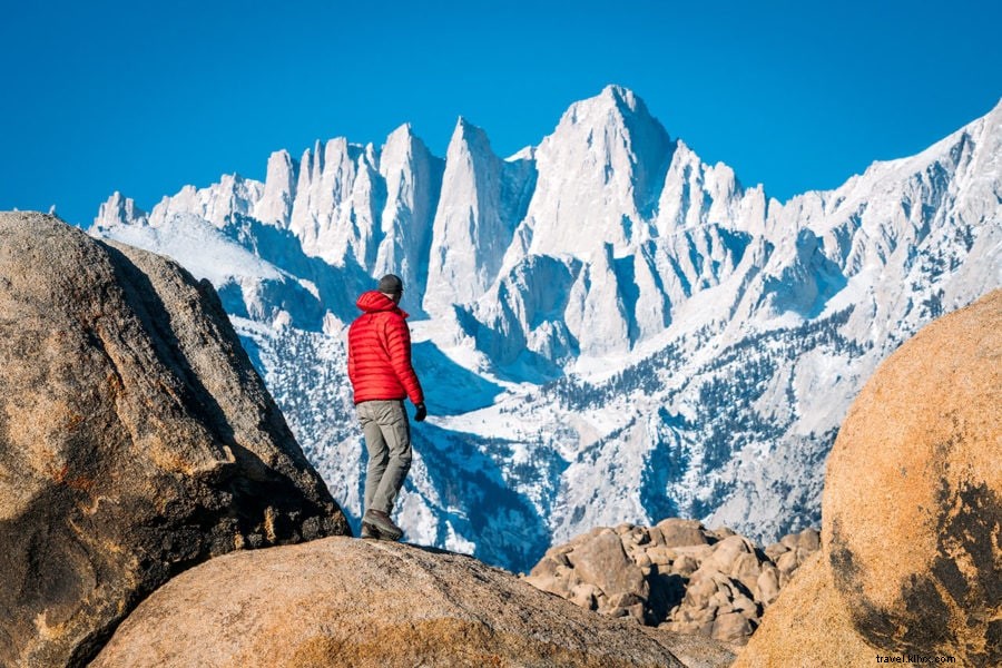
Planting one foot ahead of the other in deep snow, ice axe in hand and breath ragged, I pressed toward the summit of California's tallest peak—Mount Whitney.
Mount Whitney stands as the highest peak in the lower 48 states at 14,505 feet. Remarkably, California boasts both the nation's lowest point (Death Valley) and one of its loftiest summits.
This iconic mountain draws massive crowds, making it one of California's most sought-after hikes. Permits are required via lottery during peak summer months.
But not in winter.
To avoid crowds and permit hassles, I tackled Mount Whitney in early spring (April), when no permit is needed. This meant navigating snowfields, enduring subfreezing nights, and opting for the challenging Mountaineer's Route.
This advanced route demands mountaineering skills and is unsuitable for novices.
Table Of Contents- Mt Whitney Hiking Guide
- Don’t Underestimate This Mountain!
- Whitney’s Different Hiking Routes
- Securing A Permit For The Hike
- Climbing Mt Whitney (DAY 1)
- Climbing Mt Whitney (DAY 2)
- Climbing Mt Whitney (DAY 3)
- Additional Hiking & Packing Tips
Mt Whitney Hiking Guide
Don’t Underestimate This Mountain!
Before diving into my Mount Whitney ascent, understand its challenges for the unprepared. Around 30,000 attempt it annually, yet only 30% summit successfully.
The trail isn't excessively long but brutally steep, with rapid elevation gain. Without regular conditioning, it will test your limits.
Winter/early spring hikes, like mine, intensify risks with snow. Injuries and fatalities occur from traversing steep, icy slopes without proper gear or skills.
Whitney’s Different Hiking Routes
1. Mount Whitney Day Hike
DISTANCE: 22 miles (Round Trip)
ELEVATION GAIN: 6500 feet
TIME: 12-18 hours
DIFFICULTY: Moderate
SUMMARY: Class 1 trail, but lengthy at high altitude. Start pre-dawn to descend by dark.
2. Mount Whitney Overnight
DISTANCE: 22 miles (Round Trip)
ELEVATION GAIN: 6500 feet
TIME: 2 days
DIFFICULTY: Moderate
SUMMARY: Overnight splits the effort but requires camping gear and a heavier pack.
3. The Mountaineer’s Route
DISTANCE: 5 miles (Round Trip)
ELEVATION GAIN: 6600 feet
TIME: 2-3 days
DIFFICULTY: Difficult
SUMMARY: Demanding Class 2/3 route with scrambling. Shorter distance, same gain—straight up. This is my detailed route.
Securing A Permit For The Hike
For May 1–November 1, enter the lottery. Daily limit: 160 hikers.
Permits cost $15; apply February 1, winners notified March, purchase April 1. Weekends fill fast.
My approach: Self-issue free off-season permit (Nov 2–Apr 30). Requires experience and specialized gear.
Climbing Mt Whitney (DAY 1)
I started at Lone Pine's Eastern Sierra Interagency Visitor Center, self-issuing an overnight permit. Rented bear canister if needed; grabbed WAG bag too.
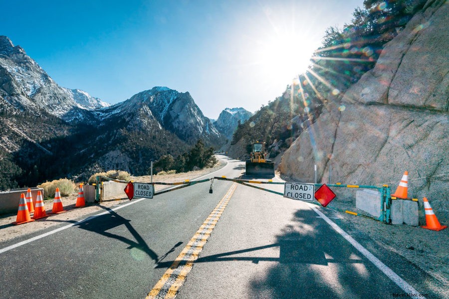
Drove Jeep to closed Whitney Portal Road gate (upper section shut for rockfall cleanup). Parked, hiked 2 miles/2,000 ft pavement to Whitney Portal Campsite (8,300 ft) for acclimatization camp. Site closed early season, but restrooms/water available.
Climbing Mt Whitney (DAY 2)
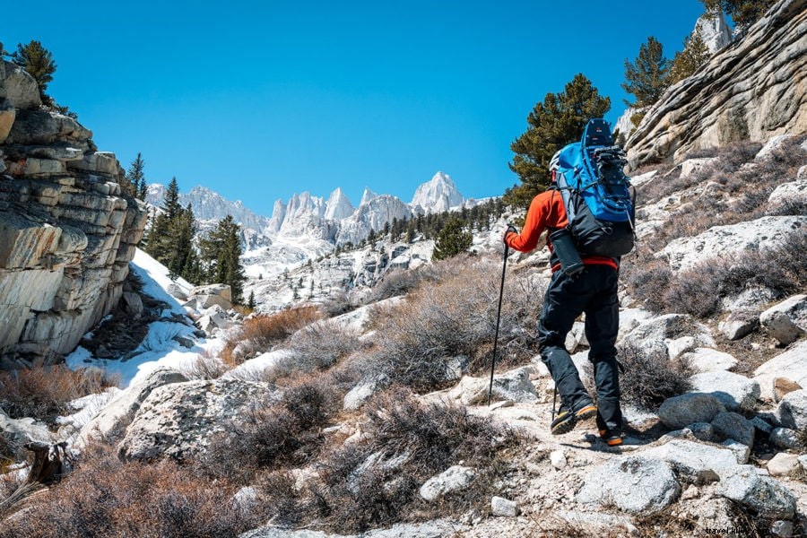
Trail by 7am via main path, then right to North Fork Trail/Mountaineer's Route—John Muir's 1873 solo path.
Crossed North Fork creek amid brush/saplings. Then Eversbacher Ledges: exposed zigzags (fine if not icy; one scramble).
Reached Lower Boyscout Lake; pushed to Upper for better progress.
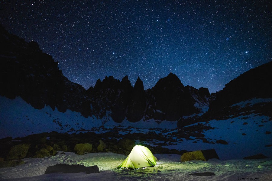
Overnight On The Mountain
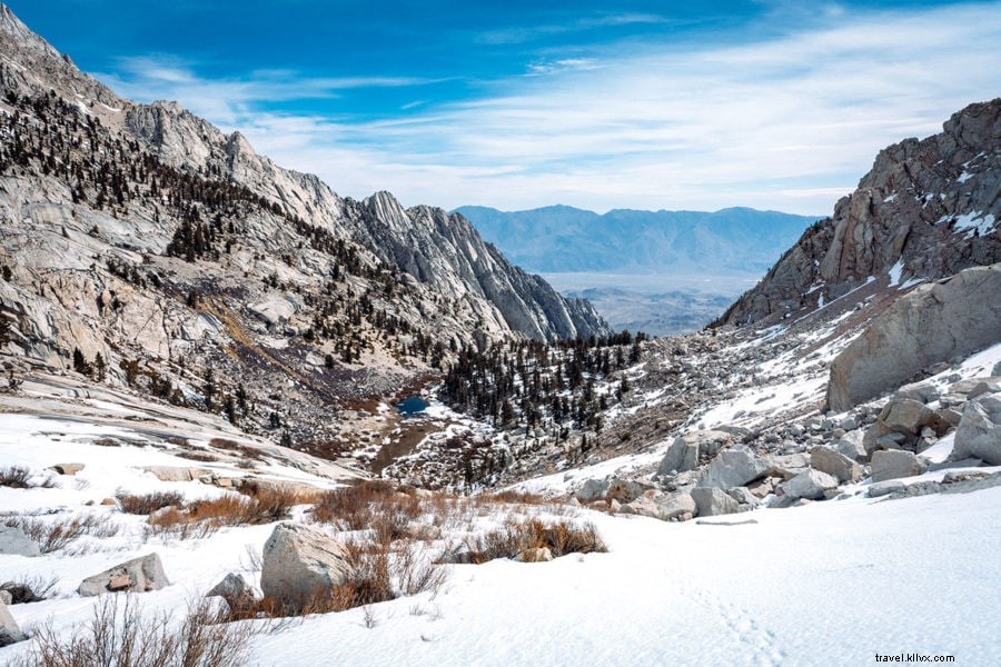
Camped rocky area between Upper Boyscout and Iceberg Lake. Snow melt provided water; no lake needed. Calm night; built no snow wall. Starry skies!
Climbing Mt Whitney (DAY 3)
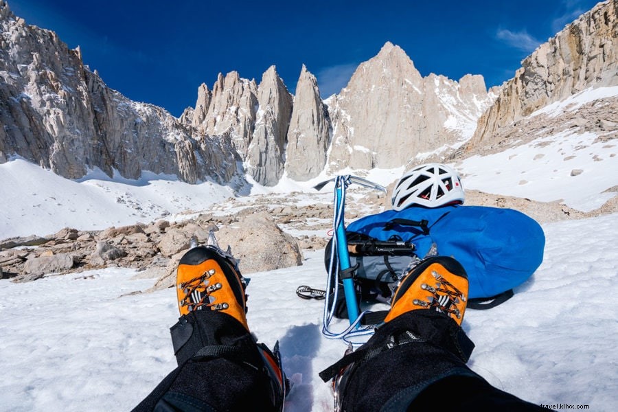
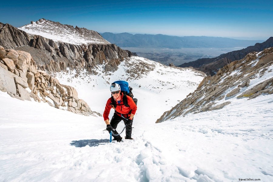
Up at 6am; stowed tent/sleeping gear. At Iceberg Lake (12,621 ft), eyed Mountaineer's Gully (35° snow chute). Crampons/ice axe essential; helmet for falling rocks/ice.
Slow slog; rested often at altitude. Top: Class 2/3 scramble to Notch for rest/snack.
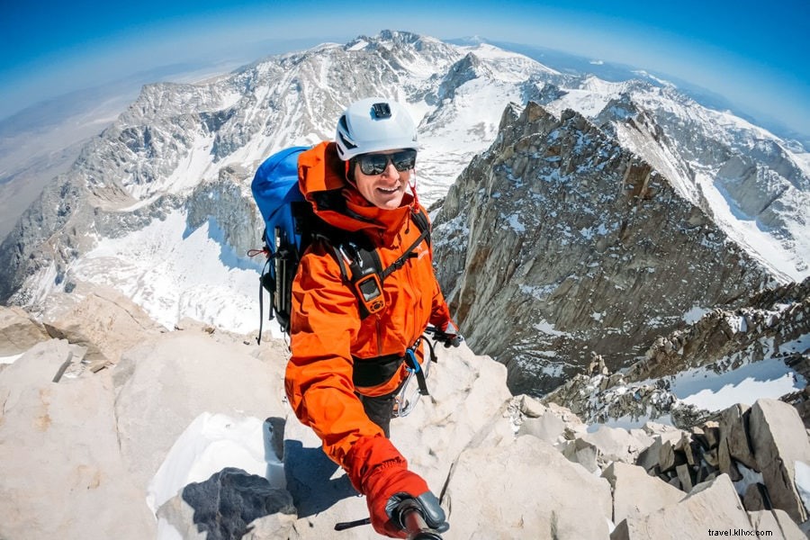
Reaching The Summit
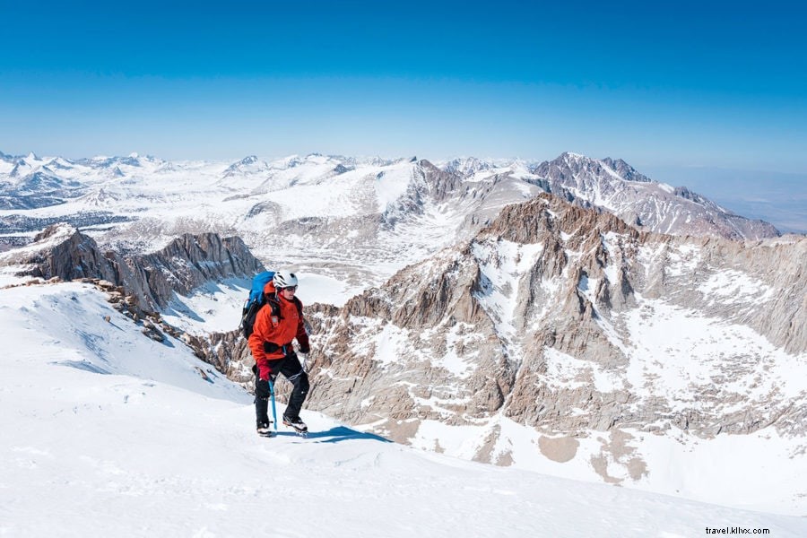
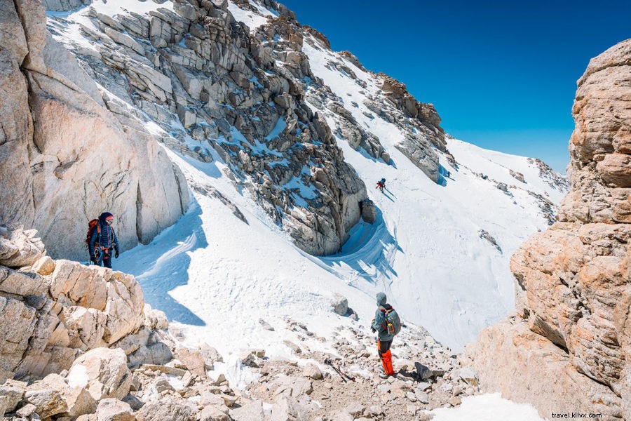
From Notch, skipped Class 3 for safer Class 2 traverse (solo, no ropes). Sketchy thin-snow downclimbs; adrenaline high.
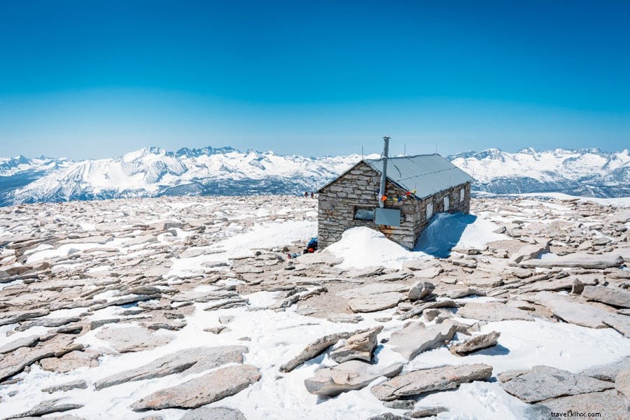
Upslope to Summit Hut (1904 Smithsonian shelter). Lunched amid 360° views on bluebird day. Solo winter summit achieved!
Additional Hiking & Packing Tips
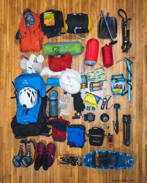
My Winter Packing List
50L pack hit 37 lbs. Winter demands more gear than summer day hikes.
- 50 Liter Backpack
- 2-Person Tent
- 0F Degree Sleeping Bag
- Insulated Sleeping Pad
- Shell Jacket
- Shell Pants
- Down Jacket
- Thermal Underwear
- Headlamp
- Balaclava
- (2) Pairs of Gloves
- Winter Hat
- First Aid Kit
- Camp Stove
- Kevlar Bear Bag
- Insulated Water Bottle
- Water Filter
- Crampons
- Ice Axe
- Snowshoes
- Avalanche Shovel
- Hiking Poles
- Climbing Helmet
- Personal Locator Beacon
Mount Whitney Hiking Tips
- No wood fires above treeline; use stoves.
- Bear-proof food storage; marmots raid tents.
- Respect limits; turn back safely.
- Time summit for daylight descent.
- Mountaineer's Route: 2 days/1 night + trailhead camp/road hike.
Hiking Video: Climbing Mount Whitney
Subscribe to my YouTube Channel for new Adventure Travel Videos!
(Click to watch Mt Whitney – Hiking The Mountaineer’s Route on YouTube)