Ultimate Guide to Outdoor Adventures in Far Southwest Virginia: Hiking, Biking, Paddling & More
Far from the crowded Eastern Seaboard, Far Southwest Virginia offers stunning mountainous terrain ideal for outdoor enthusiasts. Summit Virginia's highest peak at Mount Rogers, pedal rugged mountain bike trails or scenic rail trails, ride OHVs along overlooks and streams, backpack remote highland paths, float peaceful rivers and lakes, kayak thrilling whitewater, or camp in picturesque wooded sites.
Far Southwest Virginia lies west of I-77, between West Virginia and North Carolina. This arrowhead-shaped region borders Tennessee, Kentucky, West Virginia, and North Carolina, featuring Virginia's highest point (Mount Rogers), westernmost point (Cumberland Gap), wildest whitewater, unique rock formations, and deep Appalachian culture. Locals are famously friendly and eager to share their region's secrets.
Jefferson National Forest and Mount Rogers National Recreation Area dominate recreation here, alongside Cumberland Gap National Historical Park and state parks like Breaks Interstate Park (the "Grand Canyon of the South"), Natural Tunnel State Park, and Grayson Highlands State Park.
Rivers shine too: the overlooked North Fork Holston for fishing and floating; biologically diverse Clinch River for paddling; upper Holston forks; and challenging Russell Fork whitewater.
Lakes blend aquatic and mountain views: Pound Lake and Flannagan Reservoir as prime highland reservoirs; Virginia's share of South Holston Lake; plus smaller gems like Hungry Mother State Park lake, High Knob Lake, and Bark Camp Lake.
This guide highlights top hikes, bike routes, paddles, backpacking trips, camping spots, and OHV trails for your perfect Far Southwest Virginia adventure.
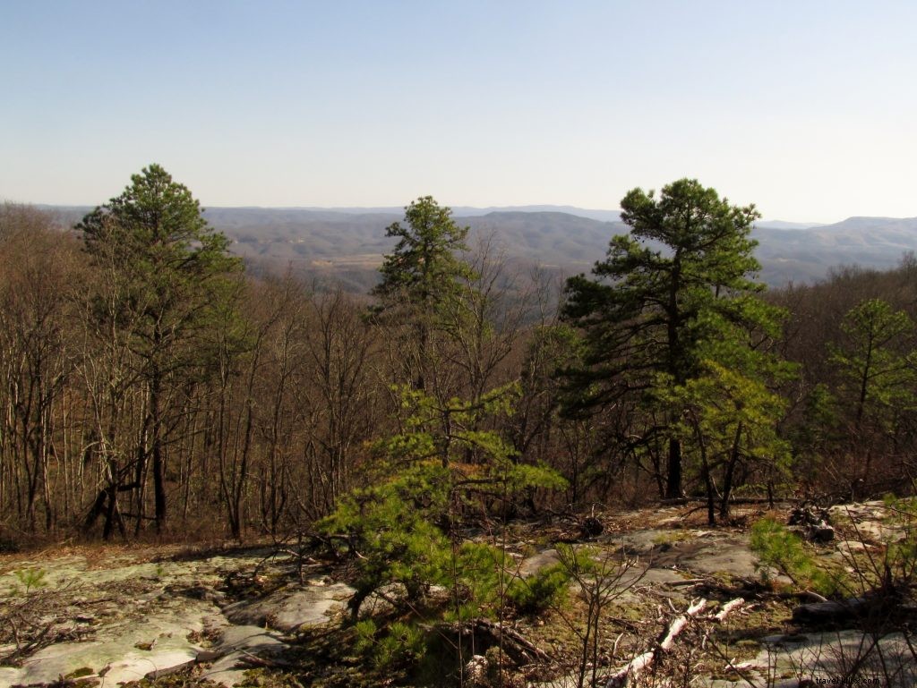
Hiking in Far Southwest Virginia
With thousands of miles of trails—including 400+ in Mount Rogers National Recreation Area and 110 miles of the Appalachian Trail—this region offers endless hiking. Explore Cumberland Gap's historic paths, Jefferson National Forest ridges and waterfalls, state park rock formations and meadows, and more geological wonders.
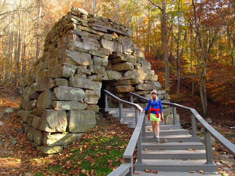
Cumberland Gap & Iron Furnace: 1.8 miles
Nearest Town: Ewing
From Cumberland Gap Visitor Center, follow Wilderness Road Trail to Gap Cave and historic Cumberland Gap. View the Daniel Boone memorial, then take Tennessee Road Trail to the preserved Newlee Iron Furnace (1820s–1880s).
Natural Tunnel State Park: 1.8 miles
Nearest Town: Duffield
Marvel at the massive Natural Tunnel carved by Stock Creek. Visit the 220-year-old Carter Cabin, ascend the gorge rim for views, and end at Lovers Leap with dramatic geology.
Comers Creek Falls: 1.2 miles
Nearest Town: Speedwell
Follow Comers Creek's cascades through rhododendron thickets to the Appalachian Trail. Turn right for the 15-foot stair-step falls.
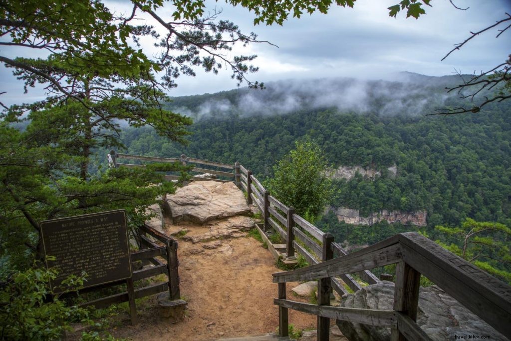
Overlook Trail: 1.5 miles
Nearest Town: Haysi
At Breaks Interstate Park, trace the gorge edge above Russell Fork (1,650 feet below). Continuous inspiring views; loop via Loop and Prospectors Trails.
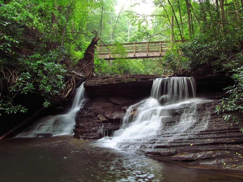
Falls of Little Stony: 5.0-mile out-and-back
Nearest Town: Dungannon
Highlights: Middle Falls, Upper Falls
Little Stony Creek National Recreation Trail winds through a gorge of waterslides, pools, bluffs, and overhangs to two stunning waterfalls. Footbridges keep feet dry.
Pinnacle Natural Area Preserve: 3.2-mile out-and-back
Nearest Town: Lebanon
Highlights: Swinging bridge, Big Falls, Pinnacle Rock
Cross a swinging bridge over scenic Big Cedar Creek to creek-wide Big Falls. Climb Pinnacle View Trail to the dramatic rock summit with expansive views.
Rowland Falls Loop: 11.8 miles
Nearest Town: Damascus
Highlights: Rowland Creek Falls, wildflowers
Ascend Rowland Creek Valley to the falls, then traverse high country via Old 84 Trail under Double Top and Round Knob. Steady grades through scenic terrain.
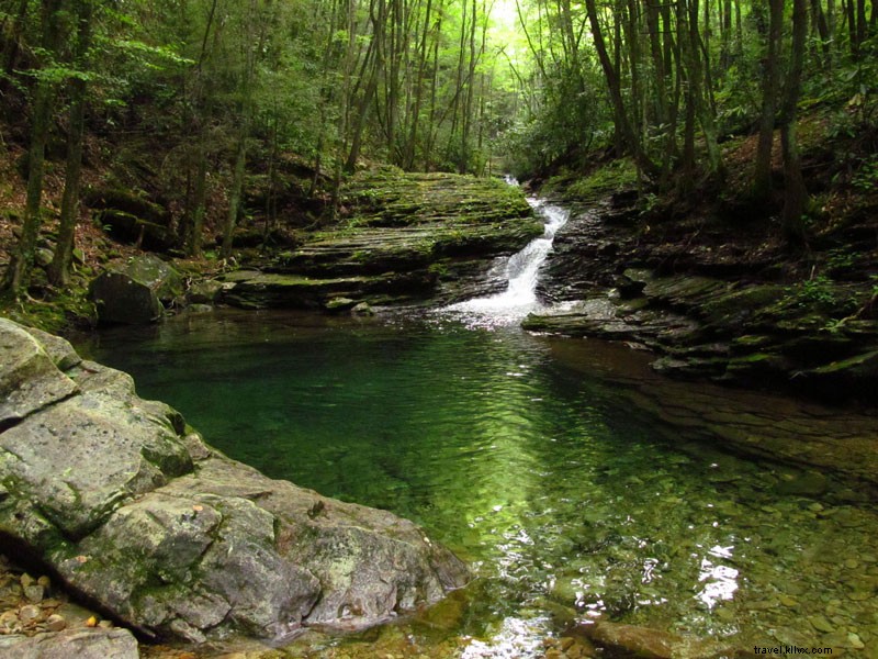
Devils Bathtub: 4.6-mile out-and-back
Nearest Town: Fort Blackmore
Highlights: Swimming holes, Devils Bathtub, Jones Hollow Falls
Navigate a boulder-strewn gorge with cliffs and cataracts (multiple fords). Reward: bone-chilling aquamarine pools in deep forest shade. Best in warm weather.
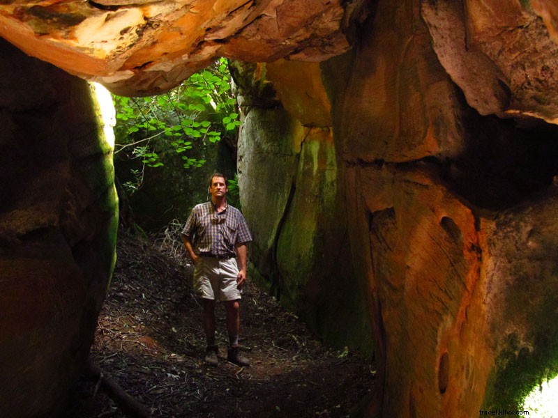
Great Channels of Virginia: 6.2-mile out-and-back
Nearest Town: Meadowview
Highlights: Middle Knob views, The Channels
Summit Middle Knob for 360-degree vistas near a fire tower, then explore the sandstone monolith maze—a unique Appalachian preserve.
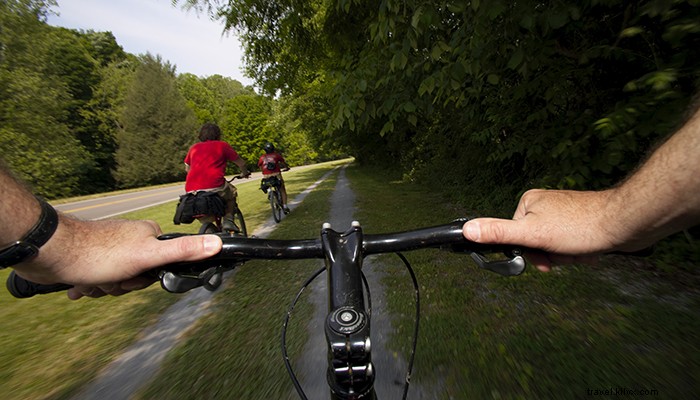
Bicycling in Far Southwest Virginia
Mountainous terrain suits mountain bikers, while rail trails welcome all. Spearhead Trails and Mount Rogers NRA offer rugged rides; Virginia Creeper Trail (34 miles), Guest River Gorge Trail, and Wilderness Road Trail (8.5 miles) provide scenic pedaling.
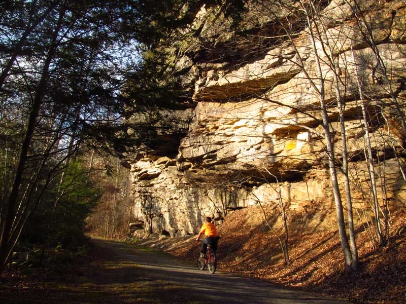
Guest River Gorge Trail: 11.8 miles
Nearest Town: Coeburn
Highlights: Swede Tunnel, waterfalls, geology
This rail trail blends history and gorge beauty: Swede Tunnel, high bridge over scenic Guest River, boulders, cascades to Clinch River confluence. Out-and-back.
Coal Canyon – Spearhead Trails: 30-mile network
Nearest Town: Grundy
Highlights: Customizable rides to overlooks, hollows
Family-friendly doubletrack through meadows and woods; OHV-shared. Part of expansive Spearhead system.
Rhododendron Gap Loop: 8.1 miles
Nearest Town: Troutdale
Highlights: Highest mountain biking in VA, views, wild ponies
From Scales, climb Crest Trail to Rhododendron Gap, loop via Gap Trail and Virginia Highlands Horse Trail through rocky sections and creeks.
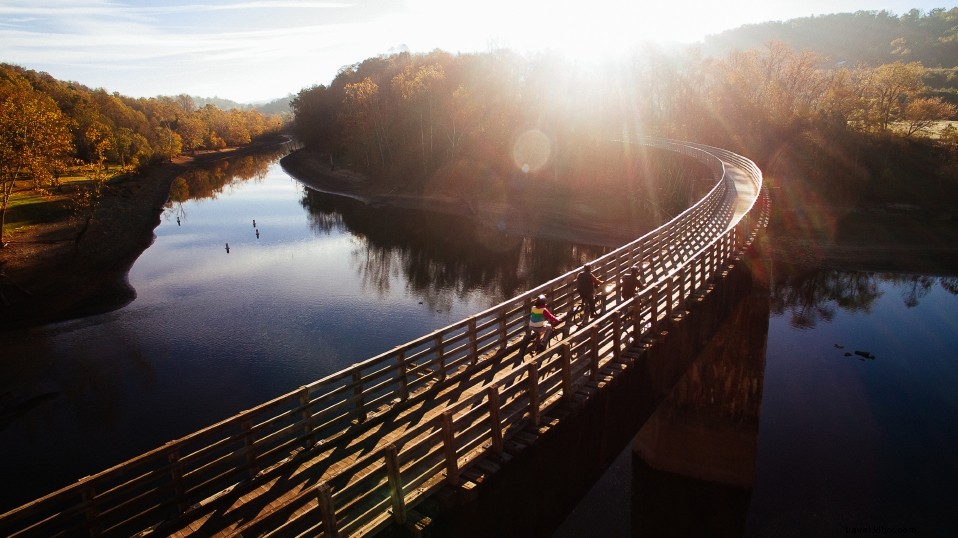
Whitetop Station to Damascus: 17 miles
Nearest Town: Damascus
Highlights: Downhill, Whitetop Laurel Creek waterfalls
Shuttle to 3,400 feet for mostly downhill Virginia Creeper Trail ride over trestles. Family-friendly classic.
Damascus to South Holston Lake and Back: 16 miles
Nearest Town: Damascus
Highlights: Alvarado station, Holston River trestle
Pastoral Virginia Creeper section past homes, alongside Laurel Creek and South Fork Holston. Turn at high trestle over forks confluence.
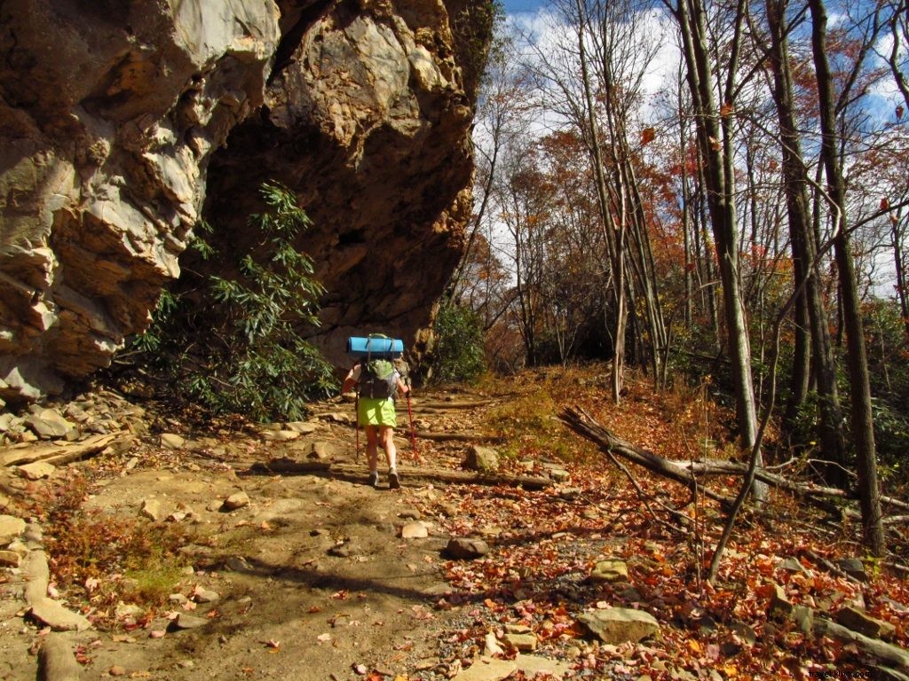
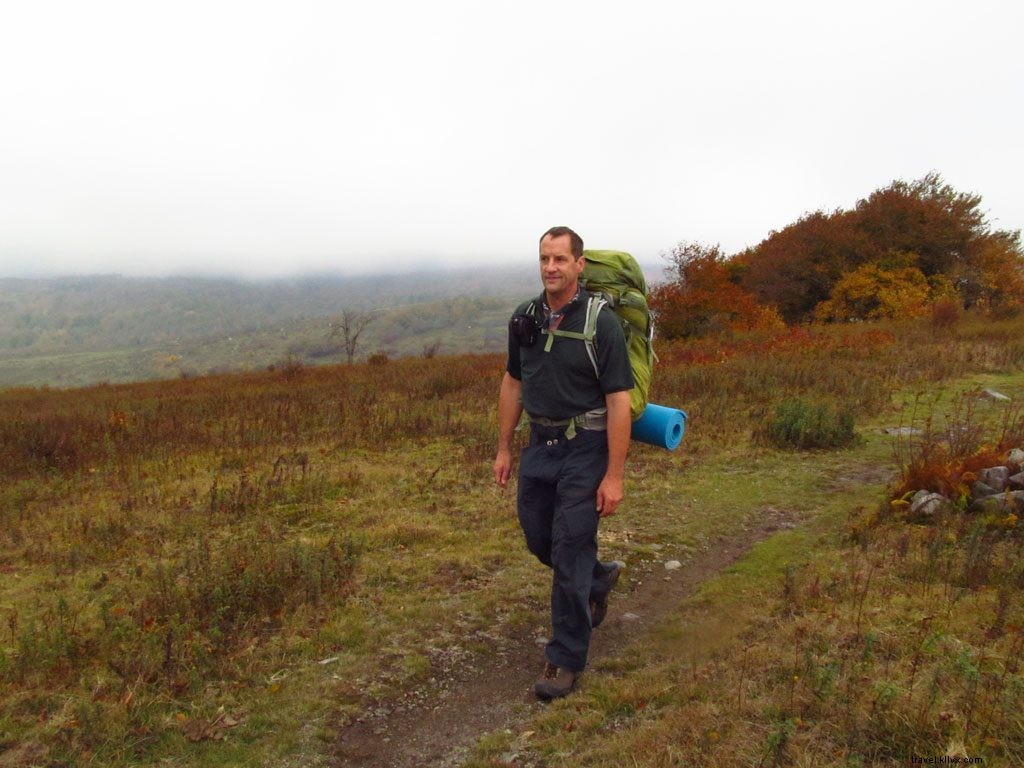
Backpacking in Far Southwest Virginia
110 miles of Appalachian Trail plus loops in Mount Rogers NRA and linear paths offer prime multi-day treks.
Ridge Trail: 20 miles end-to-end
Nearest Town: Ewing
Highlights: Overlooks, geology, Hensley Settlement
Cumberland Mountain ridgewalk with KY-VA state line views, historic settlement, Sand Cave, White Rocks. Designated sites and cabin.
Chief Benge Scout Trail: 19 miles end-to-end
Nearest Town: Norton
Highlights: High Knob Tower, Bark Camp Lake, Little Stony Falls
Mostly downhill through Jefferson NF: tower views, Stony Creek, lake, gorge waterfalls.
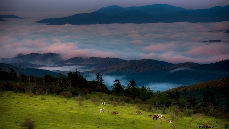
Mount Rogers High Country: Distance varies
Nearest Town: Konnarock
Highlights: VA's highest terrain, wild ponies, loops
Appalachian Trail network over Mount Rogers through Lewis Fork and Little Wilson Creek Wildernesses, Grayson Highlands meadows.
Pine Mountain Trail: Up to 40 miles end-to-end
Nearest Town: Pound
Highlights: Twin Cliffs, Mars Rock
Remote VA-KY border trail: High Rock, Eagle Arch, bare rock sections, overlooks to Russell Fork. Shelters and sites.
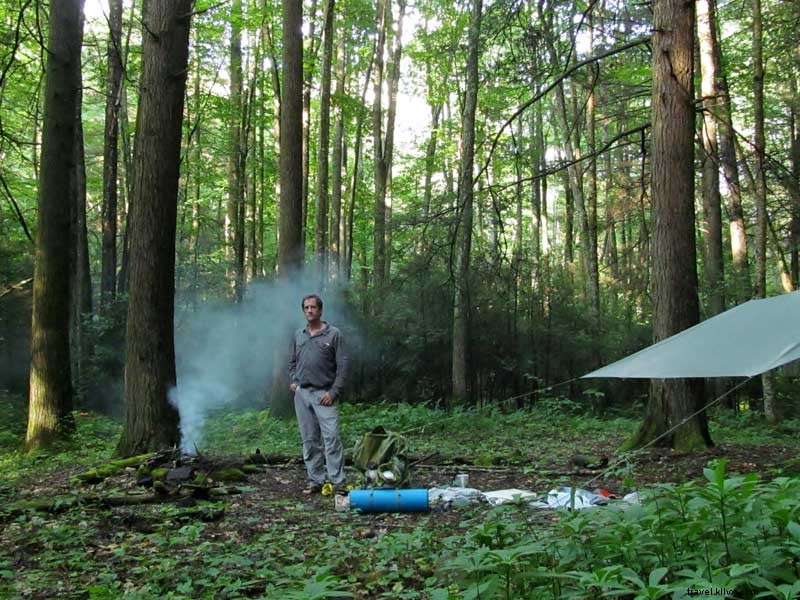
Camping in Far Southwest Virginia
Abundant campgrounds extend your stay amid forests and parks.
Wilderness Road Campground: Elevation 1,300 feet
Nearest Town: Ewing
160 wooded sites (some electric) in Cumberland Gap NHP. Spacious, with bathhouses. Ideal spring/fall for hiking and history.
Recreation: Hiking, history, programs
Hungry Mother State Park Campground: Elevation 2,300 feet
Nearest Town: Marion
Three areas: Creekside (electric/water), Royal Oak (tents), Camp Burson (full hookups). Bathhouses throughout.
Recreation: Hiking, swimming, fishing, boating
Grindstone Campground: Elevation 3,600 feet
Nearest Town: Konnarock
Shady sites in hardwoods near Mount Rogers trails and Laurel Creek.
Recreation: Hiking, fishing, wilderness
Grayson Highlands State Park Campground: Elevation 4,400 feet
Nearest Town: Volney
Premium sites (some electric/water) on Wilburn Ridge near high peaks. Bathhouses; equestrian area separate.
Recreation: Hiking, biking, riding, nature
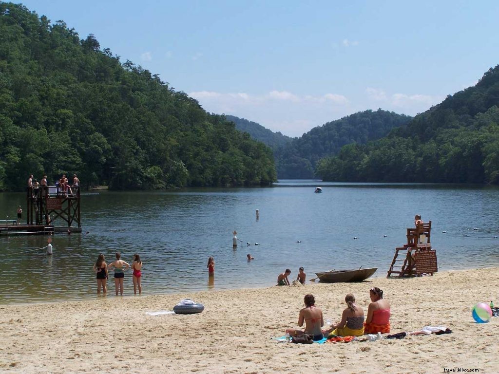
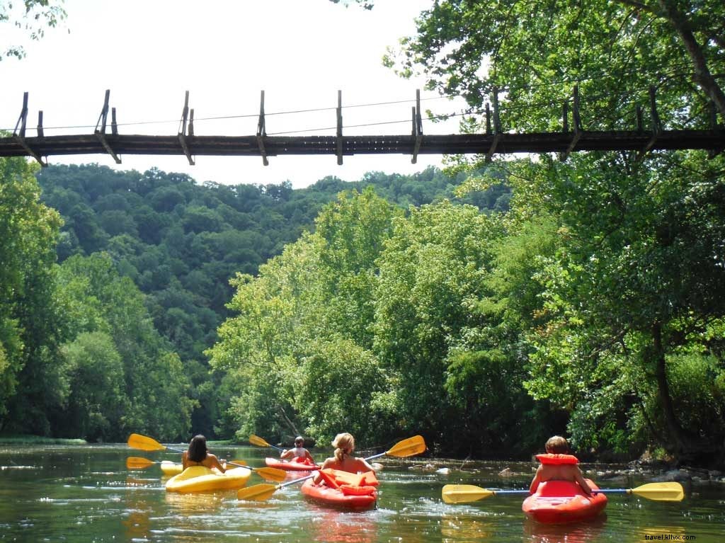
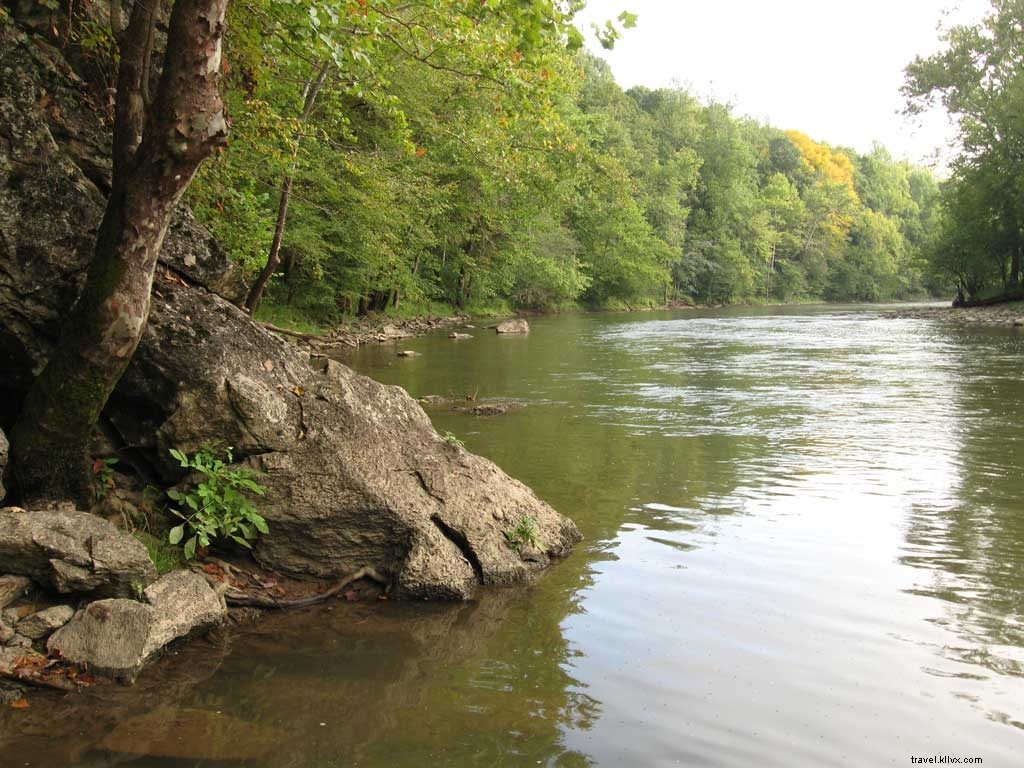
Canoeing & Kayaking in Far Southwest Virginia
Flatwater lakes, floatable rivers, and whitewater await. Powell/Clinch for overnights; multiple accesses for day trips.
North Fork Holston River
Nearest Town: Bristol
Class I-II rapids amid ridges. Novice-friendly; Adventure Mendota Outfitters offers guided 5-mile trips.
North Fork of Pound Lake
Nearest Town: Pound
154-acre wooded gem in Jefferson NF; launches at dam and upper end. Pine Mountain backdrop.
Clinch River
Nearest Town: St. Paul
Whitewater upper section; canoe/kayak-friendly below. Water trail developing; Clinch River Adventures outfitter.
Flannagan Reservoir
Nearest Town: Clintwood
1,143 acres with coves, Pound/Cranes arms for scenic paddling. Launches available.
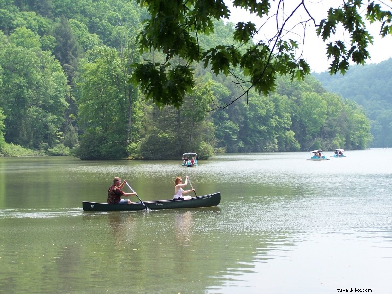
Hungry Mother Lake
Nearest Town: Marion
108-acre no-motor lake ringed by trails/highlands. Rentals: kayaks, canoes, paddleboards.
Whitetop Laurel Creek
Nearest Town: Damascus
Class II-III whitewater over boulders/falls. Shuttle via Virginia Creeper Trail.
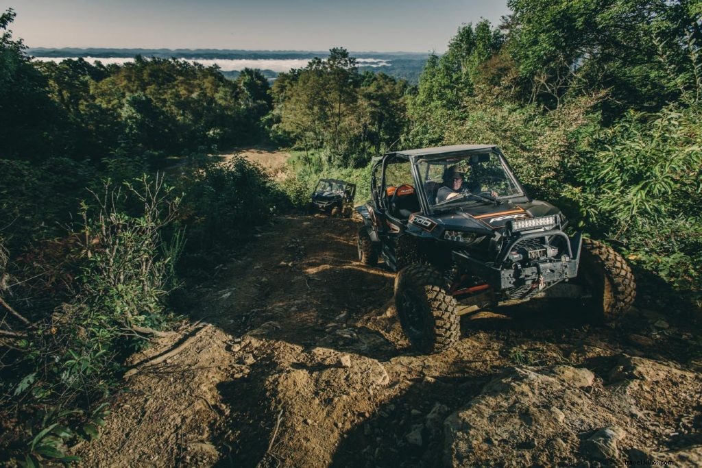
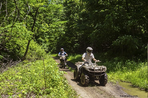
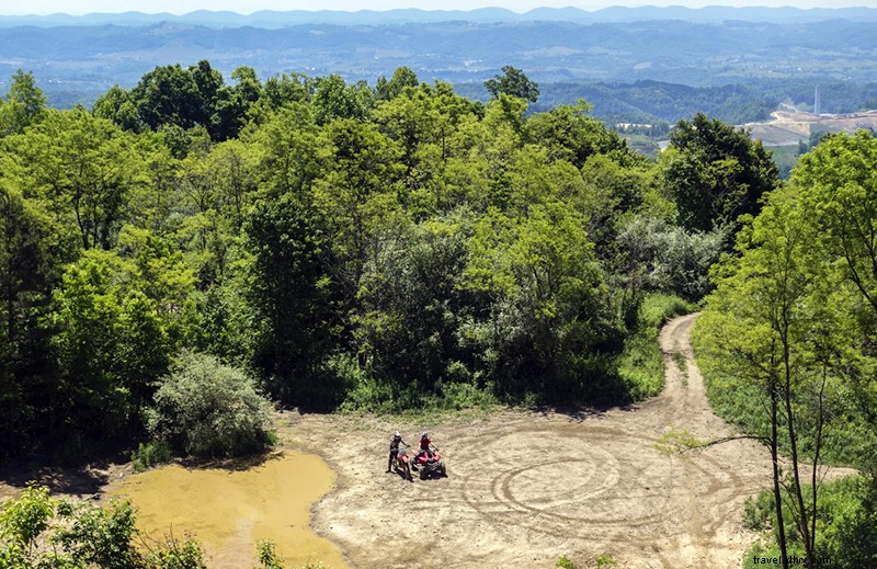
OHV Riding in Far Southwest Virginia
Spearhead Trails' 300+ miles across five areas welcome ATVs, motorcycles, bikes, hikers. Beginner to expert routes.
Ridgeview
Nearest Town: Haysi
60 miles (opened 2017) mixing ridgetops/forests from Kiwanis Park.
Coal Canyon
Nearest Town: Grundy
100-mile network to overlooks/hollows through meadows/woods.
Stone Mountain
Nearest Town: Pennington Gap
30 technical miles: overlooks, caves, rivers, steep climbs/descents.
Original Pocahontas
Nearest Town: Pocahontas
60+ wooded miles with views; visit Pocahontas Exhibition Mine.
Mountain View
Nearest Town: St. Paul
100+ miles: woods, steeps, 10 miles singletrack for dirt bikes.