Ultimate Guide to Hiking Kerlingarfjöll Geothermal Area in Iceland's Highlands
Kerlingarfjöll, Iceland
Nestled deep in Iceland’s central highlands, Kerlingarfjöll boasts small, geothermally active mountains with striking rust-colored rhyolite peaks often capped in snow. Discover how to plan your own self-drive adventure to this captivating destination.
Kerlingarfjöll offers a lesser-known yet rewarding day-hiking experience, conveniently located near Iceland’s iconic Golden Circle route. It remains one of my top highlights from exploring Iceland.
For those seeking to venture off the beaten path and enhance their Golden Circle itinerary with adventure, this surreal geothermal area is ideal for a half-day hike—or even an overnight stay.
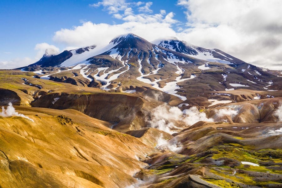
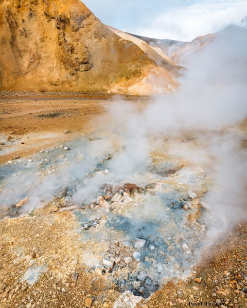
Framed by rugged green peaks and Iceland’s Tuya volcano system, Kerlingarfjöll stands out with its vibrant red and orange tones. Hiking these colorful rhyolite hills reveals hot springs, geysers, steam vents, and bubbling mud pots.
This expert travel guide shares proven tips for visiting this unique, photogenic wonder.
Kerlingarfjöll Iceland Map
How To Use This Map
Explore the interactive map above showing routes to Kerlingarfjöll. Click the top-left menu to toggle layers for routes and points of interest. Hide/show layers as needed, or click icons for details on locations mentioned in this guide. “Star” it to save to your Google Maps, or open in a new tab for a larger view. Safe travels!
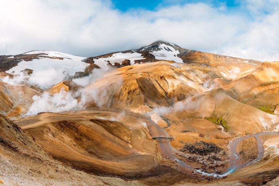
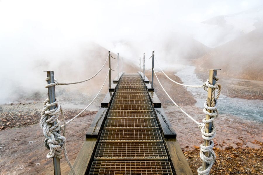
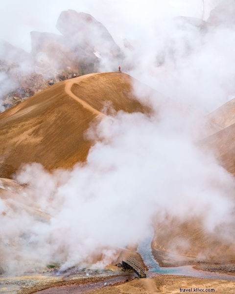
Exploring Hveradalir Geothermal Area
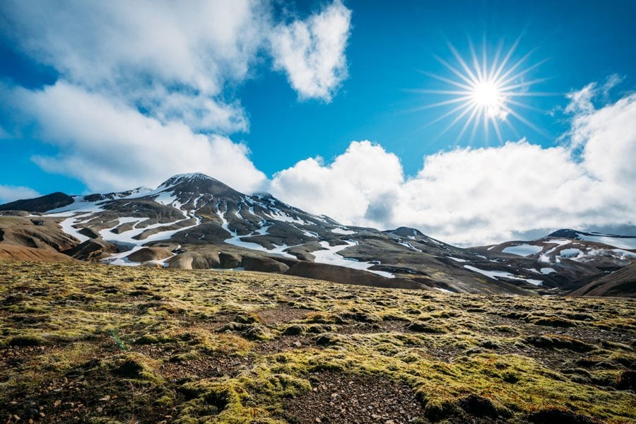
Many summits in Kerlingarfjöll, such as Fannborg and Snækollur, retain year-round snow cover. Once home to a ski lift, it was dismantled as warming climates reduced snow reliability.
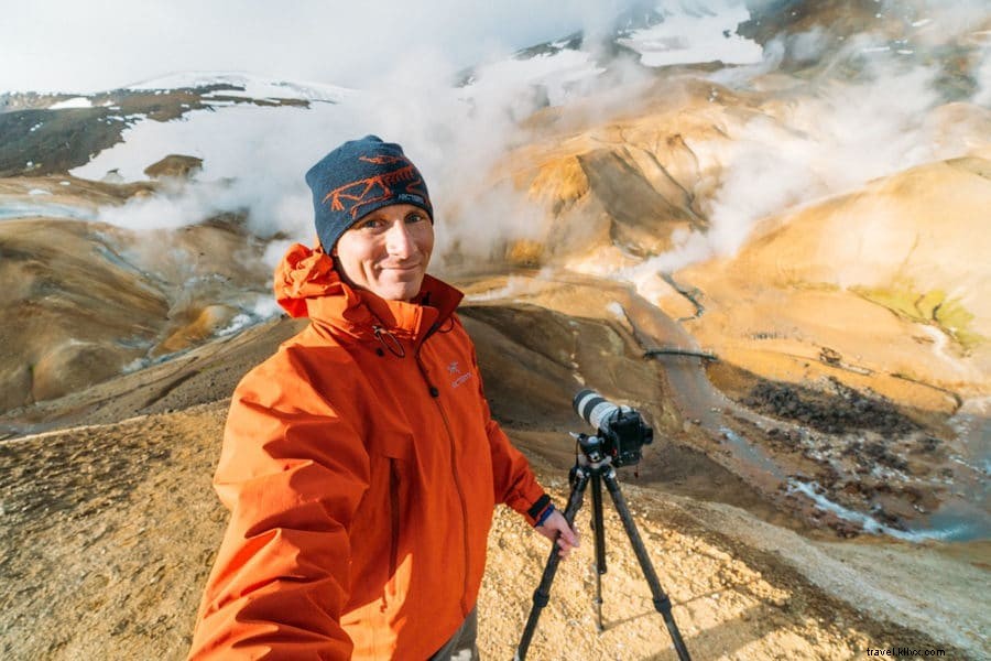
During my visit, I dedicated about 4 hours to hiking and photographing the Hveradalir geothermal area after camping at the on-site campground the previous night.
Navigating thick steam plumes from fumaroles and ascending muddy orange slopes felt like stepping onto an alien planet!
Early arrivals enjoy solitude; crowds build later in the day.
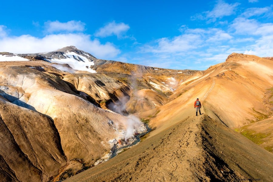
Kerlingarfjöll Hiking Trails
Kerlingarfjöll features a network of marked and unmarked trails, suitable for short outings or multi-day treks through this untamed Icelandic terrain.
Hringbrautin Ring Route – A comprehensive 3-day loop exploring every corner of Kerlingarfjöll, with two mountain huts eliminating the need for tent camping.
Austurfjall Peaks – Challenging 5-6 hour ascent covering the range’s highest summits, including Snækollur at 1,428m.
Hveradalir Walk – Popular 2-3 hour loop through the geothermal valley, featuring steam vents and hot springs, with optional peak extensions.
Myth of the Troll Woman
Kerlingarfjöll’s mountains long served as a hideout for outlaws and trolls in Icelandic lore, where belief in mystical beings endures.
Erratic weather—cloudy, windy, and fierce—defines this vast volcanic caldera, shaped by ancient eruptions beneath glaciers.
Legend speaks of Kerling, a hag troll and daughter of the fire giant Surtur, who turned to stone at sunrise. Spot her towering 30-meter pillar with a keen eye…
Getting to Kerlingarfjöll
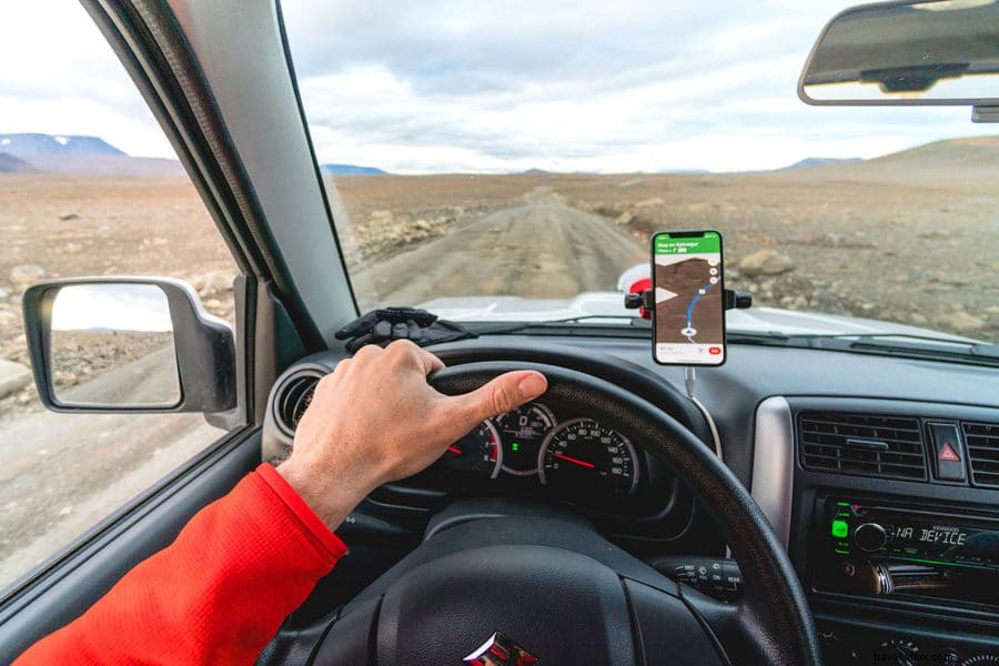
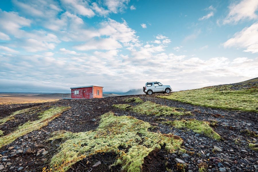
Accessible only via Iceland’s rugged F-Roads in the highlands, these unpaved jeep tracks traverse the remote interior.
F-Roads close from late September/early October until June due to snow, making summer the prime hiking season.
F-35 Kjölur, the access route, is relatively manageable among F-Roads, though a 4x4 vehicle is mandatory for all Icelandic mountain roads—2WD rentals lack insurance coverage amid extreme conditions (snow, rivers, mud).
Consult our full Iceland driving guide for essential preparation.
Golden Circle Extension
Enhance your self-drive Golden Circle with an early start: from Gullfoss, the 2-3 hour F-35 drive to Kerlingarfjöll suits rugged 4x4s. Alternatively, approach from northern Blönduós.
Highlands demand preparation: pack food, water, full fuel, and warm layers for potential breakdowns.
Overnighting is essential; return trips prevent rushing back to Reykjavík same-day, leaving time for capital highlights.
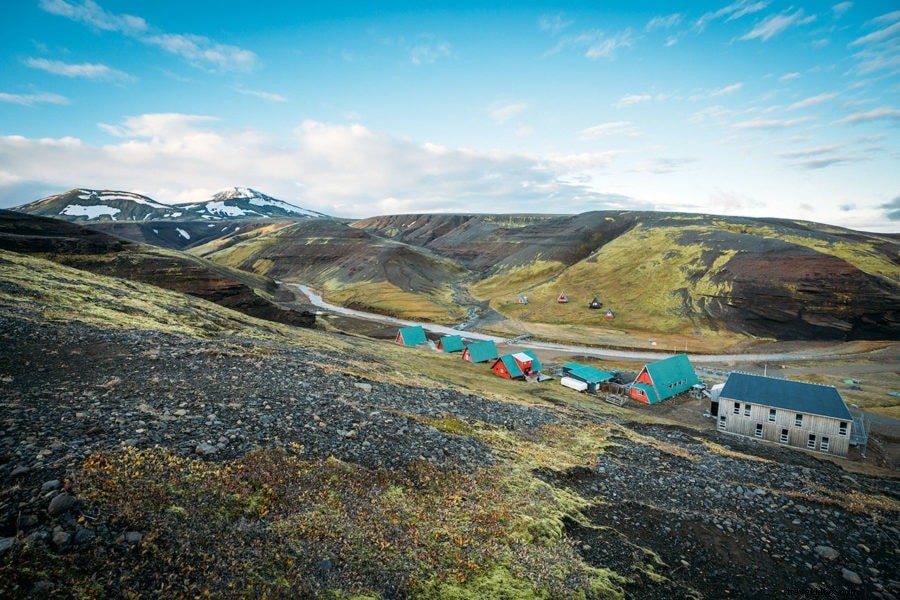
Where to Stay at Kerlingarfjöll
The Kerlingarfjöll Mountain Resort offers 20 double rooms, 10 cabins, and A-frames, plus hot showers, restrooms, a shop, and restaurant. I opted for the campground at 2,000 ISK (~$16 USD) per person.
A riverside trail from cabins leads to a swimmable hot spring pool (30-minute walk).
Further along F-35 lies Gíslaskáli Kjölur backpacker hostel.
Kerlingarfjöll Travel Tips
- Note: Kerlingarfjöll refers to the mountain range; Hveradalir is the geothermal zone.
- Reach Hveradalir’s red hills and vents by 1.5-hour hike from the resort or steep 4x4 dirt road.
- Fuel up pre-highlands; the on-site pump is unreliable.
- Buses 610/610a serve the area; plan overnight returns.
- Trails turn muddy/snowy; wear sturdy boots.
- Stick to paths to protect fragile ecosystems.
While the Golden Circle draws crowds, Kerlingarfjöll’s highlands reward intrepid explorers with unparalleled beauty. Worth every effort! ★