Explore Virginia's Charming Mountain Towns: Ultimate Guide to Scenic Adventures
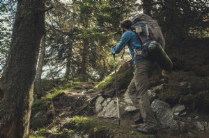
Virginia's Appalachian Mountains span hundreds of miles, from the highlands near Cumberland Gap in the southwest through the Blue Ridge to Maryland. Nestled among these majestic ridges and valleys are picturesque mountain towns. Residents enjoy stunning scenery with forested peaks, clear rivers, and endless hiking trails. While we can't all live there, visiting offers a taste of this natural beauty.
These towns provide excellent dining, lodging, supplies, and outdoor activities. Discover your ideal Virginia mountain getaway for relaxation and adventure.
BIG STONE GAP
GPS Coordinates: 36.85864, -82.78324
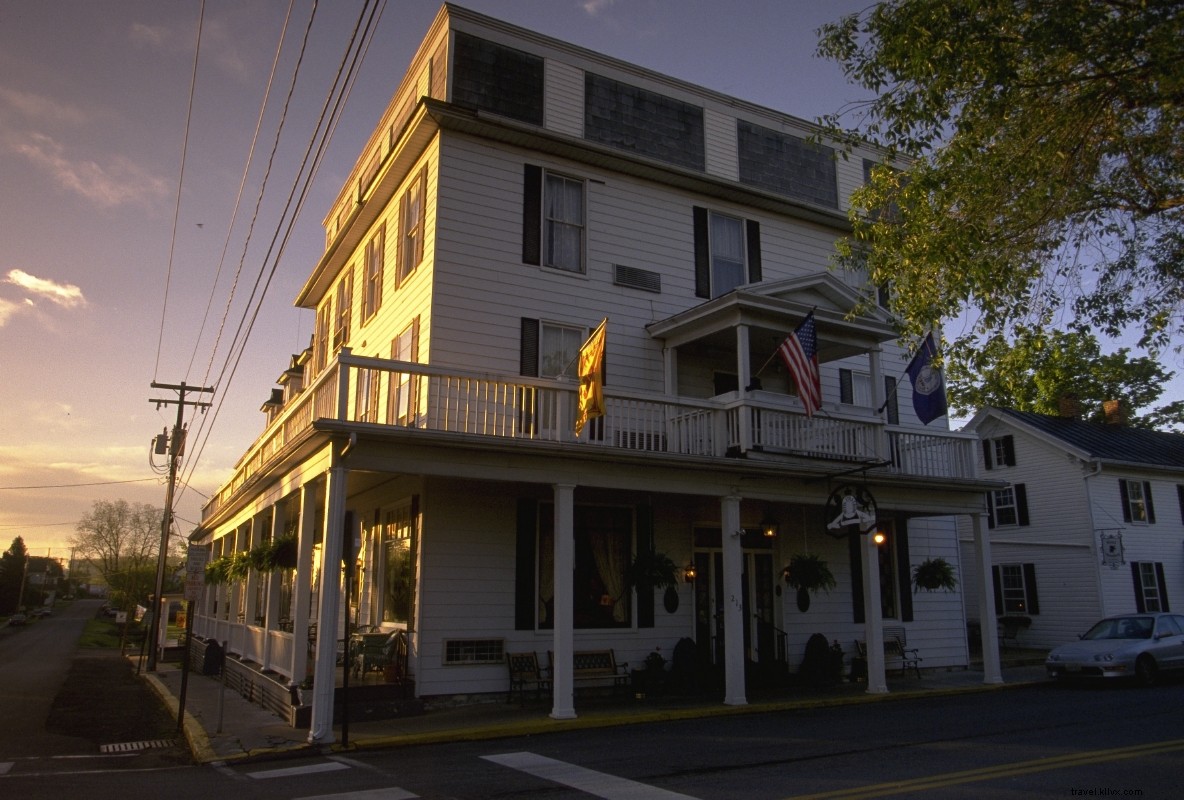
Why Visit: Immortalized in the Big Stone Gap book and film series, this real-life gem sits along the Powell River amid Southwest Virginia's mountains. Walkable downtown attractions include the Southwest Virginia Museum and The Meador Coal Museum, showcasing the region's coal mining heritage.
Activities: Ascend Stone Mountain to the restored High Knob observation tower for views of five states. Hike the 20-mile Chief Benge Scout Trail from High Knob Lake or Bark Camp Lake. Explore Devils Bathtub's waterfalls and swimming holes, or Natural Tunnel State Park. Bike the scenic 5-mile Guest River Rail Trail. Anglers can float and fish 12 miles on the Powell River from Bullitt Park to Dryden.
Dining/Shopping/Entertainment: Catch the Trail of the Lonesome Pine, Virginia's longest-running outdoor drama, based on John Fox Jr.'s novel about the coal boom era.
DAMASCUS
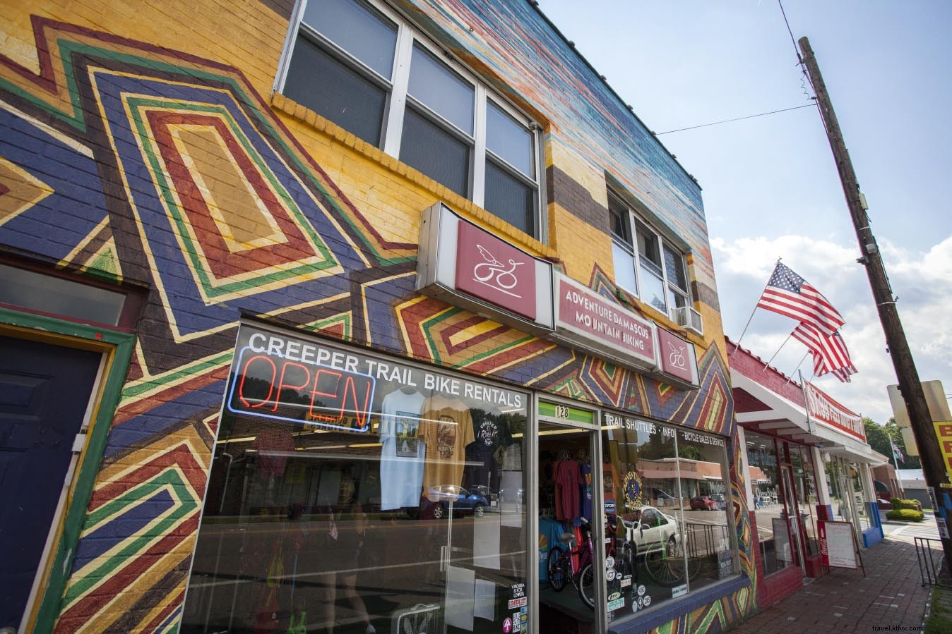
GPS Coordinates: 36.63372, -81.78373
Why Visit: Surrounded by mountains, Damascus is a trail hub where the Appalachian Trail and Virginia Creeper Rail Trail converge. Kayak and trout fish in nearby streams.
Activities: Rent bikes for the 17-mile downhill Virginia Creeper Trail from Whitetop Station, or pedal out-and-back toward Abingdon. Hike Mount Rogers High Country for wild ponies and Virginia's highest peak. Fish Whitetop Laurel or Beaverdam Creeks.
Dining/Shopping/Entertainment: Visit Mount Rogers Outfitters, a must-stop for Appalachian Trail thru-hikers, owned by local legend Jeff Patrick.
GALAX
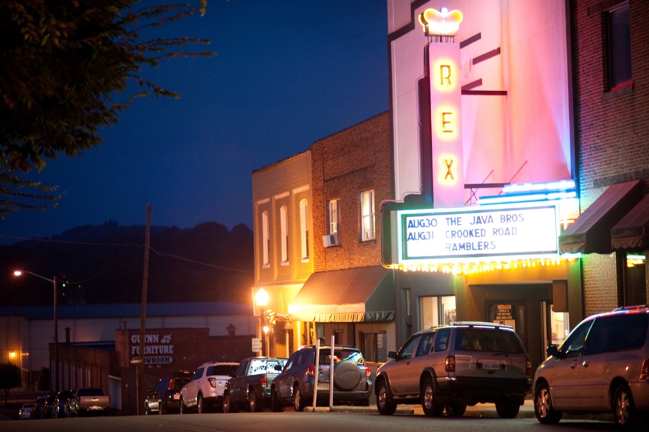
GPS Coordinates: 36.66123, -80.92396
Why Visit: Perfect for mountain music fans and outdoor enthusiasts, Galax connects water trails, rail trails, and hiking paths, with bluegrass as the soundtrack.
Activities: Bike the 50+ mile New River Trail from Galax, visiting Chestnut Creek Falls and Foster Falls' historic Shot Tower. Float the New River from Austinville to Foster Falls. Drive to Grayson Highlands State Park for wild ponies, or Mabry Mill on the Blue Ridge Parkway.
Dining/Shopping/Entertainment: Attend the world-famous Galax Old Fiddlers' Convention (since 1935), Rex Theater shows, or Blue Ridge Music Center performances.
PEARISBURG
GPS Coordinates: 37.32651, -80.73507
Why Visit: Where the New River meets the Appalachian Trail under Peters Mountain, Pearisburg blends river and mountain pursuits near the West Virginia border. Stroll historic streets and visit the Andrew Johnston House and Giles County Historical Society.
Activities: Hike the Appalachian Trail to Angels Rest and Wilburn Valley Overlook. Trek to Cascade Falls in Pembroke. Paddle the New River's Class II rapids or fish for smallmouth bass; outfitters provide rentals and shuttles.
Dining/Shopping/Entertainment: Stay at the Inn at Riverbend for river views and serene decks.
ROANOKE
GPS Coordinates: 37.27097, -79.94142
Why Visit: This vibrant mountain city offers culture and outdoor access amid the Appalachians, with the iconic Roanoke Star atop Mill Mountain overlooking the Roanoke River and surrounding peaks.
Activities: Drive the Blue Ridge Parkway, bike Carvins Cove trails, paddle its reservoir, or float the Roanoke River greenway. Hike Appalachian Trail highlights like McAfee Knob, Dragons Tooth, and Tinker Cliffs, plus Roaring Run Falls and Audie Murphy Monument.
Dining/Shopping/Entertainment: Visit Mill Mountain for the Roanoke Star views, Discovery Center, wildflower garden, and zoo trails.
WARM SPRINGS / HOT SPRINGS
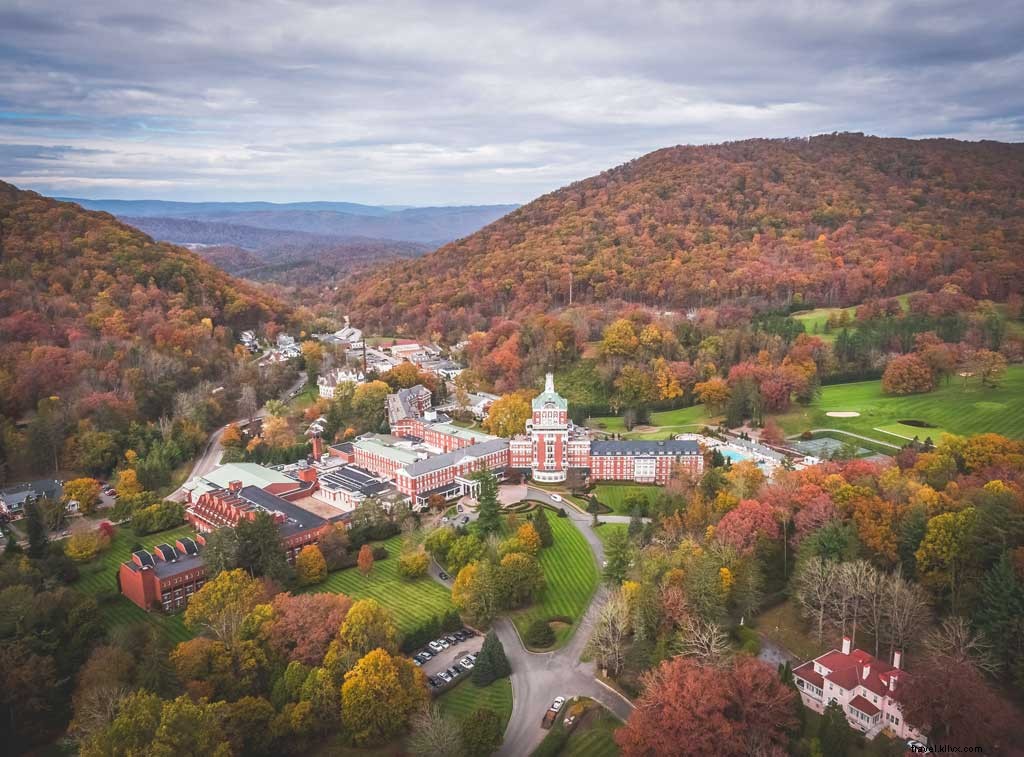
GPS Coordinates: 38.04609, -79.79058
Why Visit: Famous for natural hot springs in Bath County, these towns offer mineral soaks (Jefferson Pools under renovation) and spa traditions since 1766.
Activities: Explore Lake Moomaw for hiking, camping, and kayaking. Fish Back Creek, float the Jackson River, visit Douthat State Park waterfalls, or play Cascades golf course. See Falling Spring Falls.
Dining/Shopping/Entertainment: Dine at Omni Homestead Resort or historic Waterwheel Restaurant. Hunt antiques in Bath County.
LEXINGTON / BUENA VISTA
GPS Coordinates: 37.7343, -79.35392
Why Visit: Lexington boasts history like Stonewall Jackson's home and Natural Bridge; Buena Vista offers Blue Ridge views, Maury River recreation, and waterfalls in a rural setting.
Activities: Bike/hike the Chessie Trail linking both towns. Drive the Blue Ridge Parkway. Appalachian Trail hikes to Brown Mountain Creek or Mount Pleasant. Visit Crabtree Falls (Virginia's tallest). Paddle Maury or James Rivers.
Dining/Shopping/Entertainment: Try Amish Cupboard organics or Foot of the Mountain Café picnics.
WAYNESBORO
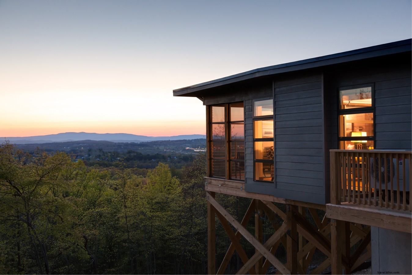
Photo Credit: Jumping Rocks Photography IG: @jumpingrocksphoto
GPS Coordinates: 38.06846, -78.88946
Why Visit: Gateway to Shenandoah National Park's Skyline Drive and Blue Ridge Parkway's southern stretches.
Activities: Hike Shenandoah's Turk Mountain, Blackrock, or Doyles River waterfalls. Parkway stops at Humpback Rocks, Sherando Lake. Paddle Waynesboro Water Trail on the South River.
Dining/Shopping/Entertainment: Sample local wines at Veritas, Afton Mountain, or Cardinal Point; breweries in Waynesboro and nearby.
LURAY
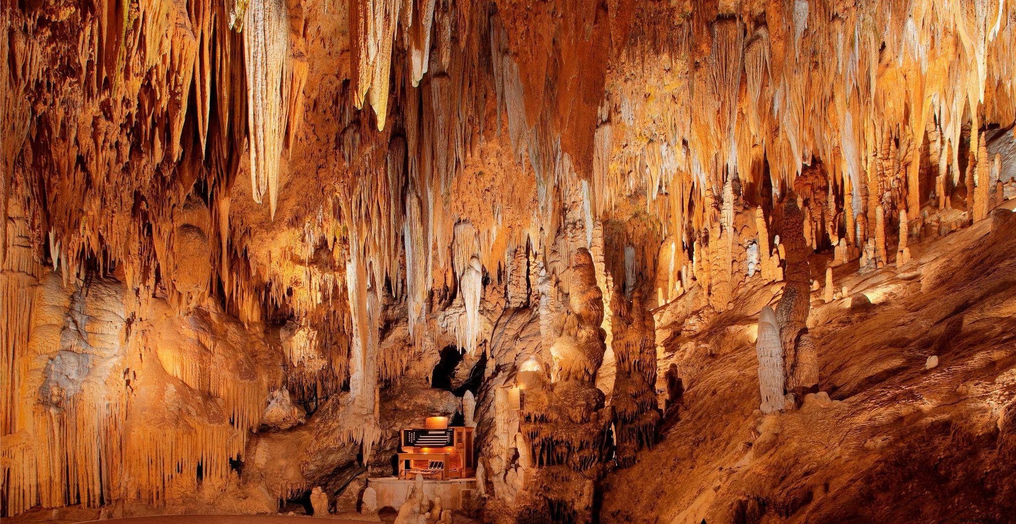
GPS Coordinates: 38.66539, -78.45945
Why Visit: Base for Shenandoah National Park, Massanutten trails, South Fork Shenandoah River, and Luray Caverns.
Activities: Drive Skyline Drive to Hawksbill or Marys Rock summits, Big Meadows. Paddle/fish the river. Bike Massanutten trails; visit Camp Roosevelt.
Dining/Shopping/Entertainment: Spend a day at Luray Caverns (caves, maze, ropes course, museums).
HARRISONBURG

GPS Coordinates: 38.44956, -78.86891
Why Visit: Near Blue Ridge, Shenandoah NP, Massanutten, and Alleghenies for diverse outdoor access.
Activities: Shenandoah hikes like Bearfence Rock Scramble. Bike Rocktown Trails, Massanutten Bike Park. George Washington NF: Todd Lake paddling, camping, hiking.
Dining/Shopping/Entertainment: Explore breweries, cideries, vineyards on Shenandoah Beerworks Trail amid farm, college, and history influences.
STRASBURG
GPS Coordinates: 38.98871, -78.35861
Why Visit: Virginia's antique capital near Washington NF and Shenandoah NP's north end; North Fork Shenandoah flows through town.
Activities: Elizabeth Furnace trails for hiking/biking. Skyline Drive to Compton Peak. Float the river with outfitters.
Dining/Shopping/Entertainment: Shop Strasburg Emporium and antique stores.
WINCHESTER
GPS Coordinates: 39.18565, -78.16333
Why Visit: Rich in Civil War history and outdoor spots like Shenandoah NP, Appalachian Trail, and Shenandoah River.
Activities: Hike AT through Sky Meadows State Park. Skyline Drive attractions. Paddle lower Shenandoah's Class I-II rapids. Winchester Green Circle trail.
Dining/Shopping/Entertainment: Tour Patsy Cline's historic home and museum.