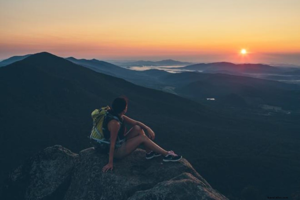
20 Must-Try Hiking Experiences in Virginia's Blue Ridge for Every Trail Lover
Attention trail enthusiasts: Discover our essential guide to 20 unforgettable hiking experiences in Virginia’s Blue Ridge. This curated list features renowned trails, hidden gems, and captivating points of interest along the way.
From challenging endurance hikes to family-friendly paths and leisurely strolls, these selections highlight the region's premier trails and scenic wonders.
Before heading out, familiarize yourself with the Leave No Trace Seven Principles to help protect and preserve Virginia’s Blue Ridge natural treasures.
1. Virginia’s Triple Crown
Virginia’s Triple Crown comprises three iconic peaks—Dragon’s Tooth, McAfee Knob, and Tinker Cliffs—offering a bucket-list challenge. Tackle them in any order, but completing all three spans 32 miles with overnight stays in Appalachian Trail shelters. Rewards include breathtaking views, climbable geologic formations, and memorable Appalachian Trail adventures.
Learn more about the Triple Crown from the Roanoke Appalachian Trail Club.
2. Waterfall Hikes
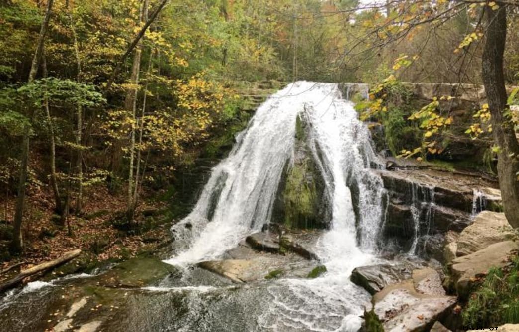
Virginia’s Blue Ridge boasts several stunning waterfall hikes, perfect for creating lasting memories. Here are four standout options:
Roaring Run Falls (pictured above) in Eagle Rock is accessible via Roaring Run Recreation Area. Explore the historic Roaring Run Furnace, a 19th-century iron ore furnace on the National Register of Historic Places. The area is ideal for swimming and fishing.
Apple Orchard Falls starts from the Blue Ridge Parkway at milepost 78.4 (Sunset Field). The 1.5-mile descent is steep; watch for wildflowers like trillium, bleeding heart, mountain fetterbush, and rhododendron. View from the platform and exercise caution on slippery surfaces.
Bottom Creek Gorge on Bent Mountain offers Virginia’s second-highest falls at 200 feet. The 5-mile loop begins at Bottom Creek Gorge Preserve on Route 669. Note: No dogs or fishing allowed. Managed by The Nature Conservancy, it’s a habitat for rare species including the orangefin madtom, bigeye jumprock, riverweed darter, and Roanoke darter.
Stiles Falls at Camp Alta Mons in Shawsville is public when no camps are in session (avoid summer). The 3-mile round trip involves rock-hopping and creek crossings to reach the 40-foot falls. Leashed dogs welcome; clean up after them.
3. Gear Up for Your Hike
Equip yourself properly with advice from local experts. Visit Walkabout Outfitter (Downtown Roanoke or Valley View Mall) or Outdoor Trails in Daleville for top gear and trail recommendations.
4. Hikes & Wineries
Pair your hike with a winery visit for the perfect reward. For instance, combine Hoop Hole (in Roaring Run Recreation Area) with nearby Blue Ridge Vineyard (under 20 minutes) or Virginia Mountain Vineyards (under 30 minutes).
See other hiking trails near wineries.
5. Hiking in Virginia State Parks
Virginia State Parks offer trails for all levels. Favorites include Claytor Lake Trail at Claytor Lake (Dublin), Little Mountain Falls Trail at Fairy Stone (Stuart), Turtle Island Trail at Smith Mountain Lake (Huddleston), and Cedar Creek Trail at Natural Bridge State Park (Natural Bridge).
6. Peaks of Otter
 — Virginia’s Blue Ridge
Near Bedford on the Blue Ridge Parkway (milepost 86), the Peaks of Otter—Flat Top, Sharp Top, and Harkening Hill—deliver horizon-defining vistas and even better summit views. Refuel at the scenic Lake View Dining Room at Peaks of Otter Lodge.
Sharp Top (pictured) is the most popular; opt for the Sharp Top Shuttle to shorten the hike.
Peaks of Otter Trail Map.
7. Poor Mountain
Explore 4 miles of trails in Poor Mountain Natural Area Preserve. Steep sections require several hours. In fall, spot the rare piratebush (Buckleya distichophylla) with its bright yellow foliage—the world’s largest population.
Poor Mountain Fact Sheet & Trail Map.
8. Backpacking & Dispersed Camping in Jefferson National Forest
Experience true wilderness with dispersed camping outside designated sites. Follow guidelines for responsible primitive camping.
Maps of Jefferson National Forest.
9. Audie Murphy Monument on Brush Mountain
Follow the Appalachian Trail in Brush Mountain East Wilderness (3,700 acres) to the monument honoring WWII hero Audie Murphy, who perished there in 1971. His honors include the Medal of Honor and more.
Brush Mountain East Trail Map.
10. Hike Mill Mountain to the Roanoke Star
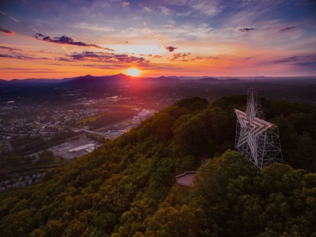
Park off Riverland Avenue and hike the 3.25-mile Star Trail (800-foot gain) for panoramic views from the iconic Roanoke Star.
Mill Mountain Park Trail Map.
11. McAfee Knob
A top Appalachian Trail photo spot, this 4.4-mile out-and-back (8.8 miles total) offers 270-degree views. Hike early to avoid crowds.
Info on Hiking McAfee Knob.
12. Smith Mountain
Short trails in Smith Mountain Cooperative WMA border Roanoke River and Smith Mountain Lake. Avoid the Safety Zone; hunting permitted.
Smith Mountain Cooperative WMA Trail Map.
13. Grassy Hill Natural Area Preserve
1,400 acres in Franklin County with 6.6 miles of signed trails. Call ahead for closures.
Grassy Hill Natural Area Preserve Hiking Trail Guide & Map.
14. Hiking & Outdoor Events
Troutville Trail Days (June): Free festival with vendors, hikes, music, camping.
GO Outside Festival (October, Roanoke): 125+ activities, demos, beer.
Seven Summits Series: Guided fall climbs of seven peaks.
15. Read Mountain Preserve
243 acres with 5 miles of trails. Summit Buzzards Rock (2,180 feet) for Roanoke Valley views.
Read Mountain Preserve Trail Map.
16. Hay Rock
2-mile trail in Carvins Cove Natural Preserve to panoramic Hay Rock overlook—a local favorite.
The Outbound: Hike to Hay Rock.
17. Easy Hikes
Six accessible trails for all levels; details in our Six Easy Hiking Trails article.
18. Dogwood Glen Trail – Philpott Lake
4.5-mile out-and-back with views around Philpott Lake. Access from Salthouse Branch Park or Philpott Dam.
Dogwood Glen Trail Map.
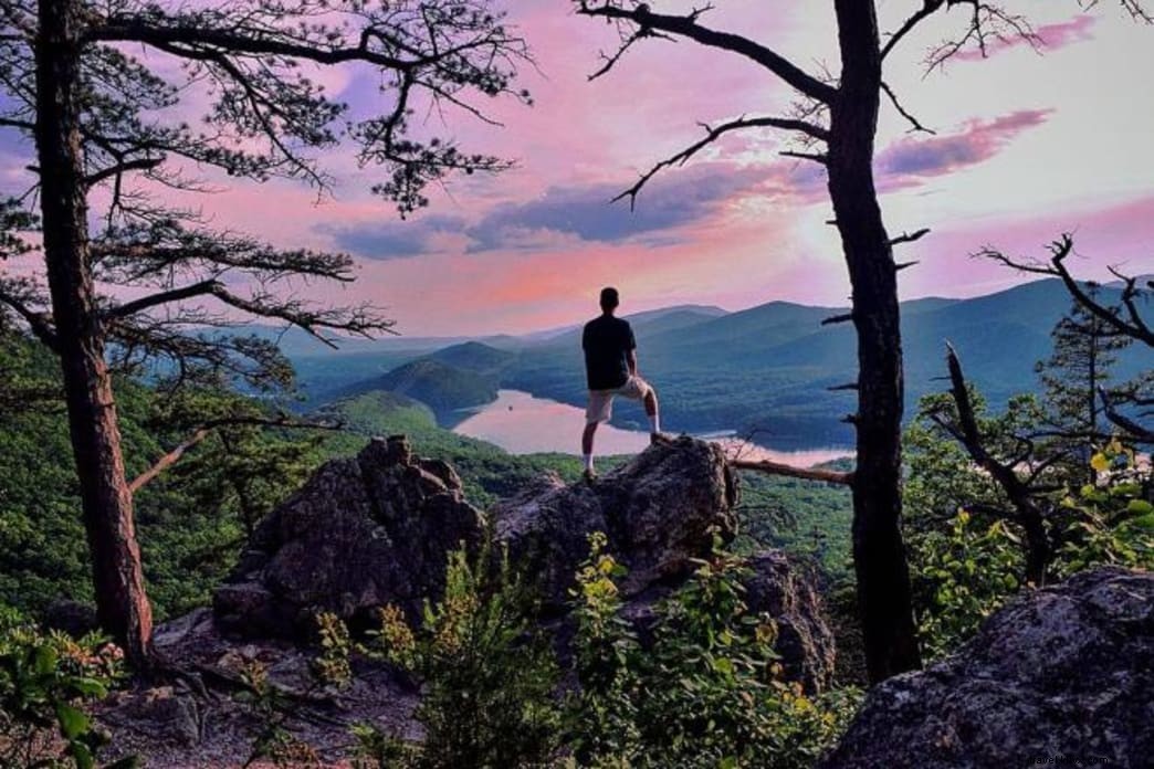
19. Rock Castle Gorge at Rocky Knob on the Blue Ridge Parkway
10.8-mile challenging loop (milepost 169) with elevation swings. Picnic at the trailhead.
Rocky Knob Trail Map.
20. Devil’s Marbleyard
Unique Antietam Quartzite boulders via Belfast Trail to Appalachian Trail for 360° views, then Gunter Ridge (11.3 miles total).
Hiking Upward: Devil’s Marbleyard.
Embrace the trails and become a #trailsetter in Virginia’s Blue Ridge—hiking capital and East Coast mountain biking hub.
Written by Casey L. Higgins for Visit Virginia’s Blue Ridge, legally licensed through the Matcha publisher network. Licensing inquiries: [email protected]
Featured image provided by Virginia’s Blue Ridge