5 Accessible Shipwrecks to Explore Along the Outer Banks Coastline
Discover the Graveyard of the Atlantic
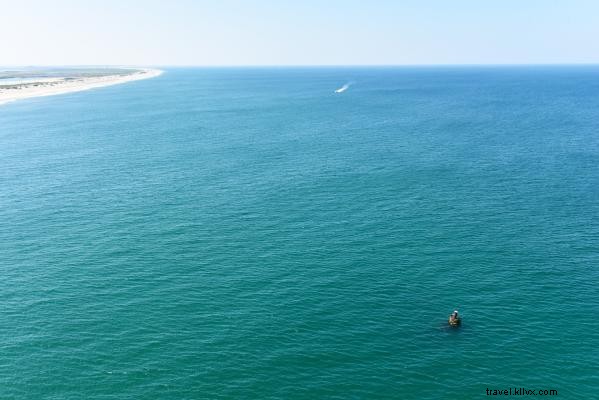
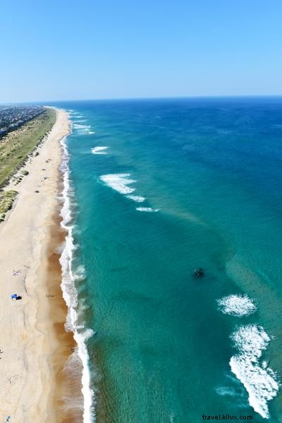
The Outer Banks of North Carolina, famously known as the "Graveyard of the Atlantic," is home to an estimated 3,000 shipwrecks dating back to America's first English settlements. Positioned along a key maritime route off Cape Hatteras, these waters have claimed countless vessels due to treacherous weather, faulty navigation, unmapped shoals, and wartime conflicts. Today, shifting sands occasionally reveal wrecks on beaches, but the East Coast's premier snorkeling and scuba sites lie just offshore.
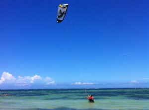
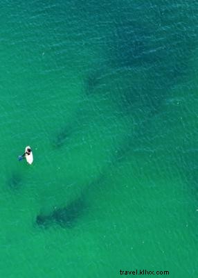
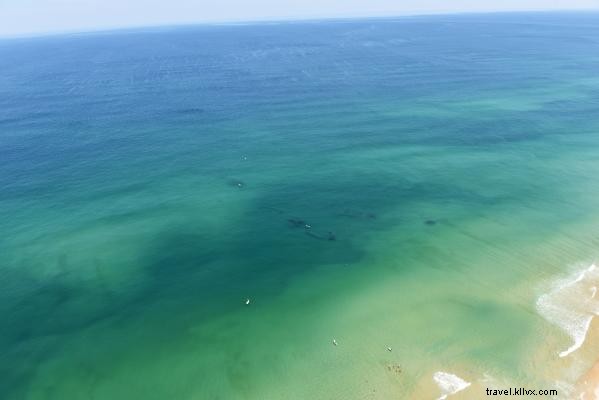
Several wrecks are reachable by swimming, stand-up paddleboarding, kayaking, or diving. For safety, explore only in ideal conditions with proper flotation, dive flags, and location markers. Always dive with a buddy, stay vigilant, and follow essential beach safety guidelines. Pro tip: Book an aerial tour for a stunning bird's-eye view of the coastline and wrecks below.
-
The Huron
Located near Bladen Street beach access in Nags Head (Milepost 11/12), north of Nags Head Fishing Pier, The Huron sits about 200 yards offshore in roughly 20 feet of water. Summer buoys often mark the site for easy spotting on clear days. Snorkelers can swim from bow to stern, viewing cannonball racks, the propeller, rudder, and boiler amid vibrant marine life and shifting sands.
This iron-hulled steamship—America's last naval vessel built primarily of iron with auxiliary sails—sank on its maiden voyage to Havana, Cuba, on November 24, 1877, after heavy winds, rain, and a faulty compass drove it aground.
-
The Triangle Wrecks
Near Second Street beach access in Kill Devil Hills (Milepost 7), these wrecks formed when two vessels ran aground in the same spot two years apart. In December 1927, the tanker Kyzikos, bound for Spain with crude oil, succumbed to a storm that flooded its boiler. In 1929, the Carl Gerhard sliced through the remnants. Forming a distinctive triangle in 15-20 feet of water, debris spans 100-250 yards offshore, including visible boilers.
-
The Oriental
Three miles south of the Basnight Bridge over Oregon Inlet, opposite Pea Island Visitor Center, this "Boiler Wreck" features a protruding steam engine 100 yards offshore in 15-20 feet of water (tide-dependent), amid strong currents. The 210-foot federal transport sank perpendicular to the shore on May 16, 1862. Use a dive flag, as fishing boats frequent the area.
-
The Pocahontas
On Hatteras Island off Sand Street in Salvo (Ramp 23, head north), a paddle-wheel shaft marks this wreck, sometimes called "The Richmond," just 75 yards out in 10-15 feet of water. Note: Beach driving may be restricted in summer by the National Park Service, but walking is allowed. Lost during the Civil War's Burnside Expedition before the Battle of Roanoke Island.
-
The Winks Wreck
Near Milepost 2 in Kitty Hawk off Luke Street, this site lies 120 yards offshore in 15-20 feet of water. Named after the nearby Winks Store on Eckner Street, it's compact and trickier to locate—time dives for high tide and good visibility. Its history is unconfirmed, but locals suspect it's the British steamer Mountaineer from Liverpool.
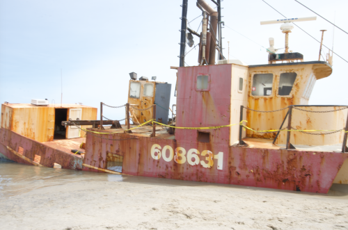
Bonus: 2020 Shipwreck - Ocean Pursuit
The 72-foot scallop boat Ocean Pursuit grounded on Coquina Beach in early March 2020, about 0.5 miles south of Cape Hatteras National Seashore Ramp 4 on Bodie Island. Do not board due to safety risks. It's ideal for photos during early morning or evening with optimal lighting and fewer crowds.
For gear rentals and guided dives, visit Roanoke Island Outfitters/Dive Center or Dive Hatteras.