Discover 10 Premier Coastal Paddling Destinations in Virginia
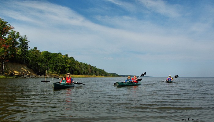
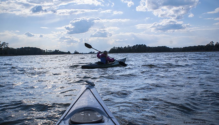
Virginia's expansive coastline along tidal rivers, Chesapeake Bay, and the Atlantic Ocean offers paddlers a treasure trove of scenic destinations. From the vast Chesapeake Bay and the serene lower tidal Rappahannock River to winding Parkers Creek on the Eastern Shore and wild Back Bay near Virginia Beach, adventures await all skill levels.
Expect diverse experiences across open waters, meandering rivers, and intimate creeks, abundant with wildlife and stunning vistas. Local outfitters provide easy rentals, shuttles, and guided tours throughout the coastal region—no gear required.
Find your ideal Virginia coastal paddling spot below.
BLACKWATER CREEK
Nearest Town: Chesapeake
The Paddle: Blackwater Creek, North Landing River
Distance: 4-10 miles
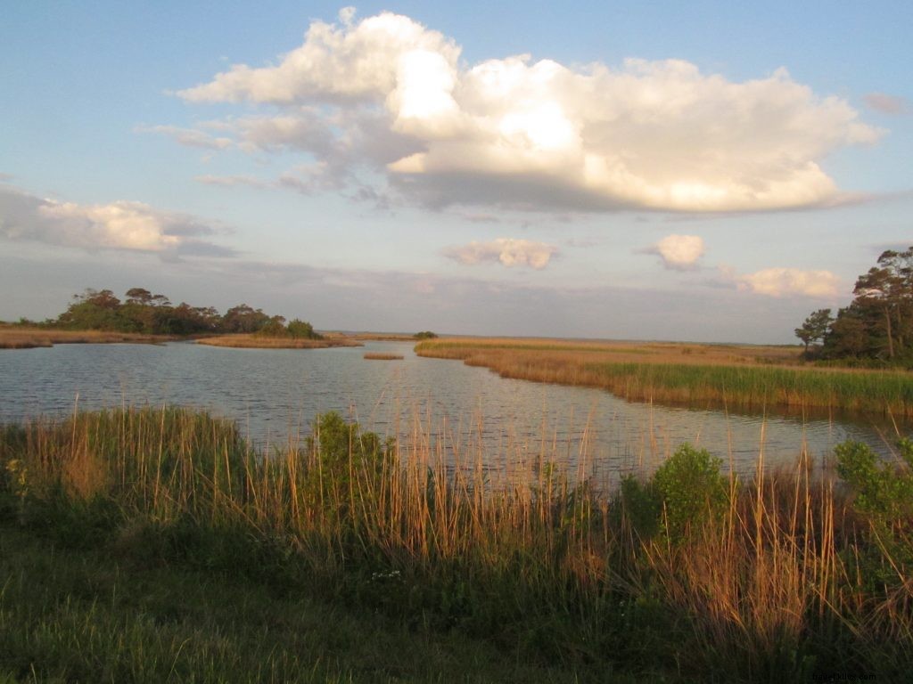
Blackwater Creek, a tributary of the North Landing River in southeast Virginia, delivers a peaceful escape. Launch at the legendary Blackwater Trading Post—a general store offering BBQ and live music. Paddle downstream past a few homes into pristine, marsh-lined waters with inviting coves. After 2.7 miles, reach the broader North Landing River; continue 1.5 miles to Minden Park for a turnaround, or head upstream through cypress-lined narrows for a 4-mile round trip on this narrowing creek.
Nearby Attractions:
- Paddle Lake Drummond in Great Dismal Swamp
- Explore Northwest River Park
- Tour USS Wisconsin Battleship at Nauticus
- Chesapeake Planetarium
CROWS NEST NATURAL AREA PRESERVE
Nearest Town: Owens
The Paddle: Accokeek Creek, Potomac Creek, Potomac River
Distance: 3-8 miles
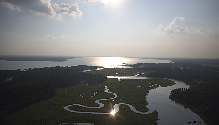
This emerging Virginia state natural area on the tidal Potomac River features an ADA-accessible dock and kayak ramp (hiking trails dedicated in 2017). Carry from parking on Brooks Road to launch on Accokeek Creek, a Potomac tributary. Paddle 3 marshy miles downstream to Potomac Creek near Crow’s Nest Point, then a half-mile left to the main Potomac. For an 8-mile out-and-back, head upriver to Aquia Landing Park. Upstream on Potomac Creek offers shelter from winds.
Nearby Attractions:
- National Museum of the Marine Corps
- Caledon State Park
- Government Island trails
- Widewater Beach
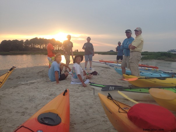
BACK BAY NATIONAL WILDLIFE REFUGE
Nearest Town: Sandbridge
The Paddle: North Bay, Shipps Bay, Back Bay
Distance: 4-10 miles
Navigate the maritime forests and marshes of greater Back Bay. Start at Little Island Park in Virginia Beach for prime access to this tidal estuary. Explore islands and channels, spotting birds. Circle Little Island or Long Island, or paddle 5 miles west to False Cape State Park (camping requires reservations). Visit Horn Point launch at Back Bay National Wildlife Refuge (entrance fee applies). Kayak rentals available from Back Bay Getaways.
Nearby Attractions:
- Virginia Aquarium & Marine Science Center
- Virginia Beach Fishing Center
- Rudee Inlet Stand Up Paddle boarding
- North Bay Shore Family Campground
POWHATAN CREEK BLUEWAY
Nearest Town: Jamestown
The Paddle: Powhatan Creek, Back River, James River
Distance: 2-12 miles
Adjacent to historic Jamestown—site of North America's first official Thanksgiving—Powhatan Creek feeds the lower tidal James River. Launch at James City County Marina, paddle 3 miles up serpentine Powhatan Creek to Powhatan Creek Park, or downstream through Sandy Bay to circle Jamestown Island (8-mile loop via Back River, part of the Captain John Smith Chesapeake National Historical Trail).
Nearby Attractions:
- Historic Jamestowne Visitor Center
- Jamestown Settlement Museum
- Colonial Williamsburg
- Jamestown Pie Company
CHINCOTEAGUE ISLAND
Nearest Town: Chincoteague
The Paddle: Chincoteague Inlet, Toms Cove, Atlantic Ocean
Distance: Varies
Chincoteague nestles among undeveloped tidal islands, creeks, bays, and the nearby Atlantic. Protected by Chincoteague, Wallops Island, and Assateague refuges, these waters teem with wildlife. From Captain Bobs Marina, paddle south and east to Toms Cove, hugging Assateague's back beach (10-mile loop). Guided tours and routes abound.
Nearby Attractions:
- Goddard Space Flight Center
- Captain Timothy Hill House
- Chincoteague Nature Tours
- Chincoteague Natural History Association Wildlife Tours
EASTERN SHORE OF VIRGINIA NATIONAL WILDLIFE REFUGE
Nearest Town: Cape Charles
The Paddle: Virginia Inside Passage, Long Point Channel, creeks
Distance: 6-mile loop (extendable)
Launch into the Virginia Seaside Water Trail's start near Chesapeake Bay and the Atlantic. Mind tides and currents while circling Raccoon and Skidmore Islands amid stunning views. Explore creeks; experienced paddlers can venture ocean-side.
Nearby Attractions:
- Chincoteague Nature Tours
- Sunset Beach Resort dining and lodging
- Kiptopeke State Park
- The Jackspot at Sunset Creek restaurant
- Kayak tours with SouthEast Expeditions
NEW POINT COMFORT LIGHTHOUSE
Nearest Town: Mathews
The Paddle: Davis Creek, Mobjack Bay, Chesapeake Bay
Distance: 8 miles round trip
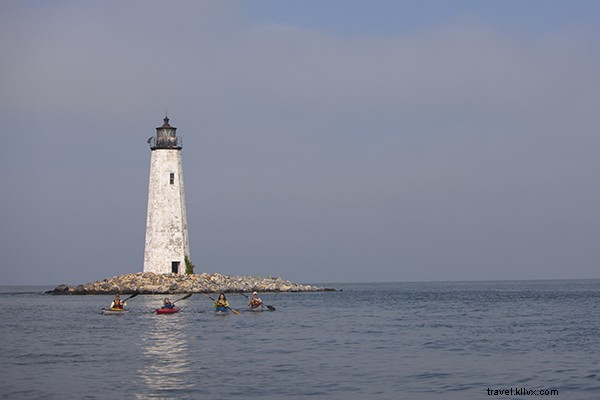
Part of Mathews County's 90+ miles of paddling trails (200 miles of shoreline in 87 square miles), this route follows the New Point Comfort Trail. From Davis Creek Public Landing, cross Mobjack Bay (watch afternoon winds) to Chesapeake Bay and the historic 1804 New Point Comfort Lighthouse. Pair with New Point Comfort Natural Area Preserve trails.
Nearby Attractions:
- Mathews Maritime Museum
- Bethel Beach Natural Area Preserve
- The Inn at Tabbs Creek
- Richardson’s Café
PARKERS CREEK
Nearest Town: Parksley
The Paddle: Parkers Creek, Metompkin Bay, Wire Passage, Gargatha Bay
Distance: 10 miles (shorter options)
On the Virginia Seaside Water Trail, launch at remote Parkers Creek ramp. Upstream splits for calm paddles; downstream opens to Metompkin Bay and barrier islands. Loop via creeks to Gargatha Bay for a 10-mile circuit.
Nearby Attractions:
- Mutton Hunk Fen State Natural Area
- Eastern Shore Railway Museum
- The Inn and Garden Cafe
- Club Car Café
YORK RIVER STATE PARK
Nearest Town: Toano
The Paddle: Taskinas Creek, York River
Distance: 2-12 miles
This paddling gem offers rentals and a park lake warmup. Venture up marshy Taskinas Creek (tides matter; call park for info), or downstream 6 miles along York River's south shore to Riverview Overlook for fossil hunting on beaches.
Nearby Attractions:
- Go Ape Zipline Treetop Adventures
- Governors Palace pre-Revolution British royal residence
- Kayaking tours from New Quarter Park
- Ripley’s Believe It or Not Museum
BELLE ISLE STATE PARK
Nearest Town: Warsaw
The Paddle: Mulberry Creek, Rappahannock River, Deep Creek
Distance: 6 miles
On the north shore of the lower tidal Rappahannock, launch (with rentals) from Belle Isle State Park into Mulberry House. Explore to lake-like Rappahannock shores, Brewers Point beach (hike-in camping), and 3 miles to Deep Creek ramp. Extend via Porpoise Creek.
Nearby Attractions:
- Rappahannock River Valley National Wildlife Refuge
- Michelle’s Sweet Treats in Warsaw
- Hughlett Point Natural Area Preserve
- Hickory Hollow Natural Area Preserve