Top 10 Must-Do Hikes in Shenandoah National Park: Ultimate Guide by Expert Johnny Molloy
Shenandoah National Park is the premier scenic mountain retreat in the Mid-Atlantic, a crown jewel of Virginia's Appalachians. Its 70-mile main ridge divides the pastoral Shenandoah Valley from the Piedmont to the east. Elevations range from 4,050 feet at Hawksbill Summit to under 550 feet near Front Royal, creating exceptional biodiversity. Lush vegetation and expansive wilderness support over 50 mammal species, including black bears.
Boasting more than 500 miles of trails, the park offers unparalleled hiking opportunities.
Hike Shenandoah for accessible, world-class scenery. Its extensive trail network enables customized adventures, enhanced by nearby attractions.
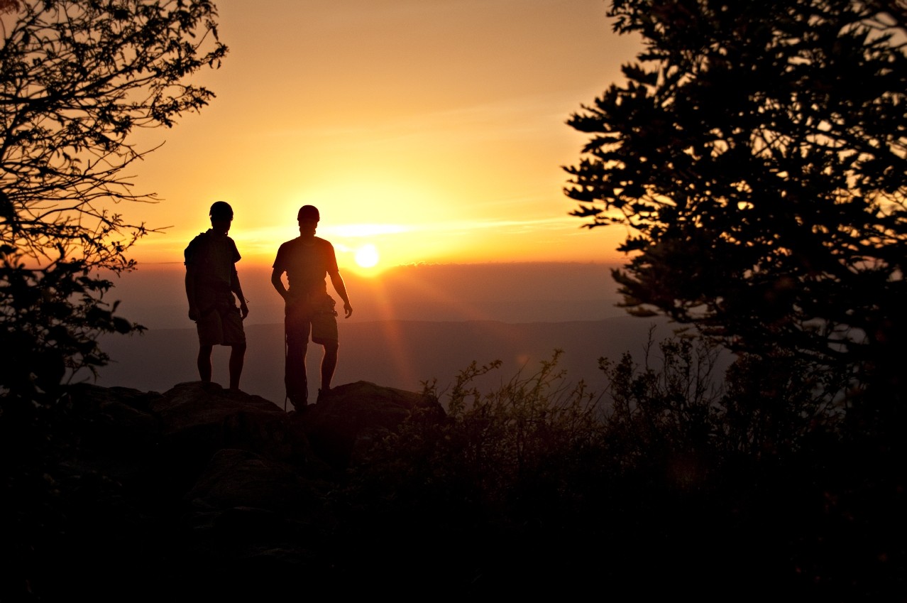
Experience iconic trails like Old Rag and Whiteoak Canyon, with roaring waterfalls in trout streams and rocky outcrops offering sweeping Blue Ridge and Shenandoah Valley views. Summit Stony Man and Hawksbill for panoramic vistas, diverse ecosystems, and rich park history amid these highlands.
Discover quieter gems like Jones Run and Furnace Mountain, featuring waterfalls amid old-growth forests and secluded lookouts. Trace pioneer history at sites like Dickey Ridge, remnants of early settlements in the Blue Ridge shadows.
These 10 essential hikes capture the essence of Virginia's largest, wildest national park.
Dickey Ridge Loop
Length: 5.0-mile double loop
Difficulty: Moderate
Why Hike It: Historic visitor center, pioneer homesteads, cemetery, interpretive signs, and stunning views.
This trail showcases Shenandoah's accessible history and scenery. Start at Dickey Ridge Visitor Center, visit the Fox Farm homestead and cemetery, then explore Snead Farm. Enjoy Shenandoah Valley vistas and scenic ridgeline woods on the return.
Trailhead: Dickey Ridge Visitor Center at milepost 4.6 on Skyline Drive. From Front Royal entrance, drive south 4.6 miles.
Nearby Attractions:
- State Arboretum of Virginia
- Sky Meadows State Park
- Skyline Caverns
Mary's Rock via The Pinnacle
Length: 7.2-mile out-and-back
Difficulty: Moderate
Why Hike It: Traverse the Appalachian Trail's most spectacular section with frequent, expansive views.
From Pinnacles Picnic Area, summit The Pinnacle for panoramas, then reach Mary's Rock for 360-degree vistas—arguably the park's best. Modest 450-foot elevation changes make it rewarding.
Trailhead: Pinnacles Picnic Area at milepost 36.7 on Skyline Drive. From Thornton Gap entrance, drive south 5.2 miles. Appalachian Trail starts at the picnic area's crest. If closed, use Jewell Hollow Overlook (milepost 36.4).
Nearby Attractions:
- Meems Bottom Covered Bridge
- Rope Adventure Park at Luray Caverns
- Luray Zoo
- Inn at Mount Vernon Farm
Old Rag
Length: 9.1-mile loop
Difficulty: Difficult
Why Hike It: Iconic granite peak with thrilling rock scrambles and breathtaking views.
This challenging classic ascends Old Rag's north slope to granite slabs and a boulder maze. Summit rewards epic panoramas; descend via Brokenback Run's gravel fire road.
Trailhead: From US 211/US 522 in Sperryville, take US 522 south 0.8 mile to VA 231. Right on VA 231 for 8 miles to VA 601 (Peola Mills Road). Right 0.3 mile, cross Hughes River, stay right on VA 601/Nethers Road 3.3 miles to lower Old Rag parking.
Nearby Attractions:
- Copper Fox Distillery
- Castleton Festival
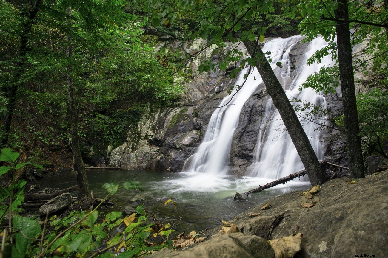
Whiteoak Canyon Falls
Length: 5.2-mile out-and-back
Difficulty: Moderate
Why Hike It: Six cascading falls (45-86 feet) in a rugged gorge; view uppermost from a promontory.
No fords make it ideal for winter/spring when falls peak. Navigate rocky chasms amid geological wonders; prepare for crowds on nice days.
Trailhead: From Madison (US 29), north on VA 231 5 miles to VA 670. Left 5 miles to VA 643. Right <1 mile to VA 600. Left 3.7 miles to Berry Hollow parking; trailhead at far rear.
Nearby Attractions:
- Blue Ridge Pottery
- DuCard Vineyards
- Four County Players Theater
- James Madison’s Montpelier
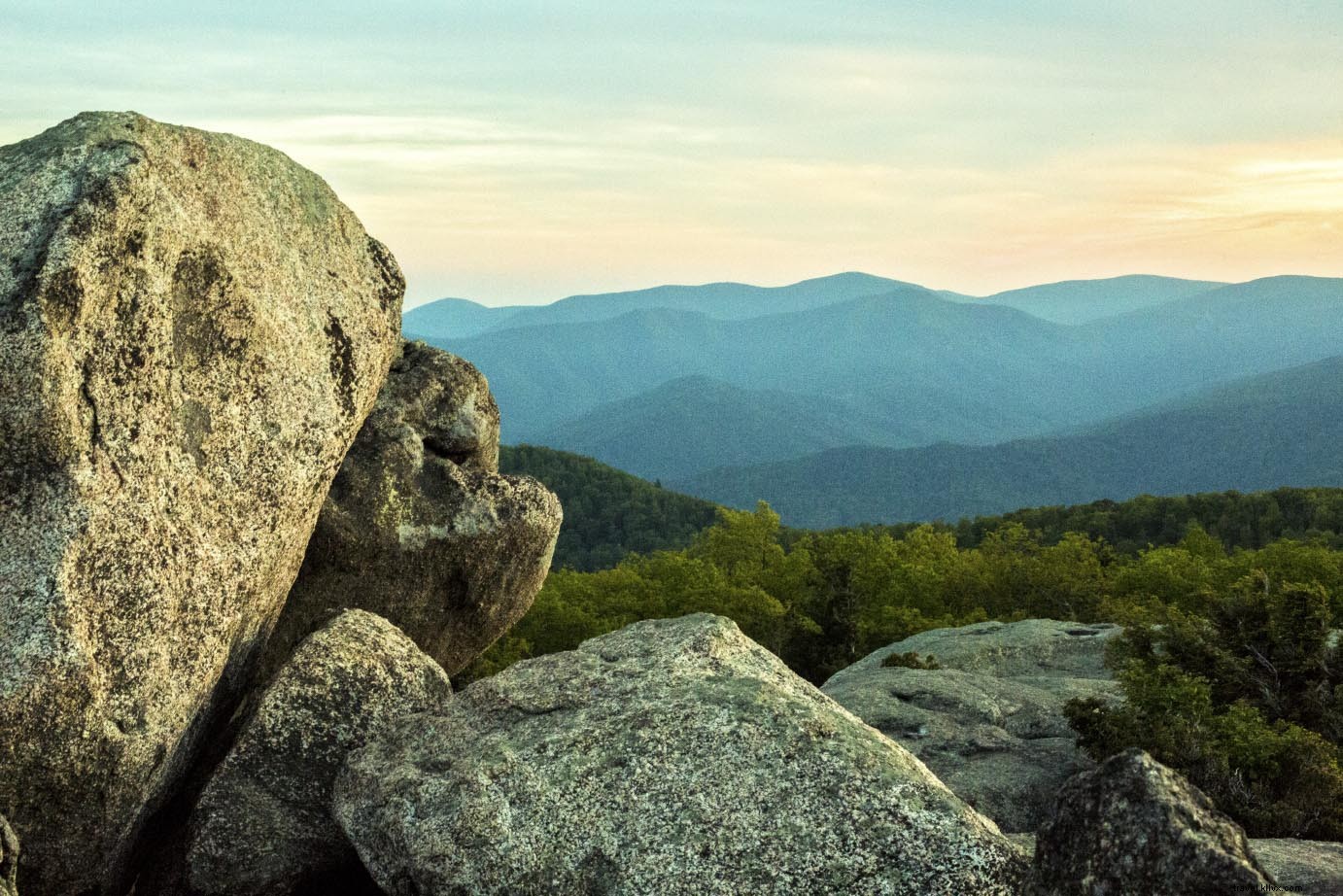
Hawksbill Summit

Length: 2.2-mile out-and-back
Difficulty: Easy
Why Hike It: Bag the park's highest point (4,050 feet) with rare spruce-fir forest and near-360-degree views.
Start at 3,600+ feet for minimal gain. Spot Fraser fir and red spruce; observation platform aids navigation.
Trailhead: Upper Hawksbill at milepost 46.7 (west side Skyline Drive). From Thornton Gap, south 15.2 miles; parking on right.
Nearby Attractions:
- Luray-Hawksbill Greenway
- Big Meadows Lodge
- New Market Battlefield State Historical Park
- Endless Caverns
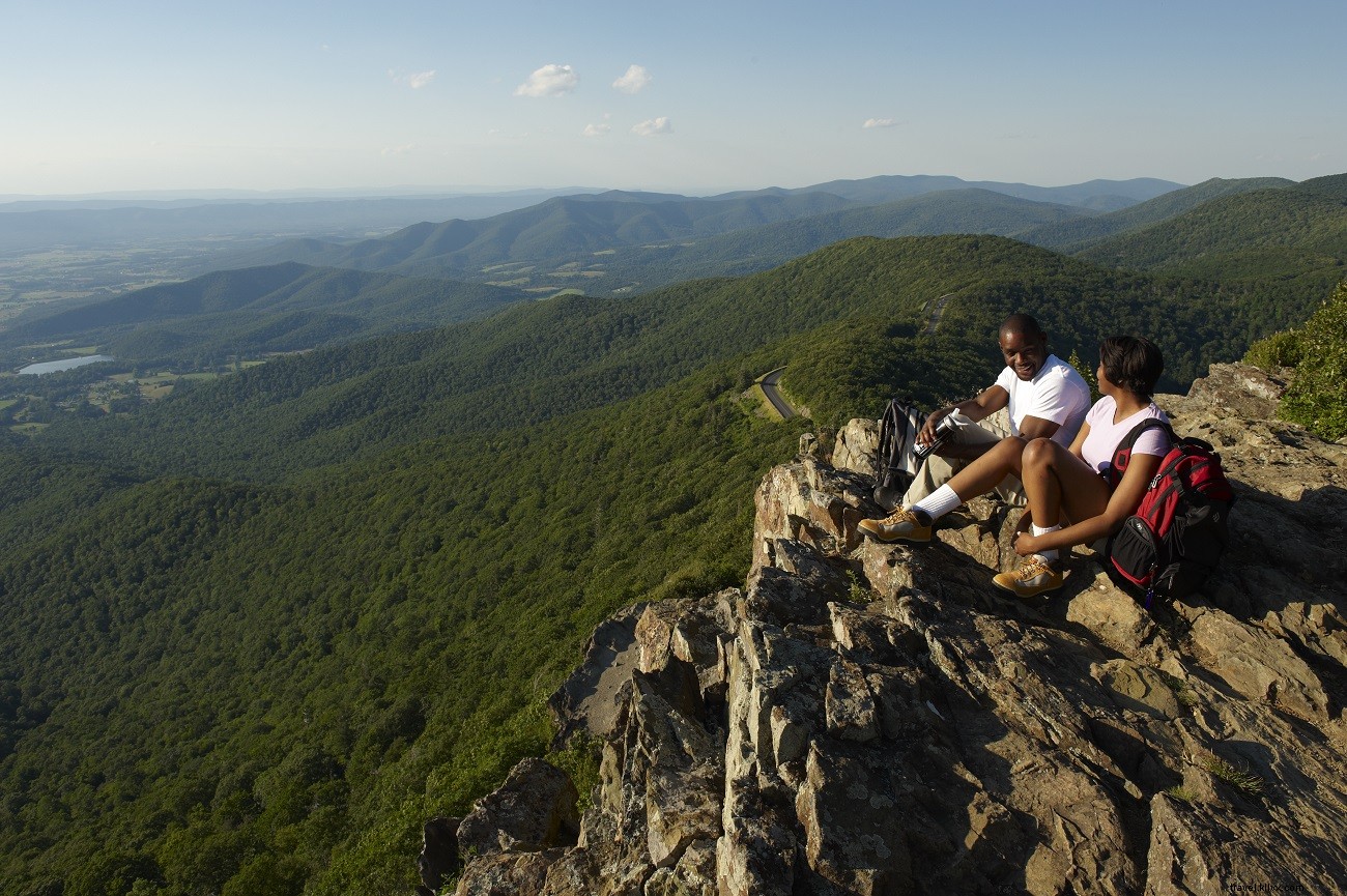
Stony Man Loop
Length: 3.7-mile loop
Difficulty: Easy
Why Hike It: Dramatic 3,000-foot cliffs over Shenandoah Valley; includes Passamaquoddy Trail.
Summit Stony Man for valley and mountain views. Detour to Little Stony Man; pass historic Furnace Spring.
Trailhead: North Skyland Resort entrance (milepost 41.7, highest Skyline Drive point). Turn right into Stony Man Nature Trail parking.
Nearby Attractions:
- Skyland Stables
- Sharp Rock Vineyards
- Skyland’s Pollock Dining Room
Rapidan Camp
Length: 3.8-mile out-and-back
Difficulty: Moderate
Why Hike It: Big Rock Falls en route to President Hoover's preserved retreat; self-guided tour available.
Follow Mill Prong to falls and camp confluence. Explore buildings, signs, and nature trails (allow 1 hour).
Trailhead: Milam Gap at milepost 52.8 (west Skyline Drive). From Swift Run Gap, north 12.7 miles.
Nearby Attractions:
- Massanutten Water Park
- Edith J. Carrier Arboretum
- A Dream Come True Playground
Loft Mountain Loop
Length: 2.9-mile loop
Difficulty: Easy
Why Hike It: Family-friendly with vast rock outcrop views; end at campground store for ice cream.
Frazier Discovery Trail to vista, Appalachian Trail through forest, then paved path back.
Trailhead: Loft Mountain Wayside (milepost 79.5, west Skyline Drive). 26.1 miles north of Rockfish Gap; trail from wayside near campground entrance.
Nearby Attractions:
- Rosebrook Inn
- Grand Caverns
- Paddle the Shenandoah River
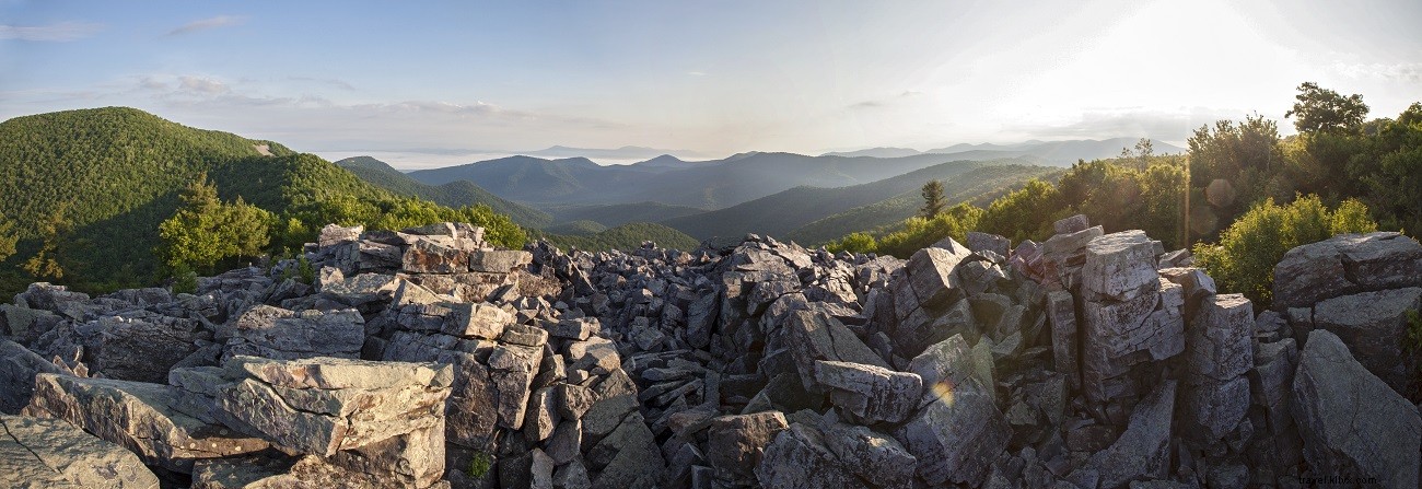
Furnace Mountain via Blackrock Summit
Length: 6.8-mile out-and-back (optional 1.1-mile loop)
Difficulty: Easy to moderate
Why Hike It: Dramatic geology: massive outcrops, talus slopes; remote solitude beyond summit.
Views at Blackrock, then Trayfoot/Furnace trails. Shorter option for families.
Trailhead: Blackrock parking at milepost 84.8 (west Skyline Drive). 19.9 miles from Rockfish Gap.
Nearby Attractions:
- Humpback Rocks
- Le Bleu Ridge Bed & Breakfast
- American Shakespeare Center
Browns Gap Waterfall Loop
Length: 7.0-mile loop
Difficulty: Moderate
Why Hike It: Three major waterfalls in boulder-strewn canyons; old-growth tulip trees along Jones Run.
Descend Browns Gap Fire Road past Confederate grave to Doyles River falls. Up Jones Run to its falls, then Appalachian Trail to Dundo Picnic Area (former CCC site).
Trailhead: Browns Gap parking at milepost 83.0 on Skyline Drive. 21.6 miles north from Rockfish Gap; on left.
Nearby Attractions:
- Carter Mountain Orchard
- Shenandoah Valley Art Center
- Augusta County Railroad Museum

Johnny Molloy, author of Top Trails: Shenandoah National Park, has hiked and backpacked the park for over 20 years, plus explored Virginia and beyond. His expertise ensures this guide's reliability.