Best Hiking Trails in Tempe and Phoenix: A Local Guide to Scenic Adventures
Ready to explore the great outdoors? The Tempe and Phoenix area boasts diverse hiking trails for all levels. This expert guide highlights our top picks, complete with directions, difficulty levels, and insider tips for a safe, rewarding experience.
Papago Park
- Papago Park features several beginner-friendly hikes, easily accessible from anywhere in the Valley. Start at the trailhead west of the parking lot at College and Curry roads for panoramic views of downtown Tempe and Tempe Town Lake. This path also leads to Loma del Rio, a historic Hohokam ruin—continue toward the freeway, veer right past the next hill's summit, and find it by the ramada.
- Another popular access point is on the west side, across Galvin Parkway from the Phoenix Zoo entrance (north of Van Buren). Here, tackle the Double Butte Loop, ideal for hikers and mountain bikers, winding toward striking red buttes.
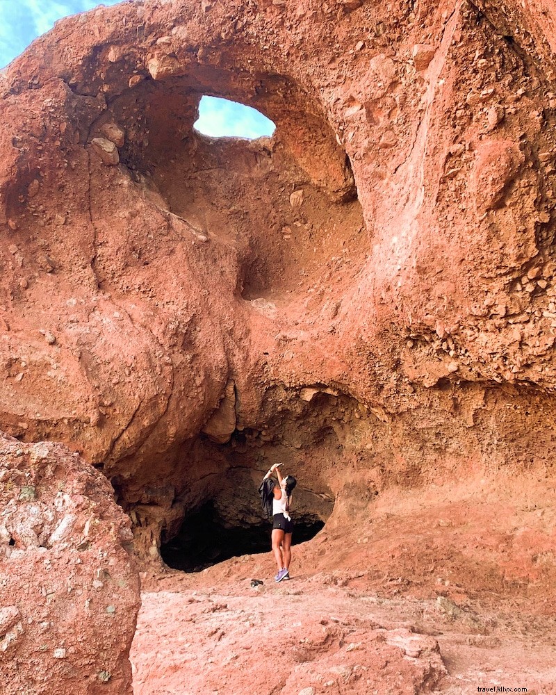
- The iconic Hole-in-the-Rock trail starts from the Phoenix Zoo parking lot—turn left upon entry, head to the lot by the lagoon and butte. It's a quick 5-10 minute ascent with stunning sunset views from the top.
- Perfect for hiking, biking, and leashed dogs. Check the park overview for full trail details.
South Mountain Park
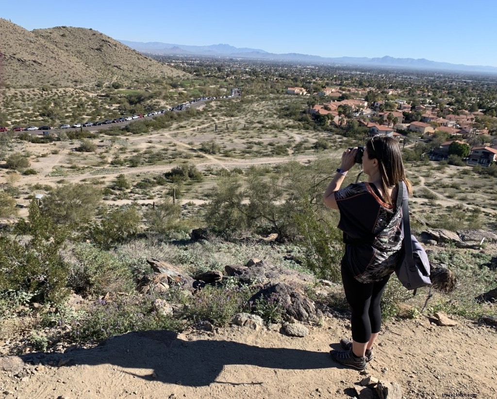
- Access east-side trails from 48th Street north of Guadalupe Road, or via Arizona Grand Resort off Baseline and I-10 (south past resort/golf course, right on Guadalupe, right on 48th). Options range from flat paths to steep climbs popular with hikers and bikers.
- A standout: National Trail to Mormon Loop (6 miles round-trip). The Pima Canyon trailhead reopened in January 2018 with expanded parking, restrooms, and water stations.
- Trails vary from short strolls to all-day adventures. Visit the City of Phoenix website for maps and updates.
Piestewa Peak
- This challenging climb in Piestewa Peak Recreation Area is a leg-burning workout with unbeatable valley vistas. The main trailhead is off Lincoln Drive west of 24th Street—turn east on Squaw Peak Drive to the lot. Not for novices, but worth it. Try the 32nd Street trailhead (north side of Lincoln) for a longer option with shimmering white boulders.
- Steep and strenuous; see this trail map for reviews and details.
“A” Mountain (Hayden Butte)
- Super accessible in downtown Tempe, with trailheads behind Tempe Mission Palms Hotel (Third/Fourth and Mill), Hayden Flour Mill (Mill and Rio Salado Parkway), and Tempe Transportation Center (Veterans Way and College). Stay on marked paths in this preserve; spot ancient petroglyphs from Ancestral Sonoran Desert People. The final ascent is steep, but summit views and nearby Mill Avenue spots reward you.
- No bikes, but great for leashed dogs—a short, intense hike with epic desert panoramas.

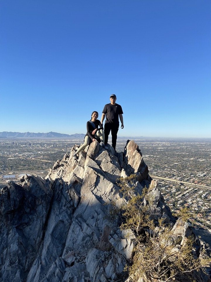
Camelback Mountain

- Phoenix's camel-shaped icon offers two demanding trails. Echo Canyon trailhead: Off McDonald Drive east of Tatum Boulevard (north on 44th past Camelback, curve right, east at McDonald light, right on Echo Canyon). Expect steep sections requiring hands; parking fills fast on weekends—no queuing allowed.
- Cholla trailhead: Off Invergordon Road north of Chaparral (park south of Cholla Lane, walk west). More switchbacks, less scrambling. Both meet at the 360-degree summit. *Cholla Trail closed for maintenance since March 28, 2020—check updates.*
- Open sunrise to sunset; no dogs. Spot desert wildlife. Visit the official site for more.
Got a favorite trail we missed? Share in the comments!
Top Tempe Spots to Celebrate National Pi (Pie) Day
Best Family-Friendly Hiking Trails in Tempe and Phoenix Area