Ultimate Death Valley Itinerary: Surprising Beauty, Historic Sites, and Epic Vistas
Despite its foreboding name, Death Valley National Park teems with vibrant life and extraordinary natural wonders, offering a stark contrast to the nearby bustle of Las Vegas and Palm Springs. Located just 120 miles northwest of Las Vegas and a few hours from Greater Palm Springs, this Mojave Desert jewel reveals pristine landscapes and profound serenity. As you enter the park, the silence envelops you, gradually giving way to the desert's subtle symphony: shifting sands, burrowing animals, and birds in flight. From Dante’s View, marvel at the highest point in the contiguous U.S.—Mount Whitney at 14,494 feet—and the lowest, Badwater Basin at 282 feet below sea level.

En Route to Death Valley
Arriving in Death Valley can be as thrilling as the destination itself. One scenic backroute via Emigrant Pass offers stunning vistas. From Barstow, take Highway 395 to State Highway 178 for the otherworldly Trona Pinnacles—500 calcium-carbonate tufa towers rising over 130 feet from the desert floor. Less famous than Mono Lake's but equally imaginative (think castles and drawbridges), they're visible along Leslie (Salt) Road, formed by ancient dried lakes.
Refuel in Trona, then continue on Trona Wildrose Highway to Emigrant Canyon. Spot wild burros on the scrubby flats. This 550-mile loop through Death Valley and surrounds is ambitious—choose side trips to savor it fully.
Start at Furnace Creek Visitor Center
Inside the park, kick off at the Furnace Creek Visitor Center on Highway 190. Catch the informative 20-minute film, and from November to April, join ranger-led walks, talks, and presentations on the park's cultural and natural history.
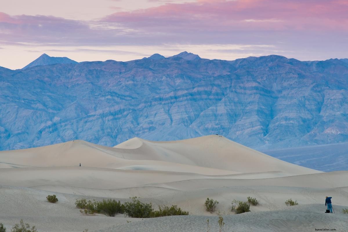
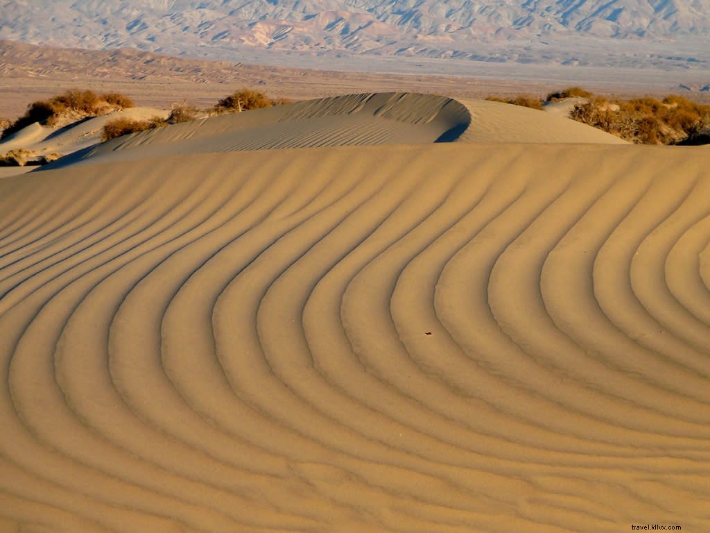
Explore the Dunes
Experience Death Valley's magic on an early-morning walk near Stovepipe Wells amid the 14-mile-square sand dunes. Spot nocturnal animal tracks as sunrise highlights eroded quartz contours. Sunsets and moonlight add dramatic allure.
Mesquite Flat Sand Dunes, the park's most accessible, lie central near Stovepipe Wells off Hwy. 190 or Sand Dunes Road. Covering a vast area (highest ~100 feet), they feature crescent, linear, and star-shaped forms on ancient lakebed clay, with mesquite hummocks supporting wildlife.
Eureka Dunes, second-tallest in the U.S. at over 700 feet, are 10 miles off Eureka Valley Road. Morning/afternoon shadows accent their flowing edges against the reddened Last Chance Mountains—perfect for wandering or summit climbs.
Panamint Dunes appear distantly north across Panamint Valley on Hwy. 190. Access via 5-mile dirt road past Lake Hill, then 3-mile hike. Uniquely sloped, their star-shaped summits offer sweeping valley views.
Unearth Rich Mining History
Death Valley's history rivals its landscapes. Indigenous cultures thrived here 9,000 years ago. In 1849, emigrants seeking a Gold Rush shortcut endured hardships that named the valley. Silver discoveries sparked booms in gold, silver, copper, and lead—borax proved most lucrative.
In 1905, gold at Skidoo birthed a company town (pop. 700) named after '23 skidoo' (23 miles piped water). Profitable until 1917 ($3M+), it became a ghost town by 1950.
Reopened in 2017 after 2008 closure, Keane Wonder Mine exemplifies early 1900s gold ops. Tramcars hauled ore 1,000 feet down Funeral Mountains—one million dollars extracted by 1912, 70 tons daily at peak. Tour this engineering marvel.
Nearby Rhyolite ghost town (35 miles from Furnace Creek) features bank ruins, jail remnants, a train depot, and restored Bottle House.
Scotty’s Castle
Closed since a 2015 flash flood, Scotty’s Castle—iconic for Spanish Colonial style and tales—now offers limited Flood Recovery walking tours showcasing water's desert-shaping power. Check nps.gov for availability and reservations here. Full reopening is in progress.
Twenty-Mule Team Days
At Harmony Borax Works ruins near Furnace Creek, follow the trail past 1880s refinery remnants and wagons. The Borax Museum displays mining gear, highlighting borax's vast uses (glass, soap, ceramics, reactors) from 2,000 tons in 1882 to 1.5M+ today.
Hike or Drive Inspirational Routes
Death Valley brims with trails and drives for all levels. Hike rainbow-hued Desolation Canyon, a 'geologic rainbow' echoing Star Wars' Tatooine (filmed here decades ago).
Drive 9-mile Artists Drive for colorful hills and Artists Palette.
Rainbow Canyon in northern Panamint Valley features dark lava flows; vista from Father Crowley Point stuns.
Darwin Falls, off Hwy. 190 west of Panamint Springs: 2-mile trail to 30-foot cascade amid lush greenery—a desert oasis.
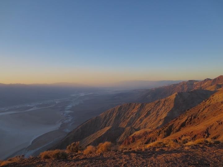
Capture Epic Vistas
Death Valley's scale shines from key viewpoints. Dante’s View (5,475 feet) overlooks Badwater Basin, Panamints, and Sierra Nevadas—sunsets are magical.
Zabriskie Point surveys golden badlands; best at sunrise/sunset.
Ubehebe Crater (600-foot, multi-hued) in northern Death Valley: rim hike or parking lot views, amid massive alluvial fans.
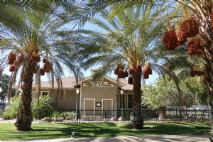
Lodge in Legendary Oasis at Death Valley
The reimagined Oasis at Death Valley (formerly Furnace Creek Resort) boasts a $50M upgrade: Inn at Death Valley (66 rooms, mountainside) and Ranch (224 rooms). Xanterra-operated, it retains the golf course (214 feet below sea level). Amid date palms and springs, the Inn's restored dining room features sky-blue ceilings and sunset vistas.
Find detailed Death Valley National Park info here or things to do here.