Lassen Volcanic National Park: Geothermal Wonders, Epic Hikes, and Volcanic History
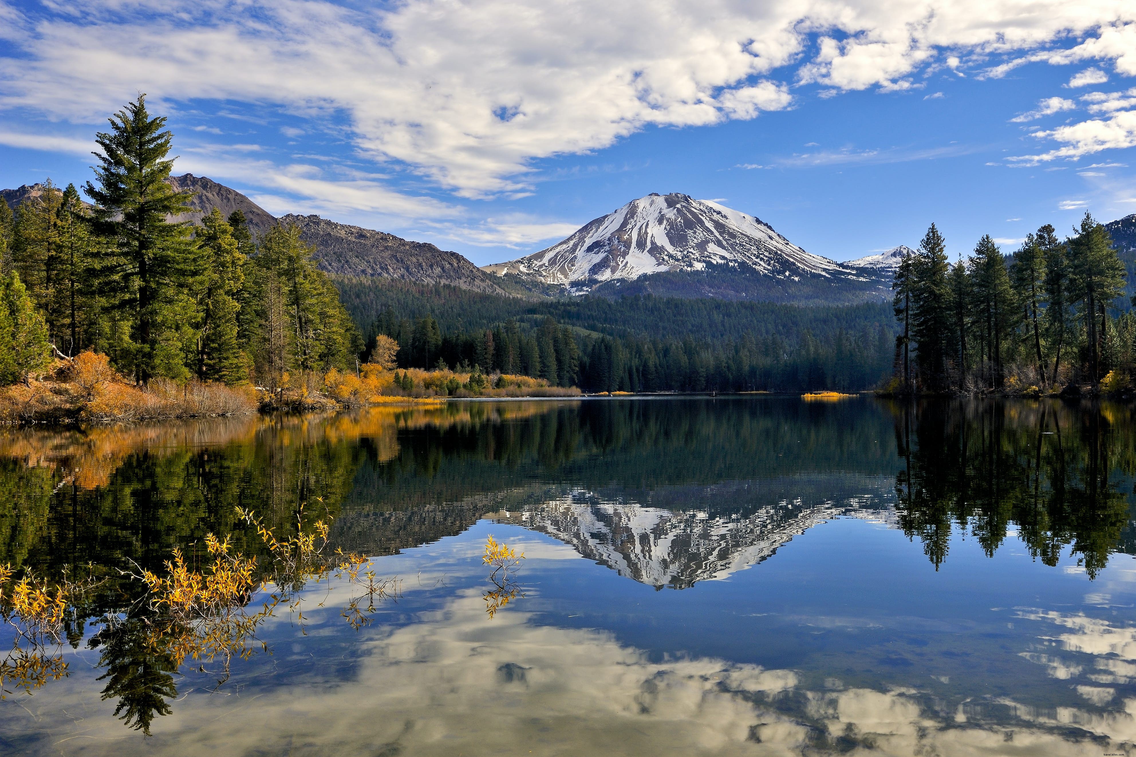
Dominating the skyline, Lassen Peak—the world's largest plug-dome volcano—rises 2,000 feet above the surrounding terrain to an elevation of 10,457 feet. As an active volcano, it famously erupted in 1915, ejecting massive plumes of smoke, steam, and ash. The U.S. government established Lassen Volcanic National Park in 1916 to safeguard this dynamic new landscape.
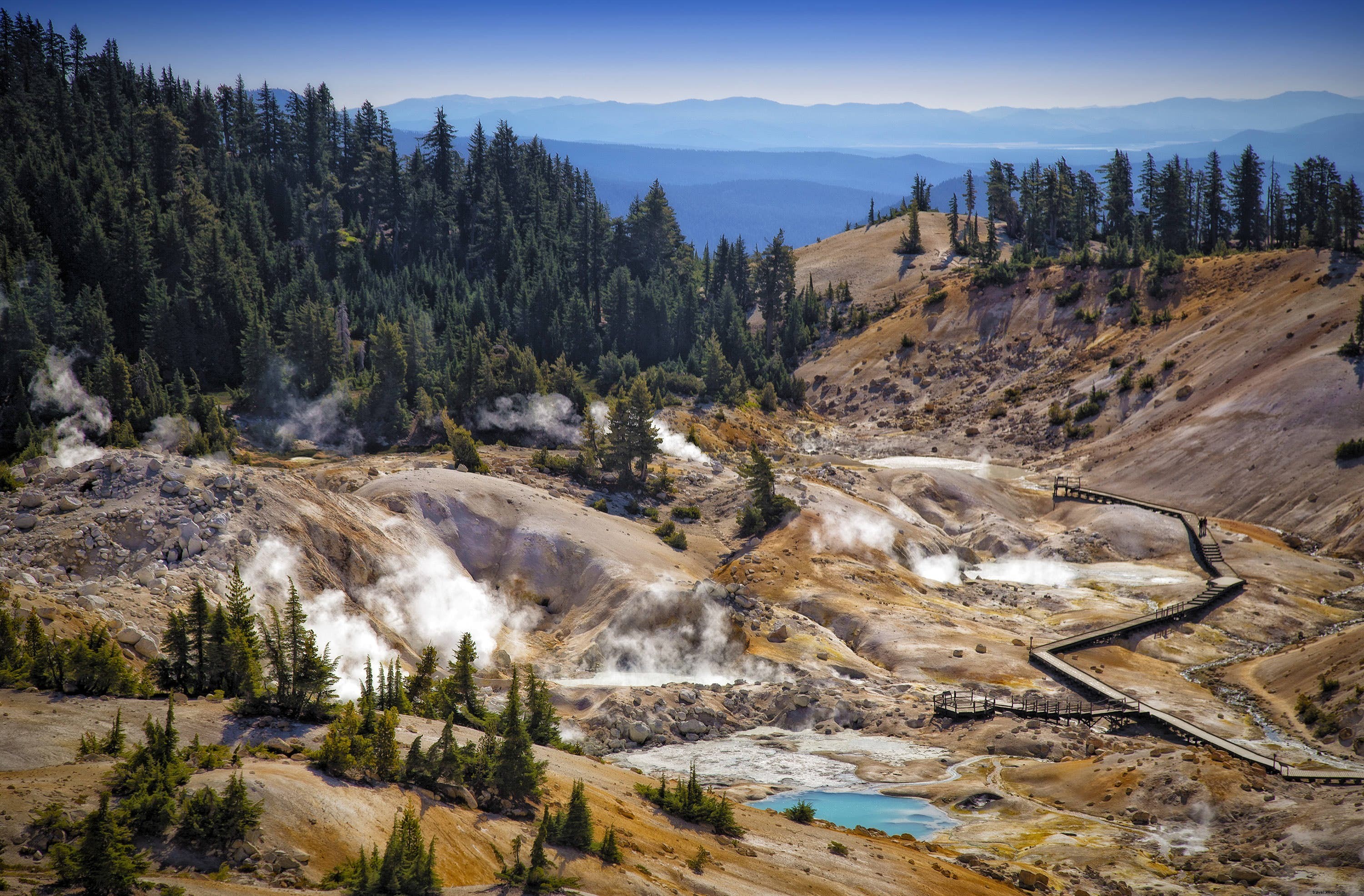
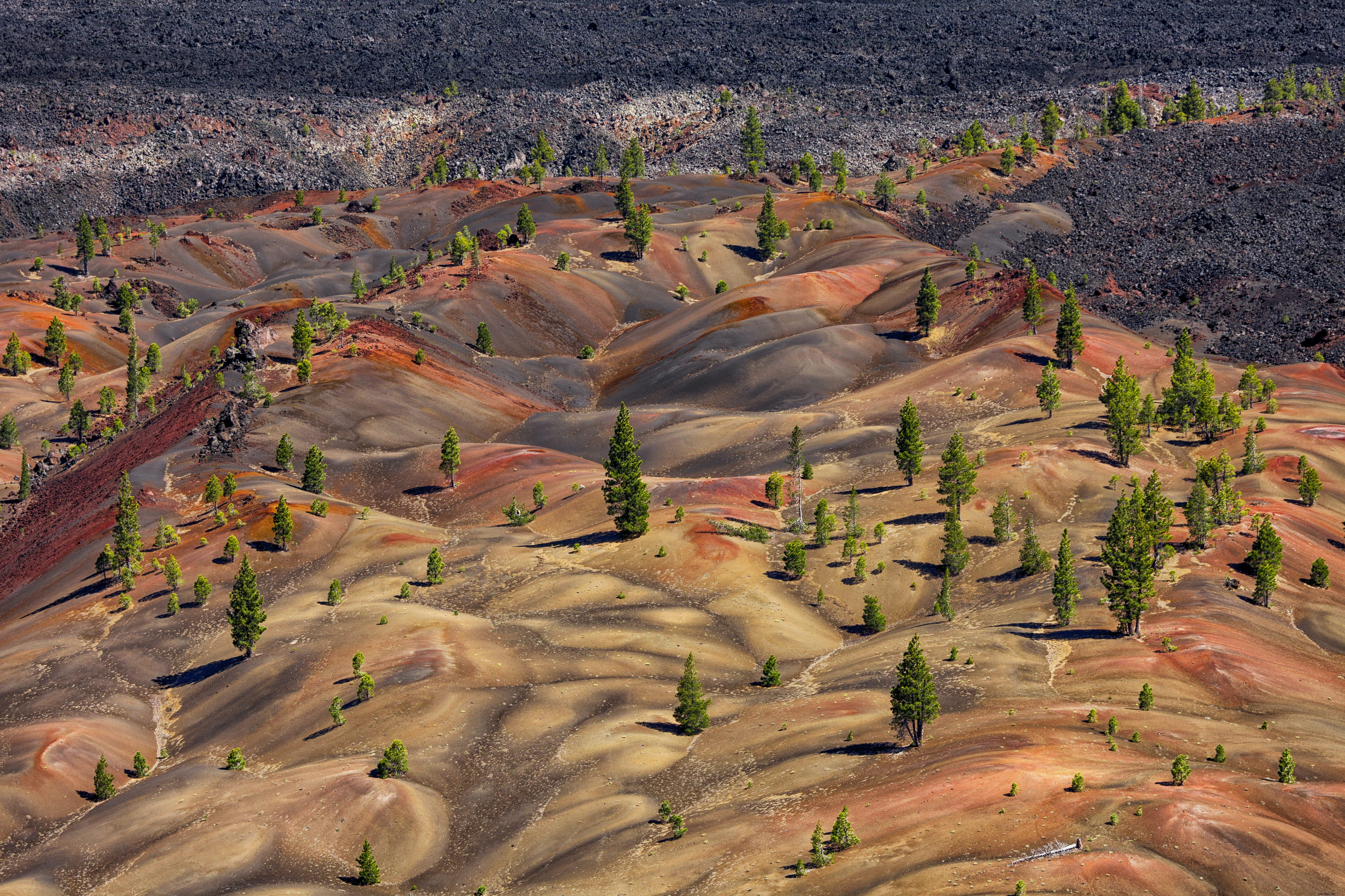
Spanning 106,000 acres, the park's arid, steaming, barren expanses contrast sharply with the lush conifer forests encircling it. Summer brings accessibility, but winter's heavy snowfall demands specialized gear for exploration. Entering from the southwest gateway transports visitors to an otherworldly realm, revealing the Earth's fiery interior through bubbling hot springs, mud pots, sulfur vents, fumaroles, lava flows, cinder cones, craters, and crater lakes.
Historically, this area served as a vital summer gathering spot for Atsugewi, Yana, Yahi, and Maidu tribes, who hunted deer and harvested plants for basketry. Today, descendant communities nearby collaborate with park rangers to share their ancestral stories and living traditions with visitors.
Top Hiking Trails in Lassen Volcanic National Park
Areas ravaged by the 1915 eruption, like the Devastated Area northeast of Lassen Peak, are rebounding remarkably. Highway 89 loops around the peak on three sides, granting access to geothermal spectacles, pristine lakes, scenic picnic spots, and secluded trails.
With 150 miles of trails—including a 17-mile stretch of the Pacific Crest Trail—options abound. Seasoned hikers tackle the challenging 5-mile round-trip Lassen Peak Trail (4.5+ hours), while families enjoy the initial 1.3 miles to Grandview viewpoint. Summit views span 360 degrees, though early-season snow requires crampons and ice axes.
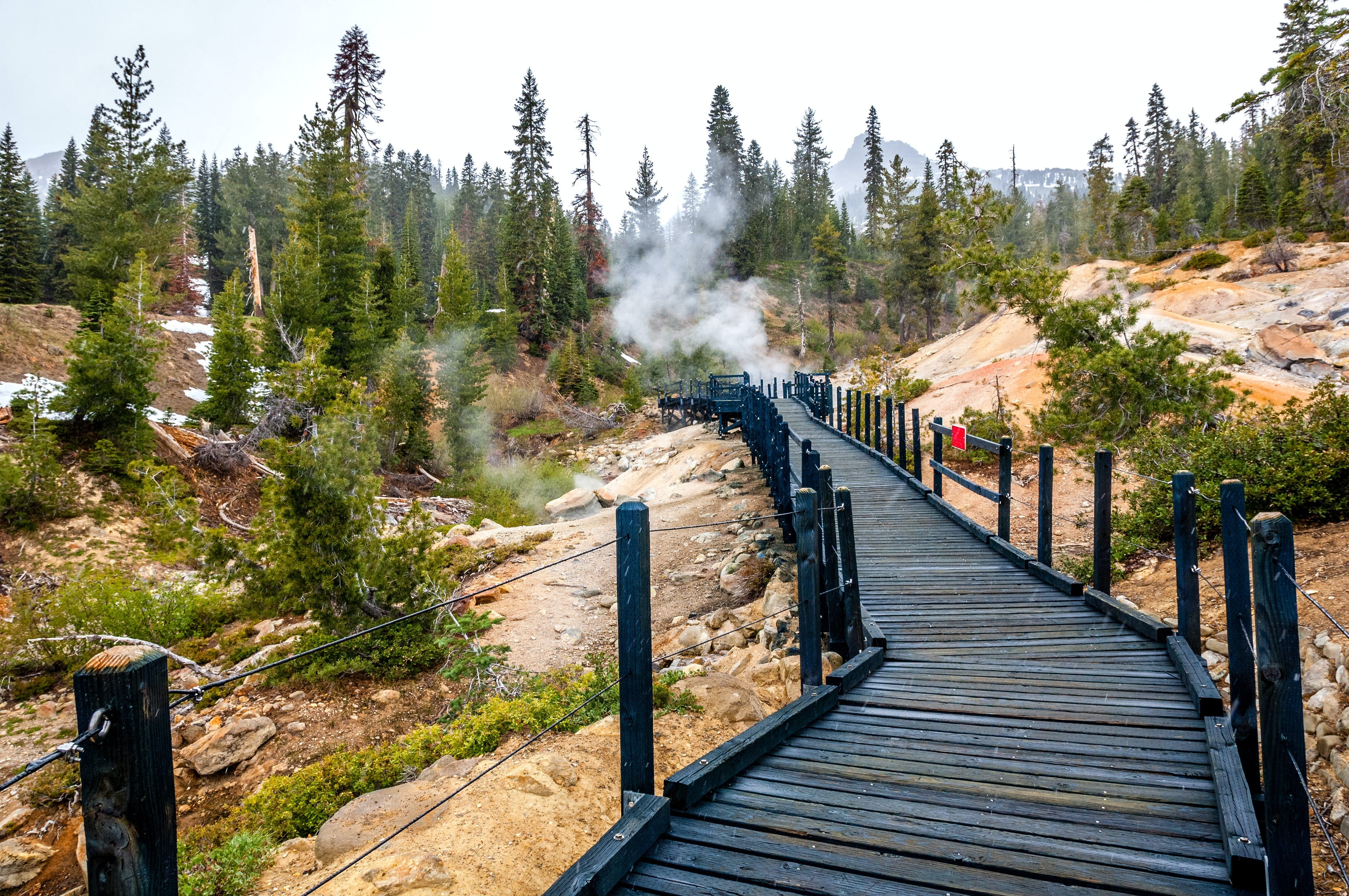
Near the Kom Yah-mah-nee Visitor Facility, a family-friendly 2.3-mile trail winds through meadows and woods to Mill Creek Falls. Along Highway 89, the Sulfur Works roadside attraction features mud pots, steam vents, and fumaroles. Bumpass Hell offers a moderate 1.5-mile boardwalk to vibrant geothermal pools and steaming vents.
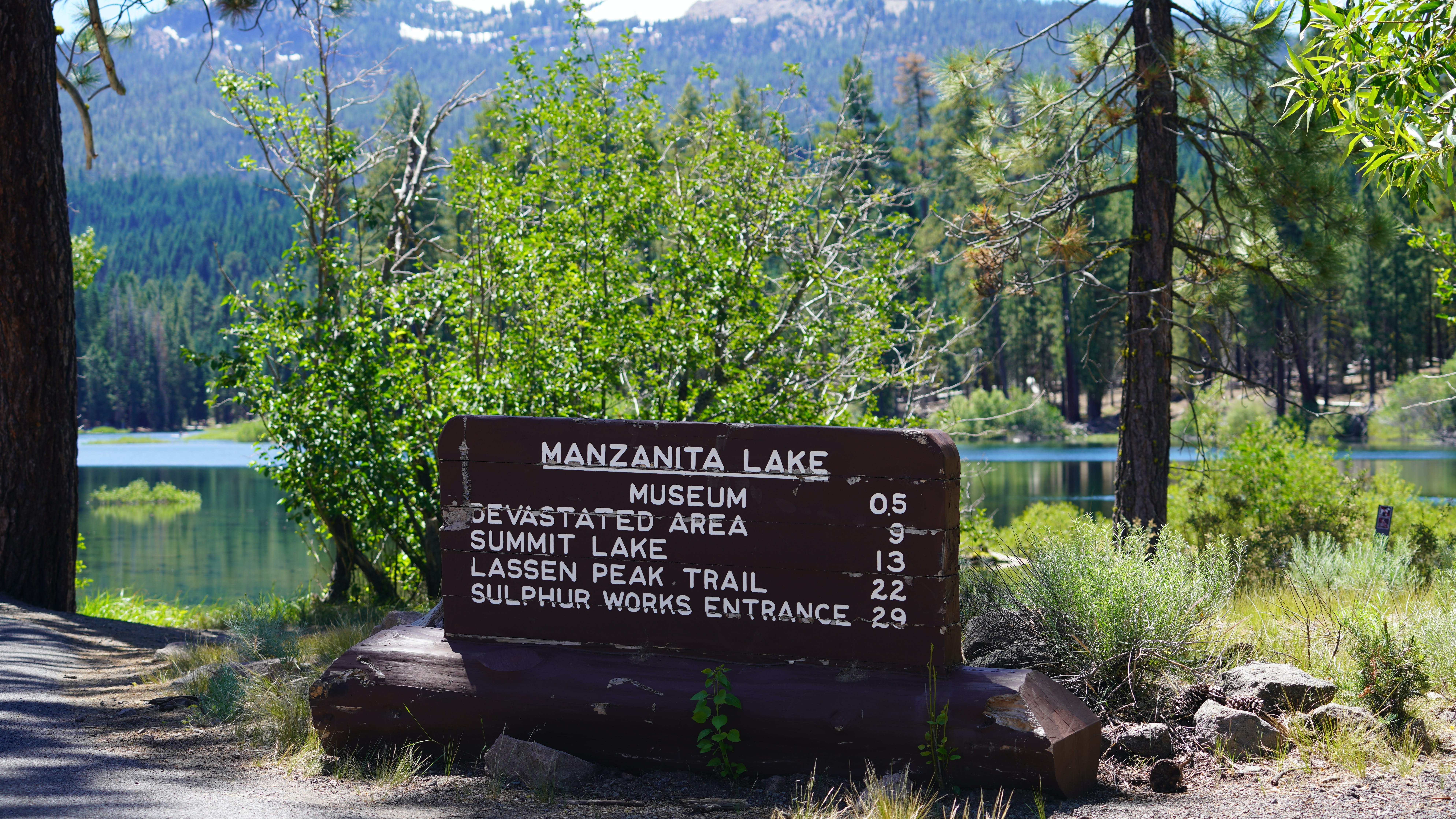
Trails meander past cinder cones, lava fields, and alpine meadows, overlooking Juniper Lake, Snag Lake, and distant plains. High-elevation lakes retain picturesque ice patches into summer. Relax at Manzanita Lake near the north entrance for fishing, swimming, or boating.
Essential Tips for Visiting Lassen Volcanic National Park
Access the park via the north entrance at Manzanita Lake (50 miles east of Redding on Hwy 44) or southwest on Hwy 89 (5 miles north of Hwy 36 junction). From there, Mineral is 5 miles west, Red Bluff 44 miles west, Chester 25 miles east, Susanville 60 miles east, and Quincy 65 miles southeast.
All visitors receive a complimentary map. Near the southwest entrance, the LEED Platinum-certified Kom Yah-mah-nee Visitor Facility offers interactive volcano exhibits, a bookstore, auditorium, gift shop, and cafe. The Manzanita Lake Visitors Center & Loomis Museum provides exhibits, films, and summer ranger programs on geology, wildlife, astronomy, and Indigenous culture.
A car is essential, though cyclists appreciate the two-lane roads and nearby national forest camping. Beware: roads typically open June-October but can close due to 40-foot snowpack. Check nps.gov/lavo for current conditions—August and September are safest.
Discover Northern California