How to Find Iceland's Iconic Sólheimasandur Plane Wreck: Directions and Tips
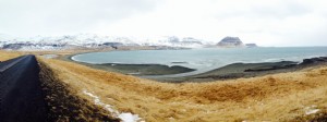
Sólheimasandur Beach, Iceland
You've likely seen the striking images: the twisted wreckage of a crashed airplane on Iceland's Sólheimasandur black sand beach. Here's your complete guide to locating it safely and easily.
[su_note note_color="#F5DCDC" text_color="#333333" radius="3" class=""]
Important Update: Access by vehicle on the beach is now banned by local landowners. You must park at the road and walk 4km (about 45-60 minutes) to the wreck. Plan accordingly with proper footwear and weather gear.[/su_note]
This haunting site is one of Iceland's most photographed landmarks, offering unparalleled travel inspiration for adventurers and photographers alike.
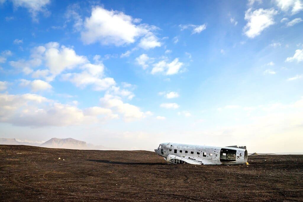
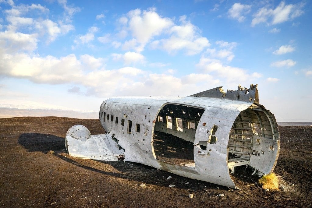
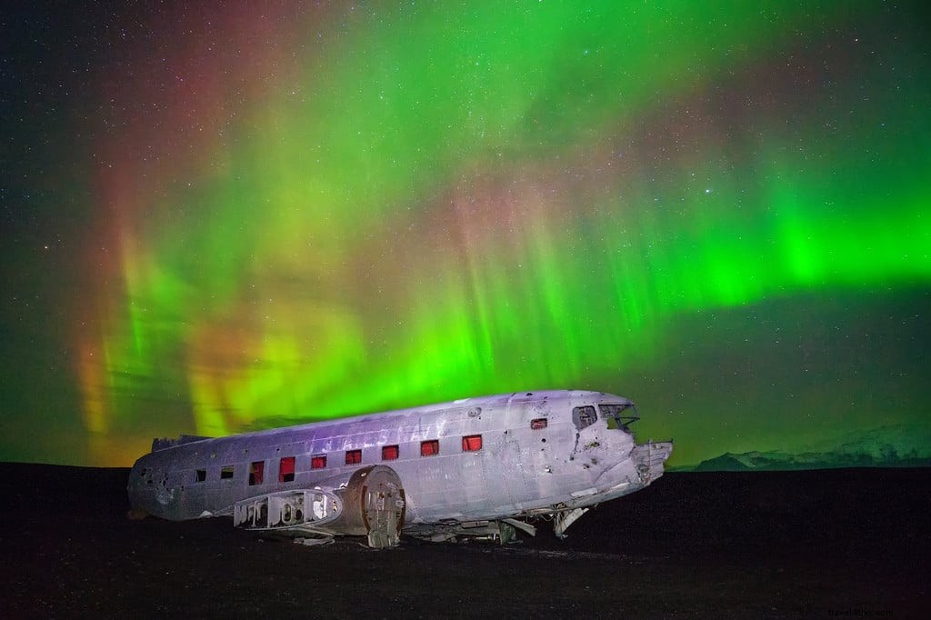
On November 24, 1973, a U.S. Navy Douglas DC-3 was forced to make an emergency landing on Sólheimasandur's black sand beach due to severe icing conditions. All crew members survived unharmed, but the fuselage was left behind, transforming into a iconic photography destination.
Finding it requires precise directions—detailed below for a seamless visit.
The Airplane Wreckage
Over 50 years later, this weathered DC-3 remains a dramatic highlight on the remote black sand beach, evoking post-apocalyptic scenes perfect for photography.
Stripped of wings and tail, riddled with holes, and partially buried in black sand, it stands as a testament to resilience. View a pre-crash photo here.
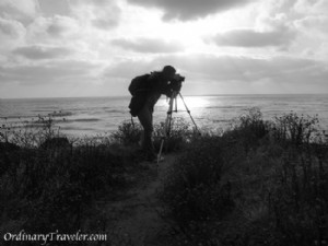
I camped overnight at the site in my Happy Camper van to photograph the Northern Lights under strong aurora activity and clear skies—a rare treat in Iceland.
Essential stop for Iceland photographers!
For Northern Lights shots over the wreck, face north (inland), bundle up, and monitor the sky. See my full guide to photographing the Northern Lights in Iceland.
Directions to the Crash Site
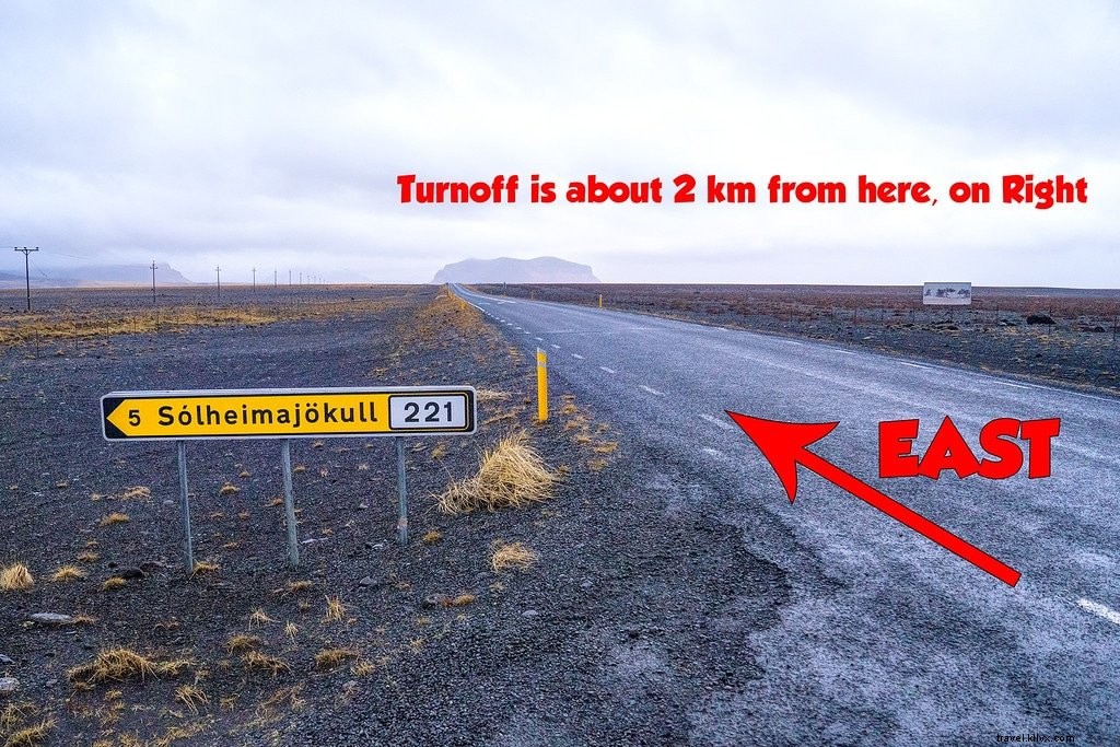
Located on Iceland's South Coast between Skógafoss waterfall and Vík town, the wreck is accessible via Route 1 (Ring Road). Heading east from Skógafoss, cross the bridge with yellow flashing lights and spot the dirt road to Sólheimajökull Glacier on your left.
The glacier road sign marks this spot [PHOTO #1]. Continue east ~2km; watch for a gated dirt road on the right [PHOTO #2]—the only fence gap after the bridge. If you cross a second bridge, turn back.
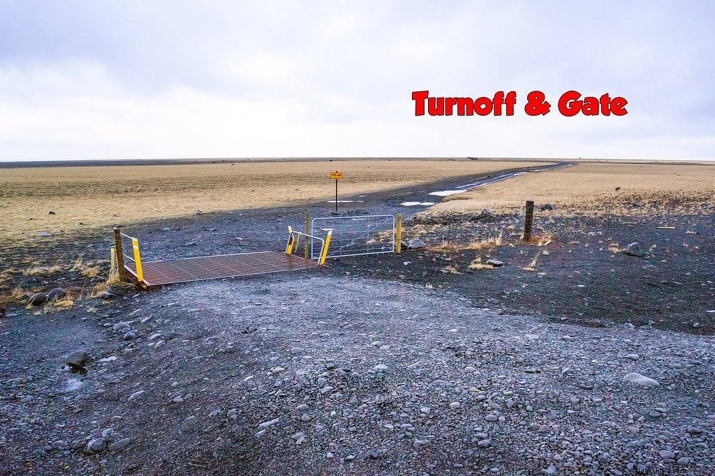
Parking and Walking Access
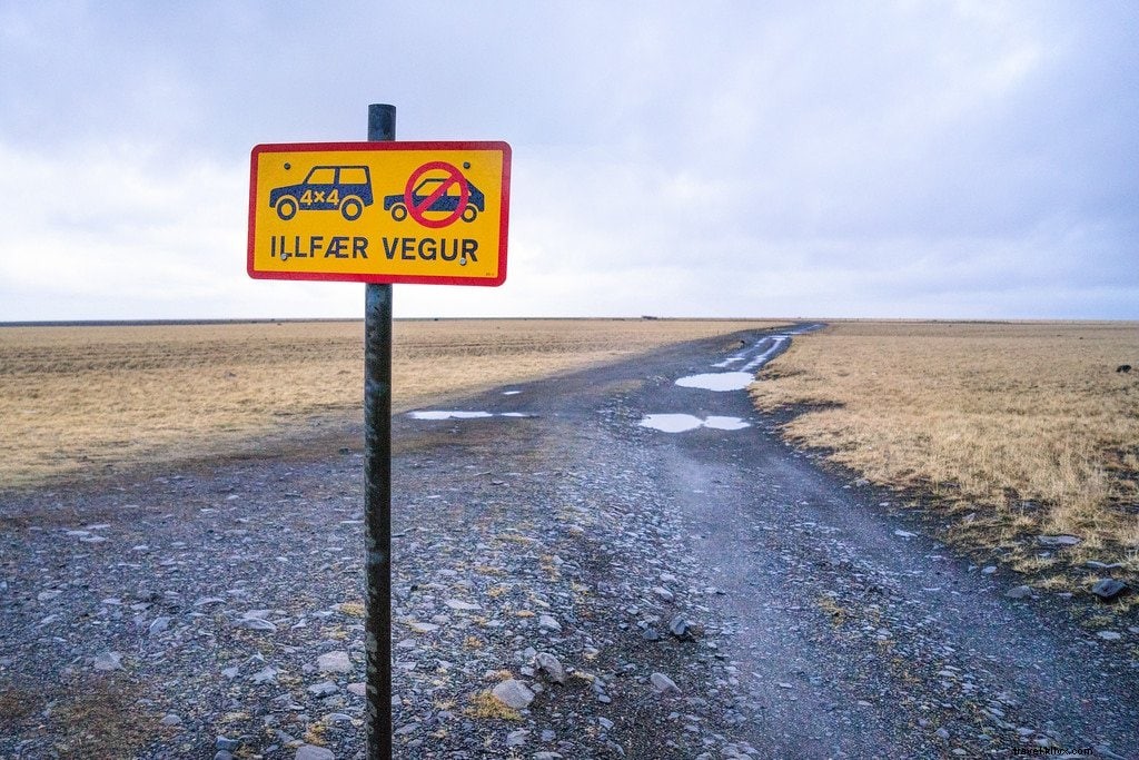
A yellow sign at the gate recommends 4x4 vehicles, but with the driving ban, park here safely. The 4km path is well-trodden gravel transitioning to sand—manageable but watch for potholes and weather.
[su_note note_color="#F5DCDC" text_color="#333333" radius="3" class=""]
Reminder: No vehicles beyond the gate. Walk the 4km to the wreck.[/su_note]
Stay Left at the Fork
The path forks shortly after the gate—veer left. Road markers guide you across the black sand toward the ocean. The wreck appears suddenly behind a dune, ~4km from the parking area.
Follow markers even at night. Happy exploring! ★
Parking Turnoff GPS Coordinates
63.4912391, -19.3632810
Wreck GPS Coordinates
63.459523, -19.364618