20 Premier Virginia Summits with Breathtaking 360° Panoramic Views
The classic hiking mantra 'because it's there' rings true across Virginia's abundant mountains. But imagine summits rewarding you with sweeping 360-degree vistas of rugged peaks, lush valleys, and distant horizons. Stand atop Mary's Rock in Shenandoah National Park for unobstructed mountain and countryside panoramas. From High Knob Tower in Southwest Virginia, glimpse five states. Overlook Humpback Rocks to spot the historic Carter Farm amid endless skylines. This expert guide details 20 such Virginia summits, complete with trail info, elevations, GPS coordinates, and insider tips for safe, memorable adventures.
High Knob Tower
Nearest Town: Norton
The Hike: 100 yards
Summit Elevation: 4,223 feet
Trailhead GPS Coordinates: 36.8951, -82.62611
A brief stroll leads to this restored fire tower in Jefferson National Forest, overlooking Clinch River and Guest River Valleys. The circular design ensures true 360-degree views into Virginia, Kentucky, Tennessee, North Carolina, and West Virginia. High Knob also launches the 19-mile Chief Benge Scout Trail, featuring remote valleys, waterfalls, lakes, and nearby campgrounds.
Beyond the Summit: Stay at High Knob Campground below for an ideal base to explore the region.
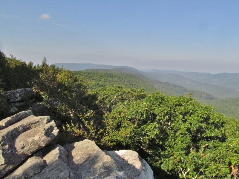
The Channels
Nearest Town: Lebanon
The Hike: 6.2 miles round trip
Summit Elevation: 4,180 feet
Trailhead GPS Coordinates: 36.86484, -81.94704

This Virginia Natural Area Preserve showcases unique sandstone monoliths forming 'The Channels,' plus an old fire tower and warden's cabin. The trail from Hayters Gap ascends 1,000 feet to Middle Knob on Clinch Mountain, delivering exceptional 360-degree mountain vistas—one of the Appalachians' most distinctive rock formations.
Beyond the Summit: Fuel up beforehand at Harvest Table in Meadowview, a charming eatery and general store.
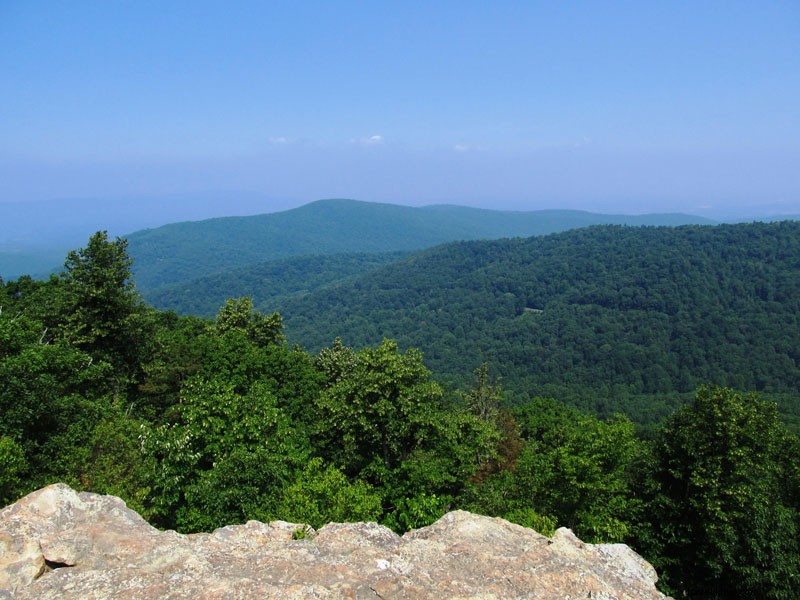
Dragon's Tooth
Nearest Town: Roanoke
The Hike: 4.9 miles round trip
Summit Elevation: 3,020 feet
Trailhead GPS Coordinates: 37.37875, -80.1562
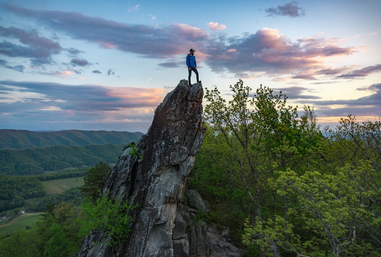
A popular yet challenging trek up Cove Mountain culminates at a striking vertical stone slab with 360-degree panoramas of the Roanoke River Valley. Along the Appalachian Trail section, expect moderate rock scrambling—hands and feet required—but it's accessible to thousands annually, blending geology and scenery seamlessly.
Beyond the Summit: Descend to Salem for a tour of Dixie Caverns, offering cave exploration, shopping, souvenirs, and camping.
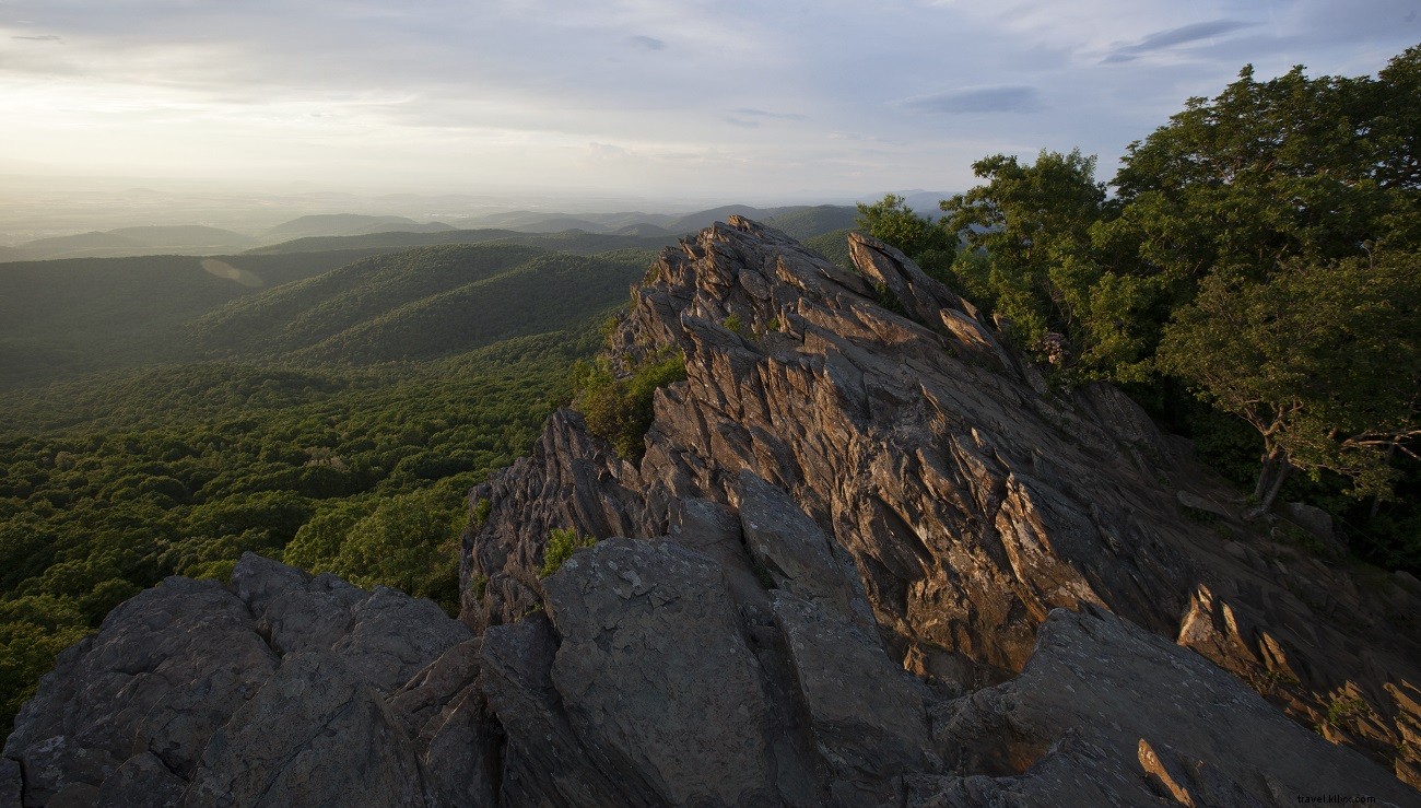
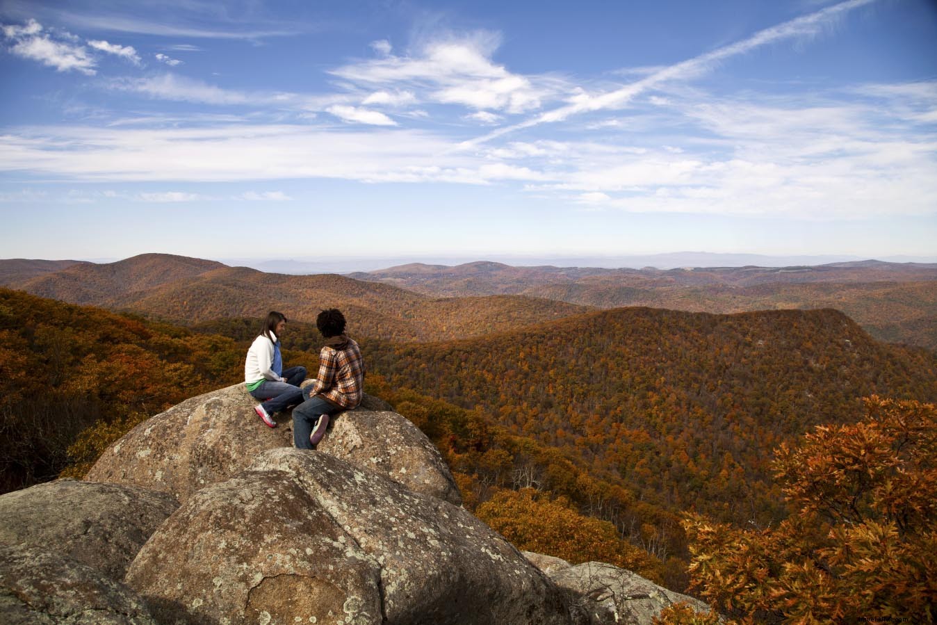
Old Rag
Nearest Town: Sperryville
The Hike: 9.1-mile loop
Summit Elevation: 3,268 feet
Trailhead GPS Coordinates: 37.96874, -78.89613
Virginia's iconic Shenandoah challenge: Ascend the north slope to granite slabs and boulder mazes with serious scrambling to the summit. Wind-sculpted flora thrives in cracks, protected in spots. Enjoy stellar 360-degree views, especially the eastern drop-off, then descend via scenic Brokenback Run fire road.
Beyond the Summit: Refuel in Culpeper at Shawn's BBQ—indulge after burning serious calories.
Bearfence Mountain
Nearest Town: Elkton
The Hike: 1.2 miles round trip
Summit Elevation: 3,420 feet
Trailhead GPS Coordinates: 38.2204, -78.3692

The Bearfence Mountain Rock Scramble Trail from Skyline Drive offers short, fun boulder-hopping (avoid in rain) to an open outcrop with prime Shenandoah views: Conway River, Fork Mountain, Jones Mountain, Cat Knob, Shenandoah Valley, and Piedmont. Family-friendly with big rewards.
Beyond the Summit: Head to Massanutten WaterPark in Elkton for family water fun.
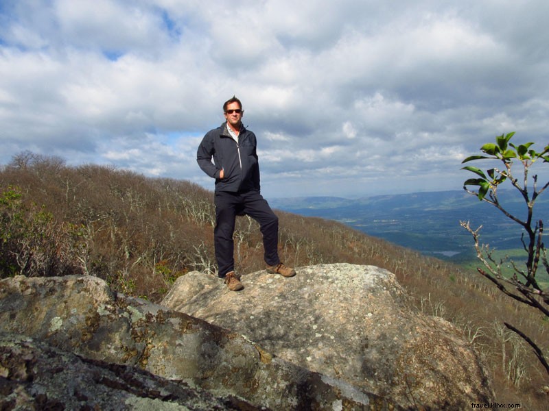
Blackrock Summit
Nearest Town: Waynesboro
The Hike: 1.1-mile loop
Summit Elevation: 3,160 feet
Trailhead GPS Coordinates: 38.22292, -78.73332
An easy Skyline Drive stroll to a massive boulder pile on the Appalachian Trail. Miles-wide views south, west into Paine Hollow, Trayfoot Mountain, and Blackrock's jagged crown—stunning in all directions.
Beyond the Summit: Visit Loft Mountain Wayside for ice cream (summer) or camp nearby.
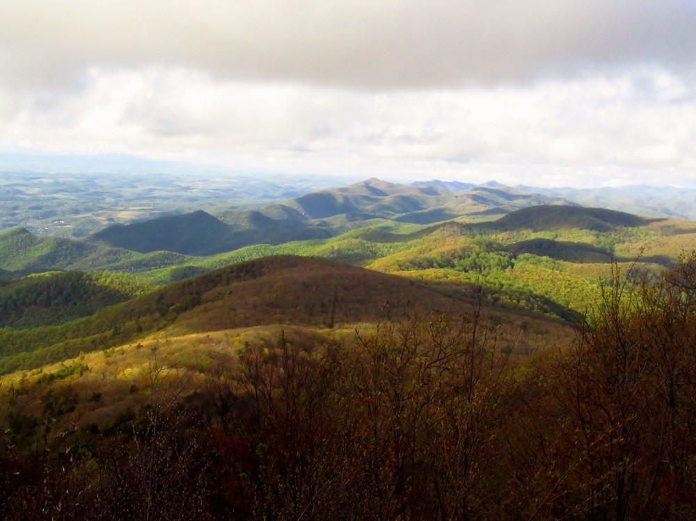
Flat Top
Nearest Town: Bedford
The Hike: 5.6 miles round trip
Summit Elevation: 4,001 feet
Trailhead GPS Coordinates: 37.47295, -79.58028
Switchbacks ease the 1,500-foot climb through woods to Cross Rock previews and dual-sided Peaks of Otter vistas. Optimal on clear days: fall foliage, winter clarity, or spring greens from James River below.
Beyond the Summit: Stay at Peaks of Otter Lodge on Abbott Lake; dine, or bus to Sharp Top.
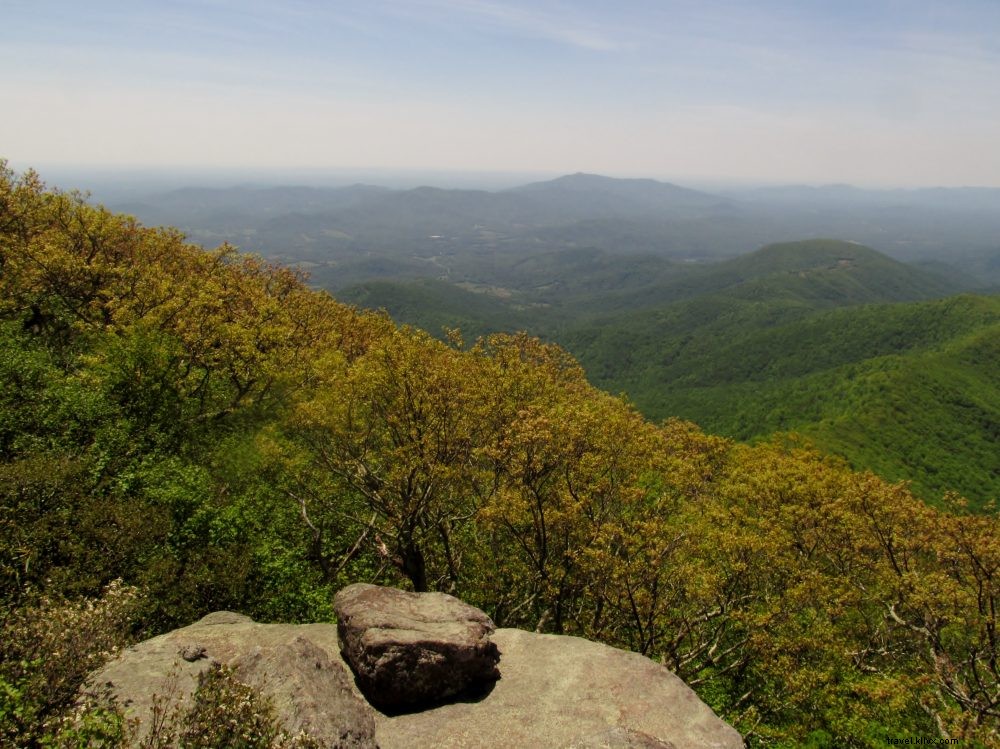
Humpback Rocks
Nearest Town: Waynesboro
The Hike: 4.9-mile loop
Summit Elevation: 3,260 feet
Trailhead GPS Coordinates: 37.8507, -79.0175
Blue Ridge Parkway start to rocky heights: Tiny Carter Farm below, Shenandoah spine north, Shenandoah Valley/Alleghenies west, Piedmont east. Multiple overlooks, AT switchbacks, Howardsville Turnpike return.
Beyond the Summit: Drive Parkway; camp/fish/swim at Sherando Lake in George Washington National Forest.
White Rocks
Nearest Town: Ewing
The Hike: 7 miles round trip
Summit Elevation: 3,513 feet
Trailhead GPS Coordinates: 36.65227, -83.43571

Prominent knob at Cumberland Gap National Historical Park (Boone-named?): Graded trail to rounded stone with Tennessee Valley/Smokies, Pine Mountain (VA-KY line), Kentucky views.
Beyond the Summit: Tour Cumberland Gap and Wilderness Road State Park for Boone history.
Stone Mountain
Nearest Town: Troutdale
The Hike: 1.6 miles round trip
Summit Elevation: 4,940 feet
Trailhead GPS Coordinates: 36.67, -81.48692
Mount Rogers High Country gem: First Peak Trail from Scales (4,600 ft) to open crest surveying nearby peaks and lowlands—a quieter grandstand view.
Beyond the Summit: Hike AT/Scales Trail; summit viewless Mt. Rogers (5,728 ft) with slope panoramas.
Comers Rock
Nearest Town: Speedwell
The Hike: 0.8 miles round trip
Summit Elevation: 4,100 feet
Trailhead GPS Coordinates: 36.76457, -81.22706

Near-drive-up to stone steps/platform in Mount Rogers NRA: 360° over forests, farms in Grayson/Wythe Counties. Trails, Comers Rock Campground, Hale Lake trout fishing nearby.
Beyond the Summit: Dine at Log House 1776 Restaurant in Wytheville.
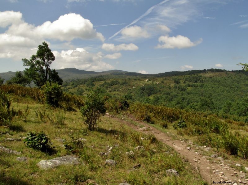
Chestnut Ridge/Knob
Nearest Town: Bland or Tazewell
The Hike: 9.2 miles round trip
Summit Elevation: 4,390 feet
Trailhead GPS Coordinates: 36.98347, -81.40641

Appalachian Trail through meadows to grassy knob overlooking Burkes Garden (VA's highest valley/rural district). Historic stone shelter (ex-fire warden) remains.
Beyond the Summit: Stop at Big Walker Lookout en route to Bland (since 1947).
Wind Rock
Nearest Town: Pembroke
The Hike: 0.5 miles round trip
Summit Elevation: 4,128 feet
Trailhead GPS Coordinates: 37.41216, -80.52266
Short AT uphill on Potts Mountain (ex-Stoney Creek Tower) to angled outcrop: Peters Mountain, Stony Creek Valley, Big Mountain/New River, Potts extension.
Beyond the Summit: Relax at Mountain Lake Lodge (VA's rare natural lake, nature preserve, historic resort).
Bluff Mountain
Nearest Town: Buena Vista
The Hike: 3.8 miles round trip
Summit Elevation: 3,372 feet
Trailhead GPS Coordinates: 37.67512, -79.33334
Haunted Parkway site (Ottie Powell memorial): Towerless tower spot with Maury River/Lexington/WV west, James Valley/Richmond east, Blue Ridge north.
Beyond the Summit: Continue Parkway south (James crossing) or north (Shenandoah NP).
Mount Pleasant
Nearest Town: Buena Vista
The Hike: 6.4-mile loop
Summit Elevation: 4,021 feet
Trailhead GPS Coordinates: 37.75884, -79.18842
Henry Lanum Trail loop in Mount Pleasant National Scenic Area to twin outcrops: Cole Mountain meadows, Blue Ridge spine, distant terrain.
Beyond the Summit: Italian eats at Original Italian Pizza in Buena Vista.
The Priest
Nearest Town: Steeles Tavern
The Hike: 3.6 miles round trip
Summit Elevation: 4,063 feet
Trailhead GPS Coordinates: 37.82992, -79.08259
AT through Priest Wilderness to outcrop: Tye River Gap, Pinnacle Ridge, Big Levels, Torry Ridge, Three Ridges; Massanutten afar. Nearby Crabtree Falls (VA's tallest).
Beyond the Summit: Tour Cyrus McCormick Farm historic site.
Reddish Knob
Nearest Town: Harrisonburg
The Hike: Mere feet
Summit Elevation: 4,397 feet
Trailhead GPS Coordinates: 38.46234, -79.2417
Drive-up northern VA highpoint on VA-WV line: 360° Shenandoah Valley east, WV mountains west. Trails, biking, camping in George Washington NF.
Beyond the Summit: Harrisonburg eats: Capital Ale House burgers/beers, Jack Brown's, Bella Luna Pizza, Heritage Bakery.
Woodstock Tower
Nearest Town: Woodstock
The Hike: 2.0 miles round trip
Summit Elevation: 1,893 feet
Trailhead GPS Coordinates: 38.86725, -78.44327
George Washington NF trail (avoid OHVs) to Powell Mountain tower: North Fork Shenandoah, Woodstock, Green Mountain Gap, South Fork, Shenandoah NP.
Beyond the Summit: Float South Fork Shenandoah with local outfitters.
Mary's Rock
Nearest Town: Luray
The Hike: 7.2 miles round trip
Summit Elevation: 3,730 feet
Trailhead GPS Coordinates: 38.62397, -78.34273
Premier AT route from Pinnacles Picnic Area: Frequent views to stony summit panoramas—Blue Ridge north, Luray/Valley west, Thornton Gap south (USGS markers atop).
Beyond the Summit: Navigate Luray's Garden Maze.
Compton Peak
Nearest Town: Front Royal
The Hike: 3.2 miles round trip
Summit Elevation: 2,909 feet
Trailhead GPS Coordinates: 38.82326, -78.17021
Gentle AT in Shenandoah NP to dual outcrops: Skyline Drive snaking, South Fork/Valley left, DC flats ahead; Mount Marshall/east second vista.
Beyond the Summit: Lunch at PaveMint Taphouse in Front Royal, tour Skyline Caverns.