Kamikochi: Your Gateway to the Majestic Japanese Alps
The Pristine Beauty of Kamikochi
Kamikochi places the Japanese Alps right at your doorstep. For over a century, this stunning highland valley has drawn mountaineers to tackle some of Japan's highest peaks.
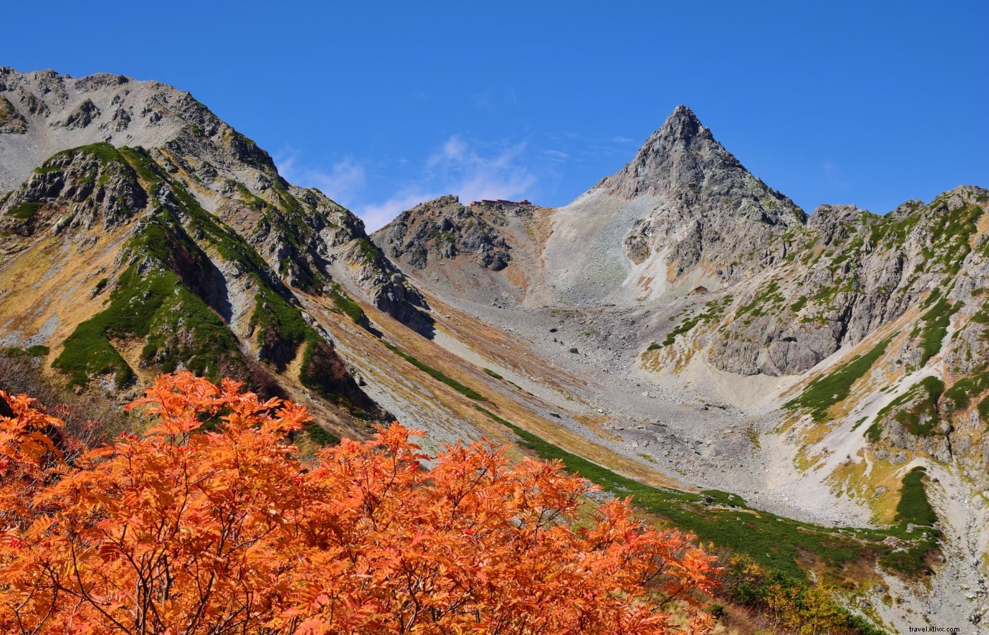
The jagged peaks and sheer cliffs of the Hotaka range and Mt. Yakedake tower over forests, wetlands, and the crystal-clear Azusa River.

The azure waters of the Azusa River, with Mt. Yakedake in the background.
Despite its fame, Kamikochi remains remarkably unspoiled. Pioneering environmental protections since the 1960s—including community cleanups and a 1975 ban on private vehicles—have preserved its purity, with visitors encouraged to follow suit.
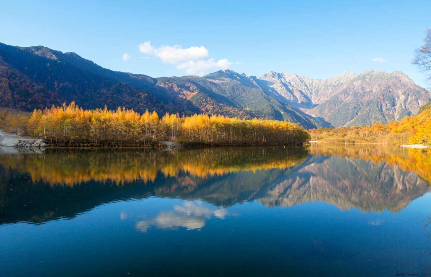
Unique vegetation sets it apart: larch, beech, and white birch trees create a spectacular autumn display, unlike Japan's typical cedar forests.
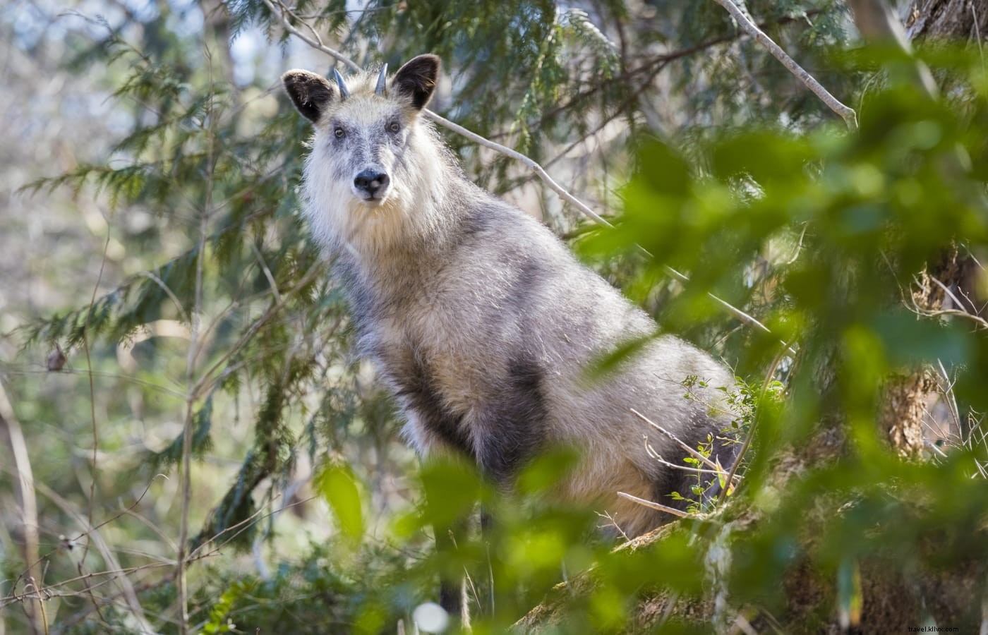
Wildlife sightings may include Japanese macaques and the distinctive serow, a goat-antelope hybrid.
The Cradle of Japan's Mountaineering Heritage
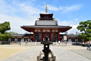
Kamikochi hosted Japan's first Mountain Day celebrations in 2016, fitting its pivotal role in popularizing recreational hiking.
Centuries ago, monks like Banryu Shonin pioneered ascents, such as Mt. Yarigatake—Japan's Matterhorn—in 1828, installing ropes for others.
The distinctive shape of Mt. Yarigatake has led to it being dubbed Japan’s answer to the Matterhorn.
English surveyor William Gowland named the region the "Japanese Alps" in the late 19th century. Missionary Walter Weston, exploring from 1888-1895, popularized it globally with his 1896 book Mountaineering and Exploration in the Japanese Alps.
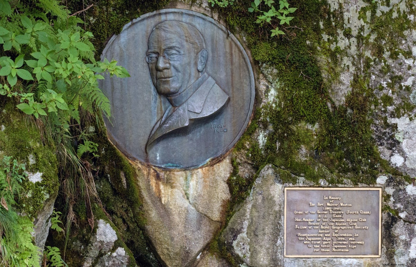
The Weston Relief pays tribute to a pioneering mountaineer.
A relief honors Weston near Mt. Nishi-Hotakadake trailhead, with a June festival; Myojin Pond features a memorial to guide Kamijo Kamonji.
Iconic Spots Along the Azusa River
Explore Kamikochi's highlights along the flat, well-maintained 3-4 hour Azusa River trail of gravel paths, roads, and boardwalks.
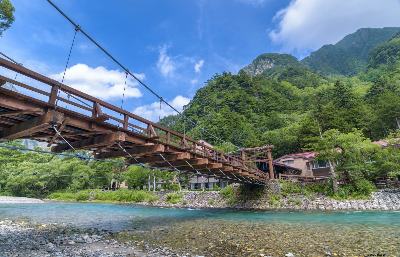
Kappabashi Bridge, one of Kamikochi’s most famous landmarks.
Iconic Kappabashi Bridge offers stunning photo ops amid towering peaks, named for folklore's kappa creature—featured in Akutagawa's story and local souvenirs.
Arriving by bus? Stop at Taisho Pond, formed by a 1915 Mt. Yakedake eruption. Its shrinking size belies its beauty, mirroring Hotaka peaks.
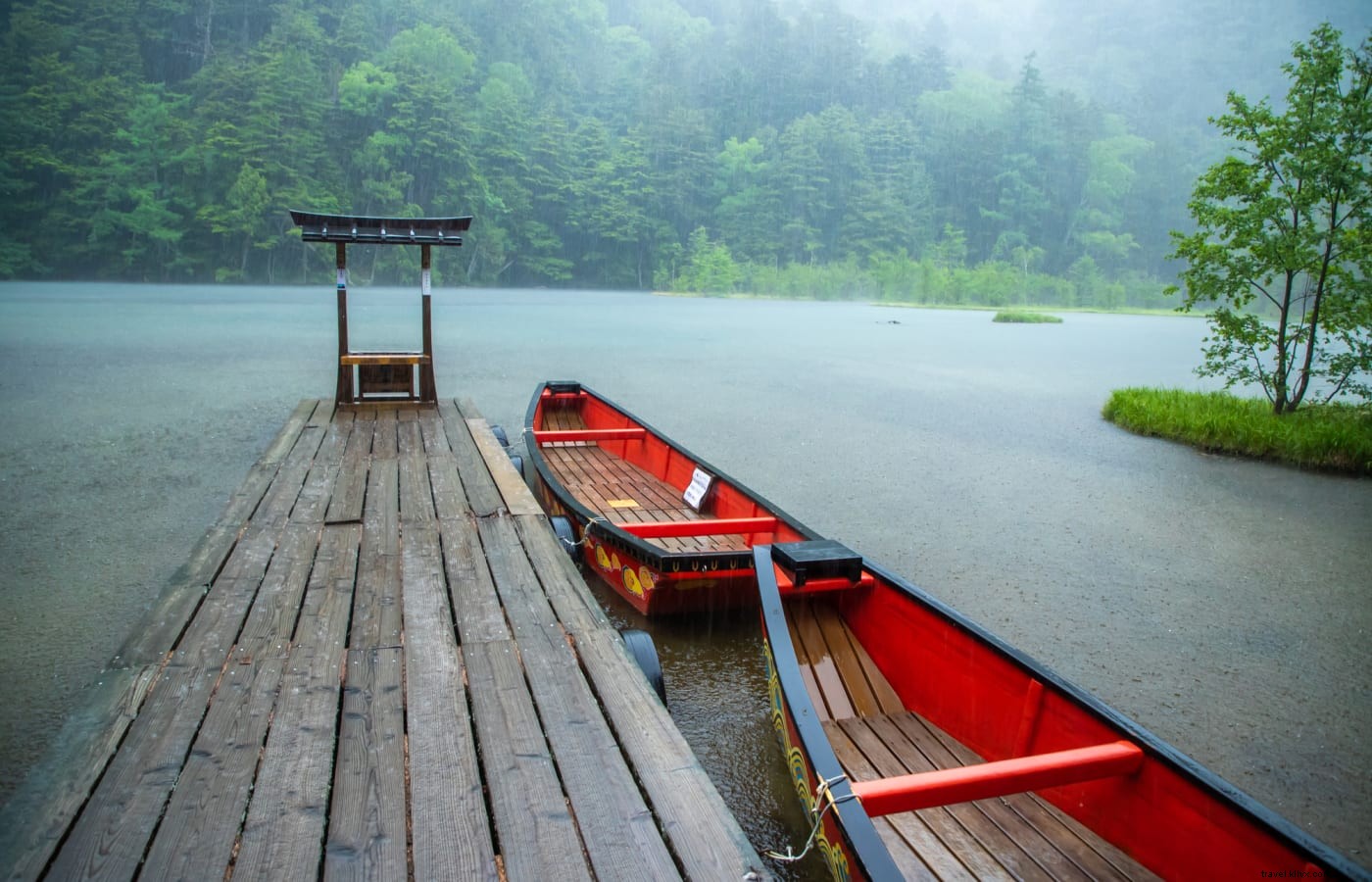
A small shrine stands at the edge of Myojin Pond.
An hour from Kappabashi, sacred Myojin Pond (small fee) resembles a natural garden; witness the October 8 Hotaka Shrine Boat Festival.
Hikes for All Levels
Follow hikers upstream to Tokusawa and Yokoo (3 hours from Kappabashi, gentle gradient) for peak ascents.
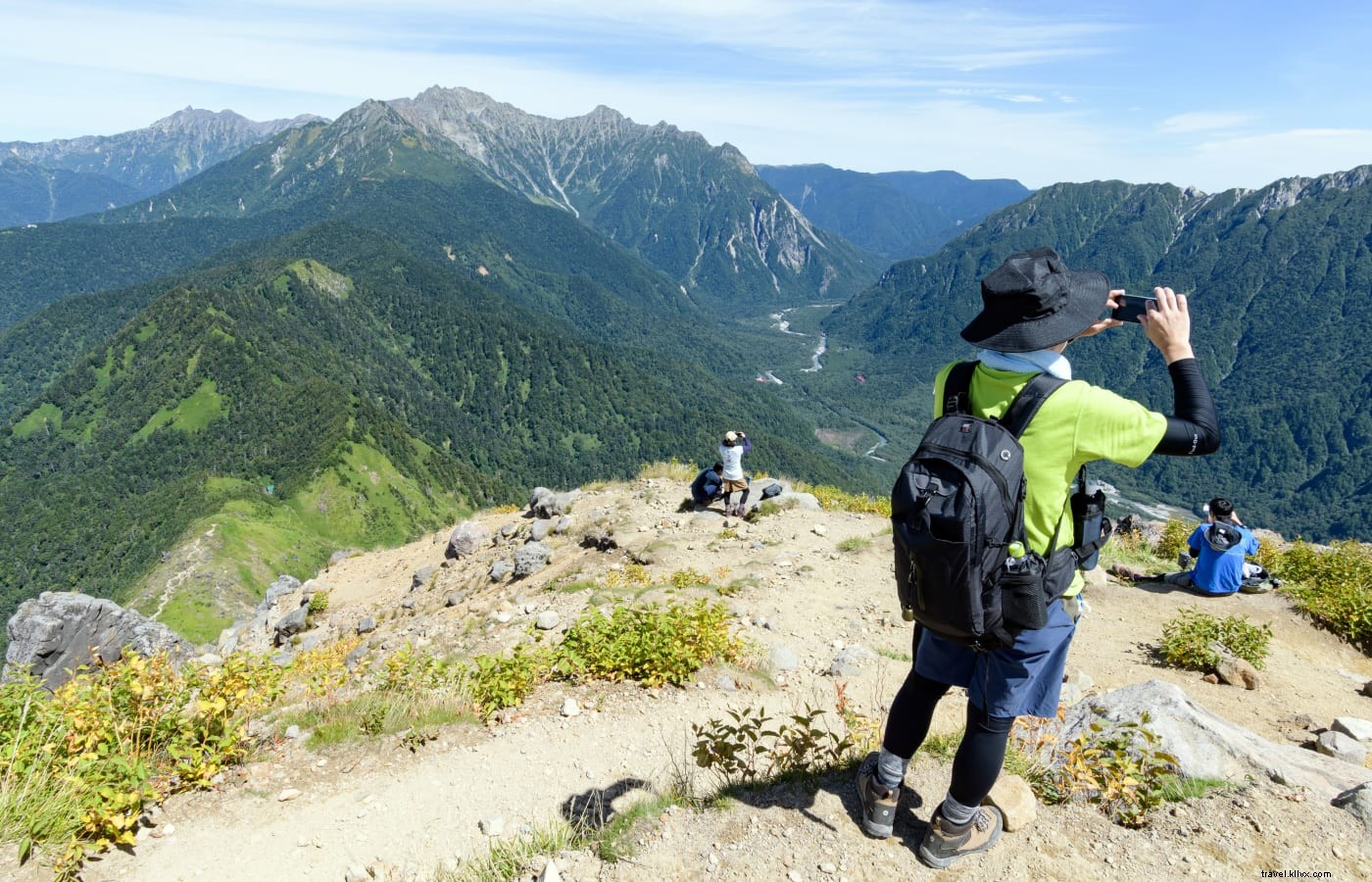
Hikers take in the panoramic view from the peak of Mt. Yakedake.
Day-trip Mt. Yakedake (2,455m), an active volcano with summit vents. Oku-Hotakadake (3,190m, Japan's third-highest) needs two days; the three-day Yarigatake loop features the challenging Daikiretto ridge.
Seasonal Wonders in Chūbu Sangaku National Park
Alphorns herald the April 27 opening amid snowy peaks and fresh greenery. May windflowers, June azaleas, summer mists; peak October foliage draws crowds.
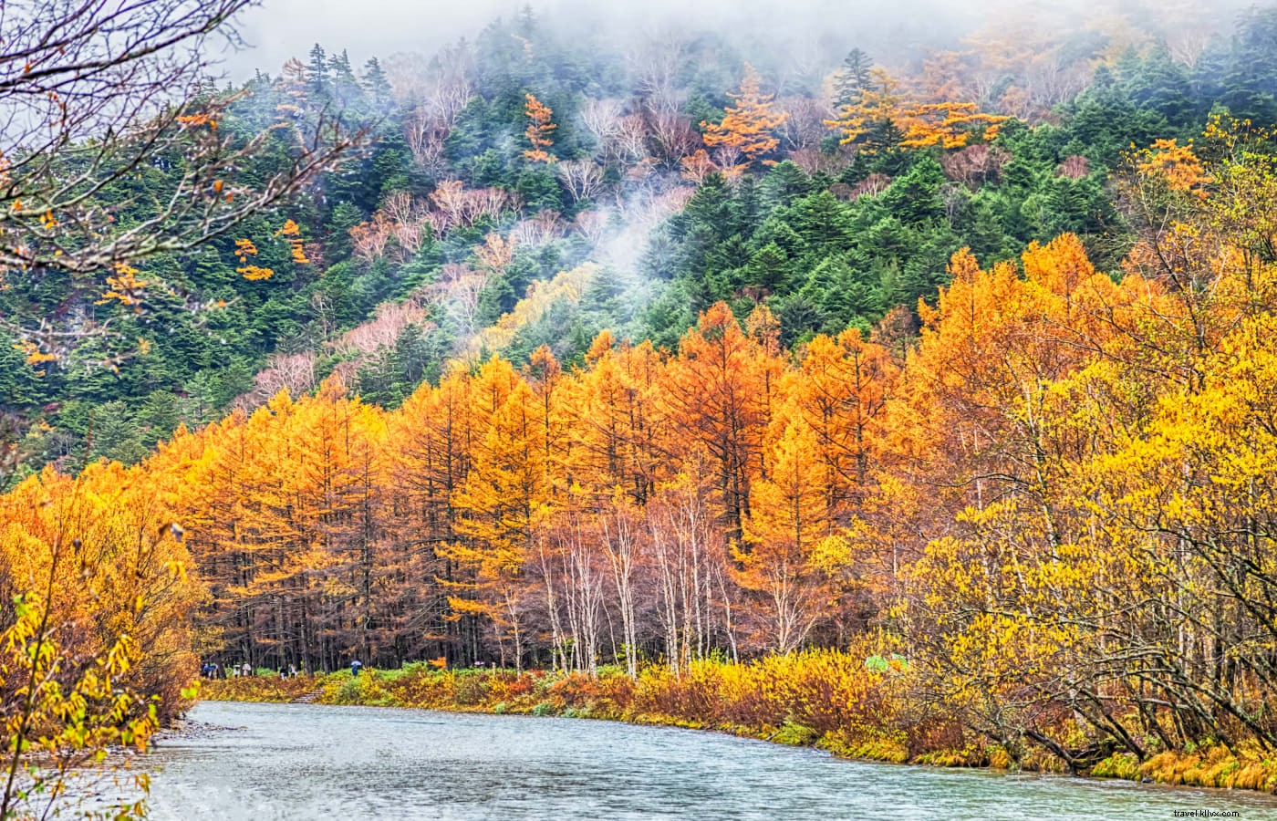
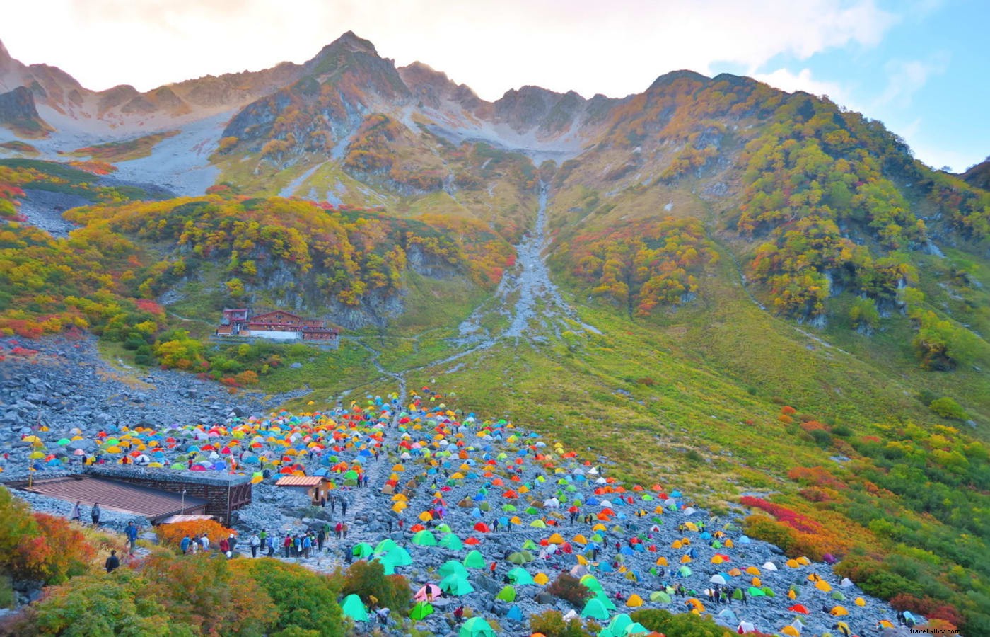
Myojin Pond, Taisho Pond, and Dakesawa Marsh shine in fall; Karasawa Cirque's fiery slopes reward a 6-hour hike and overnight stay.
Autumn leaves © Yashiro_Hino (Licensed under CC BY 4.0)
Open mid-April to mid-November with buses from Tokyo, Osaka, Kyoto. Off-season requires snowshoes.